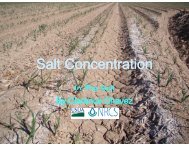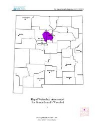
SAMPLING VEGETATION ATTRIBUTES - New Mexico NRCS - US ...
SAMPLING VEGETATION ATTRIBUTES - New Mexico NRCS - US ...
SAMPLING VEGETATION ATTRIBUTES - New Mexico NRCS - US ...

You also want an ePaper? Increase the reach of your titles
YUMPU automatically turns print PDFs into web optimized ePapers that Google loves.
METHODS—Visual Obstruction—Robel Pole<br />
124<br />
a Site Selection The most important factor in obtaining usable data is selecting<br />
representative areas (critical or key areas) in which to run the study (see Section<br />
II.D). Study sites should be located within a single plant community within a<br />
single ecological site. Transects and sampling points need to be randomly<br />
located within the critical or key areas (see Section III).<br />
b Pilot Studies Collect data on several pilot studies to determine the number of<br />
samples (transects or observation points) and the number and size of quadrats<br />
needed to collect a statistically valid sample (see Section III.B.8).<br />
c Vertical Cover Classes Establish the number of vertical cover classes and<br />
height limits for each class based on objectives. These cover classes must be<br />
developed locally for each ecological site or plant community. The following is<br />
an example of cover classes established for upland bird nesting cover on the Fort<br />
Pierre National Grasslands:<br />
Cover Classes Visual Obstruction Height<br />
1 0.0 - 1.9<br />
2 2.0 - 2.9<br />
3 3.0 - 3.9<br />
4 4.0 +<br />
d Number of Transects Establish the minimum number of transects to achieve the<br />
desired level of precision for the key species in each study site (see Section III.B).<br />
e Number of Observation Points The number of observation points will<br />
depend on the objectives, level of precision required, etc.; however, it is recommended<br />
that a minimum of 50 be read per transect. Additional observation<br />
points should be read, depending on the pilot study.<br />
f Study Layout Data can be collected using the baseline, macroplot, or linear<br />
study designs described in Section III.A.2 beginning on page 8. The linear<br />
technique is the one most often used.<br />
g Reference Post or Point Permanently mark the location of each study with a<br />
reference post and a study location stake (see beginning of Section III).<br />
h Study Identification Number studies for proper identification to ensure that<br />
the data collected can be positively associated with specific sites on the ground<br />
(see Appendix B).<br />
i Study Documentation Document pertinent information concerning the study<br />
on the Study Location and Documentation Data form (see beginning of Section<br />
III and Appendix A).<br />
7. Taking Photographs The directions for establishing photo plots and for taking<br />
close-up and general view photographs are given in Section V.A.