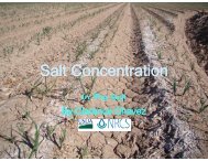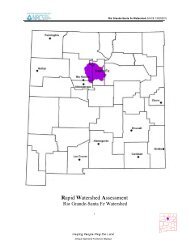
SAMPLING VEGETATION ATTRIBUTES - New Mexico NRCS - US ...
SAMPLING VEGETATION ATTRIBUTES - New Mexico NRCS - US ...
SAMPLING VEGETATION ATTRIBUTES - New Mexico NRCS - US ...

Create successful ePaper yourself
Turn your PDF publications into a flip-book with our unique Google optimized e-Paper software.
70<br />
METHODS—Step Point<br />
F. Step-Point Method<br />
1. General Description The Step-Point Method involves making observations<br />
along a transect at specified intervals, using a pin to record cover “hits.” It measures<br />
cover for individual species, total cover, and species composition by cover.<br />
It is important to establish a photo plot (see Section V.A) and take both close-up<br />
and general view photographs. This allows the portrayal of resource values and<br />
conditions and furnishes visual evidence of vegetation and soil changes over time.<br />
2. Areas of Use This method is best suited for use with grasses and forbs, as well<br />
as low shrubs. The greater the structure to the community, the more difficult it<br />
becomes to determine “hits” due to parallax, observer bias, wind, etc. This method<br />
is good for an initial overview of an area not yet subjected to intensive monitoring.<br />
3. Advantages and Limitations This method is relatively simple and easy to<br />
use as long as careful consideration is given to the vegetation type to which it is<br />
applied. It is suitable for measuring major characteristics of the ground and vegetation<br />
cover of an area. Large areas can easily be sampled, particularly if the<br />
cover is reasonably uniform. It is possible to collect a fairly large number of<br />
samples within a relatively short time.<br />
A limitation of this method is that there can be extreme variation in the data<br />
collected among examiners when sample sizes are small. Tall or armored vegetation<br />
reduces the ability to pace in a straight line, and the offset for obstructions<br />
described in the procedures adds bias to the data collection by avoiding certain<br />
components of the community. Another limitation is that less predominant plant<br />
species may not be hit on the transects and therefore do not show up in the study<br />
records. The literature contains numerous studies utilizing point intercept<br />
procedures that required point densities ranging from 300 to 39,000 in order to<br />
adequately sample for minor species. One major consideration in the use of this<br />
method is to assure that a sharpened pin is used and that only the point is used to<br />
record “hits.” Pins have finite diameters and therefore overestimate cover (Goodall<br />
1952). Another limitation of this method is that statistical analysis of the data is<br />
suspect unless two and preferably more transects are run per site (see Section III -<br />
Study Design and Analysis).<br />
4. Equipment The following equipment is needed (see also the equipment listed in<br />
Section V.A, page 31, for the establishment of the photo plot):<br />
• Study Location and Documentation Data form (see Appendix A)<br />
• Cover Data form (see Illustration 13)<br />
• Permanent yellow or orange spray paint<br />
• Tally counter (optional)<br />
• One stake: 3/4- or 1-inch angle iron not less than 16 inches long<br />
• 3-foot long, 3/16th-inch diameter sharpened pin<br />
• Compass<br />
• Steel post and driver<br />
5. Training A minimum amount of training is needed for this method. Examiners<br />
must be able to identify the plant species, be familiar with the ground-level cover