sr 60 “twin pairs” - City of Vero Beach
sr 60 “twin pairs” - City of Vero Beach
sr 60 “twin pairs” - City of Vero Beach

Create successful ePaper yourself
Turn your PDF publications into a flip-book with our unique Google optimized e-Paper software.
ROADWAY SEGMENT EVALUATION – EXISTING CONDITIONS<br />
The roadway segment evaluation consisted <strong>of</strong> the following:<br />
A review <strong>of</strong> historical Annual Average Daily Traffic (AADT) data<br />
Level <strong>of</strong> service (LOS) determination based on daily traffic volumes<br />
Level <strong>of</strong> service determination based on peak hour and concurrency data<br />
Historical Traffic Data<br />
The purpose <strong>of</strong> reviewing historical data was to identify trends in traffic volume growth and fluctuation.<br />
This analysis helps to identify the roadways (and roadway segments) within the study area that have<br />
experienced increases/decreases in traffic volume. Table 1 provides a summary <strong>of</strong> historical AADT data<br />
available from the FDOT database. Overall, historical data shows traffic volumes on the one-way segment<br />
<strong>of</strong> SR <strong>60</strong> have remained relatively constant over the last 10 years. While historical traffic data are limited<br />
on the primary minor streets within the study area, the trends for the available data are similar to that <strong>of</strong><br />
SR <strong>60</strong>.<br />
LINK<br />
DESCRIPTION<br />
SR <strong>60</strong> from<br />
27 Ave to 20 Ave<br />
SR <strong>60</strong> EB from 20<br />
Ave and Old Dixie<br />
Hwy<br />
SR <strong>60</strong> WB from 20<br />
Ave and Old Dixie<br />
Hwy<br />
SR <strong>60</strong> EB from Old<br />
Dixie Hwy to 10<br />
Ave<br />
SR <strong>60</strong> WB from<br />
Old Dixie Hwy to<br />
10 Ave<br />
21 St from 20 Ave<br />
to US 1<br />
20 Ave south <strong>of</strong><br />
SR <strong>60</strong><br />
Old Dixie Hwy<br />
south <strong>of</strong> SR <strong>60</strong><br />
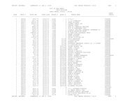
Table 1: Historical AADT Data<br />
2002 2003 2004 2005 2006 2007 2008 2009 2010 2011<br />
n.a. 26,000 27,500 29,500 25,500 27,500 n.a. 24,000 19,900 23,000<br />
14,000 13,000 13,500 14,000 14,000 15,500 n.a. n.a. 11,500 12,500<br />
11,000 11,000 11,500 12,000 11,500 12,000 9,<strong>60</strong>0 9,400 11,000 11,500<br />
13,000 13,000 14,000 13,000 12,000 12,500 n.a. 13,000 11,000 12,000<br />
13,000 12,000 12,500 9,<strong>60</strong>0 11,000 11,000 n.a. 10,500 10,000 12,000<br />
n.a. n.a. n.a. n.a. n.a. n.a. 4,100 4,400 4,000 4,000<br />
n.a. n.a. n.a. n.a. n.a. n.a. 5,800 4,800 5,300 4,300<br />
n.a. n.a. n.a. n.a. n.a. n.a. 4,400 4,<strong>60</strong>0 4,000 4,000<br />
SR <strong>60</strong> “Twin Pairs” Traffic Calming Feasibility Study Page 8