Texas Social Studies Framework - Department of Geography ...
Texas Social Studies Framework - Department of Geography ...
Texas Social Studies Framework - Department of Geography ...

Create successful ePaper yourself
Turn your PDF publications into a flip-book with our unique Google optimized e-Paper software.
Not too long ago, social studies teachers who had a<br />
world map, a set <strong>of</strong> textbooks, and an ample supply <strong>of</strong><br />
chalk were considered to be well equipped to carry out<br />
their instructional duties. Today, maps and textbooks are<br />
still important resources for social studies teachers, but<br />
many other resources are also needed to provide a rich<br />
and effective learning environment. Following is a list <strong>of</strong><br />
resources that should be considered for every classroom<br />
in which social studies is taught.<br />
Campuses should provide age and topic appropriate<br />
variations <strong>of</strong> these instructional materials, K-12. The<br />
<strong>Social</strong> <strong>Studies</strong> Center for Educator Development has<br />
developed resources, both online and in print versions,<br />
to help aid in the selection <strong>of</strong> these materials. See the<br />
SSCED website at or use the order form in this framework to access<br />
these resources (Appendix D).<br />
INSTRUCTIONAL RESOURCES<br />
Maps and Globes<br />
World, USA, and State Wall Maps<br />
Maps should:<br />
Appendix C<br />
The Well-Equipped<br />
<strong>Social</strong> <strong>Studies</strong> Classroom<br />
• be appropriate for the grade level, e.g., beginner,<br />
intermediate, or advanced;<br />
• be appropriate for the purpose <strong>of</strong> instruction,<br />
e.g., political, physical, thematic, historical;<br />
• be accurate and up-to-date; and<br />
• provide a realistic view <strong>of</strong> the world, i.e., use an<br />
equal area projection in order to provide<br />
students with an accurate image <strong>of</strong> the relative<br />
size <strong>of</strong> places and regions.<br />
Outline Maps<br />
Student desk maps (8.5x11 or 8.5x14) can be obtained<br />
from most companies that produce maps and globes.<br />
Maps appropriate for student work can also be downloaded<br />
from electronic sources. Refer to the SSCED<br />
website, both the general and grade level/course URLs,<br />
for electronic sources <strong>of</strong> maps.<br />
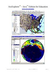
Atlases<br />
Globes<br />
• Comprehensive world reference atlas<br />
• Comprehensive U.S. reference atlas<br />
• Comprehensive state reference atlas<br />
• Student desk atlases - classroom set<br />
• 16 or 24 inch demonstration globe - May be a<br />
political or physical or combination globe.<br />
• 9 inch student globes - One for every two<br />
students. May be inflatable.<br />
Globes should:<br />
• be appropriate for the grade level, e.g., beginner,<br />
intermediate, or advanced;<br />
• be appropriate for the purpose <strong>of</strong> instruction,<br />
e.g., political, physical, or combination;<br />
• be accurate and up-to-date; and<br />
• be well constructed and sturdy.<br />
Map Puzzles and Games<br />
Map puzzles and games should be<br />
• appropriate for the grade level and<br />
• appropriate for the purpose <strong>of</strong> instruction.<br />
COMPUTER HARDWARE<br />
Hardware<br />
• Computer and monitor for teacher use<br />
• Computers and monitors for student use<br />
• CD-ROM drive should be installed on all teacher<br />
and student computers<br />
• Expanded memory<br />
• Access to school network