

Phase I - Halifax Regional Municipality
Phase I - Halifax Regional Municipality
Phase I - Halifax Regional Municipality

You also want an ePaper? Increase the reach of your titles
YUMPU automatically turns print PDFs into web optimized ePapers that Google loves.
Archaeological Resource Impact Assessment<br />
Pre-development Assessment<br />
Spring Garden Road/Queen Street Public Lands Plan<br />
B<br />
C<br />
A<br />
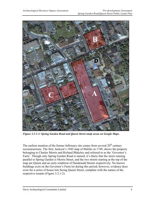
Figure 3.2-1-1: Spring Garden Road and Queen Street study areas on Google Maps.<br />
The earliest mention of the former Infirmary site comes from several 20 th century<br />
reconstructions. The first, Jackson’s 1945 map of <strong>Halifax</strong> in 1749, shows the property<br />
belonging to Charles Morris and Richard Blakeley and referred to as the ‘Governor’s<br />
Farm’. Though only Spring Garden Road is named, it’s likely that the street running<br />
parallel to Spring Garden is Morris Street, and the two streets starting at the top of the<br />
map are Queen and an early rendition of Dundonald Streets respectively. No known<br />
buildings exist on the Governor’s Farm lot during this period; however, evidence does<br />
exist for a series of house lots facing Queen Street, complete with the names of the<br />
respective tenants (Figure 3.2.1-2).<br />
Davis Archaeological Consultants Limited 6


