

Phase I - Halifax Regional Municipality
Phase I - Halifax Regional Municipality
Phase I - Halifax Regional Municipality

You also want an ePaper? Increase the reach of your titles
YUMPU automatically turns print PDFs into web optimized ePapers that Google loves.
Archaeological Resource Impact Assessment<br />
Pre-development Assessment<br />
Spring Garden Road/Queen Street Public Lands Plan<br />
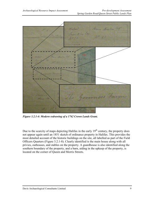
Figure 3.2.1-4: Modern redrawing of a 1762 Crown Lands Grant.<br />
Due to the scarcity of maps depicting <strong>Halifax</strong> in the early 19 th century, the property does<br />
not appear again until an 1851 sketch of ordinance property in <strong>Halifax</strong>. This provides the<br />
most detailed account of the historic buildings on the site, all labelled as part of the Field<br />
Officers Quarters (Figure 3.2.1-8). Clearly identified is the main house along with all<br />
privies, outhouses, and stables on the property. A guardhouse is also identified along the<br />
southern boundary of the property, and a barn, aiding in the upkeep of the property, is<br />
located on the corner of Queen and Morris Streets.<br />
Davis Archaeological Consultants Limited 9


