

Phase I - Halifax Regional Municipality
Phase I - Halifax Regional Municipality
Phase I - Halifax Regional Municipality

Create successful ePaper yourself
Turn your PDF publications into a flip-book with our unique Google optimized e-Paper software.
Archaeological Resource Impact Assessment<br />
Pre-development Assessment<br />
Spring Garden Road/Queen Street Public Lands Plan<br />
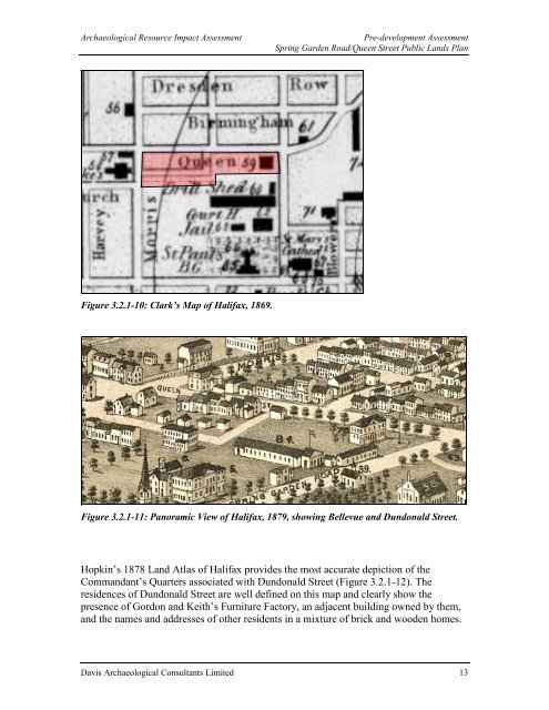
Figure 3.2.1-10: Clark’s Map of <strong>Halifax</strong>, 1869.<br />
Figure 3.2.1-11: Panoramic View of <strong>Halifax</strong>, 1879, showing Bellevue and Dundonald Street.<br />
Hopkin’s 1878 Land Atlas of <strong>Halifax</strong> provides the most accurate depiction of the<br />
Commandant’s Quarters associated with Dundonald Street (Figure 3.2.1-12). The<br />
residences of Dundonald Street are well defined on this map and clearly show the<br />
presence of Gordon and Keith’s Furniture Factory, an adjacent building owned by them,<br />
and the names and addresses of other residents in a mixture of brick and wooden homes.<br />
Davis Archaeological Consultants Limited 13


