

Phase I - Halifax Regional Municipality
Phase I - Halifax Regional Municipality
Phase I - Halifax Regional Municipality

You also want an ePaper? Increase the reach of your titles
YUMPU automatically turns print PDFs into web optimized ePapers that Google loves.
Archaeological Resource Impact Assessment<br />
Pre-development Assessment<br />
Spring Garden Road/Queen Street Public Lands Plan<br />
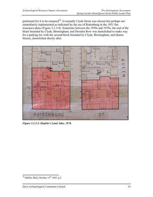
petitioned for it to be renamed 38 . Eventually Clyde Street was chosen but perhaps not<br />
immediately implemented as indicated by the use of Rottenburg in the 1951 fire<br />
insurance plans (Figure 3.2.3-8). Sometime between the 1950s and 1970s, the end of the<br />
block bounded by Clyde, Birmingham, and Dresden Row was demolished to make way<br />
for a parking lot, with the second block bounded by Clyde, Birmingham, and Queen<br />
Streets, demolished shortly after.<br />
Figure 3.2.3-3: Hopkin’s Land Atlas, 1878.<br />
38 <strong>Halifax</strong> Mail, October 15 th 1947, p.3<br />
Davis Archaeological Consultants Limited 34


