

Phase I - Halifax Regional Municipality
Phase I - Halifax Regional Municipality
Phase I - Halifax Regional Municipality

You also want an ePaper? Increase the reach of your titles
YUMPU automatically turns print PDFs into web optimized ePapers that Google loves.
Archaeological Resource Impact Assessment<br />
Pre-development Assessment<br />
Spring Garden Road/Queen Street Public Lands Plan<br />
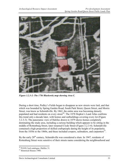
Figure 3.2.3-2: The 1784 Blaskowitz map showing Area C.<br />
During a short time, Pedley’s Fields began to disappear as new streets were laid, and that<br />
which was bounded by Spring Garden Road, South Park Street, Queen Street, and Morris<br />
Street, was know as Schmidtville. By 1862, the entire area was becoming densely<br />
populated and had residents on every street 36 . The 1878 Hopkin’s Land Atlas confirms<br />
this trend only a decade later, with homes and outbuildings covering every lot (Figure<br />
3.2.3-3). The panoramic view of <strong>Halifax</strong> drawn in 1879 shows homes completely<br />
dominating the study area, including a curious building which appears to be sitting in the<br />
middle of Rottenburg Street, later renamed Clyde Street (Figure 3.2.3-4). Schmidtville<br />
contained a high proportion of skilled craftspeople during the height of its popularity<br />
from the 1830s to the 1860s, and these included coopers, sailmakers, and carpenters 37 .<br />
By the early 20 th century, Schmidtville was considered a slum. In 1947, residents of<br />
Rottenburg Street were sensitive of their streets name considering the neighbourhood and<br />
36 PANS Card catalogue, <strong>Halifax</strong> 31.<br />
37 Historical Houses 1980.<br />
Davis Archaeological Consultants Limited 33


