

Phase I - Halifax Regional Municipality
Phase I - Halifax Regional Municipality
Phase I - Halifax Regional Municipality

Create successful ePaper yourself
Turn your PDF publications into a flip-book with our unique Google optimized e-Paper software.
Archaeological Resource Impact Assessment<br />
Pre-development Assessment<br />
Spring Garden Road/Queen Street Public Lands Plan<br />
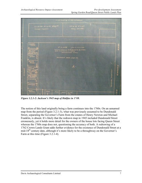
Figure 3.2.1-2: Jackson’s 1945 map of <strong>Halifax</strong> in 1749.<br />
The notion of this land originally being a farm continues into the 1760s. On an unnamed<br />
map from the period (Figure 3.2.1-3), what was previously assumed to be Dundonald<br />
Street, separating the Governor’s Farm from the estates of Henry Newton and Michael<br />
Franklin, is absent. It’s likely that the redrawn map in 1945 included Dundonald Street<br />
erroneously, yet it holds more detail for the owners of the house lots facing Queen Street<br />
whereas the 1760s map does not, questioning the accuracy of both. A redrawing of a<br />
1762 Crown Lands Grant adds further evidence for the existence of Dundonald Street at a<br />
mid-18 th century date, although it’s more likely to be a throughway on the Governor’s<br />
Farm at this time (Figure 3.2.1-4).<br />
Davis Archaeological Consultants Limited 7


