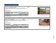
TABLE OF CONTENT - Emfuleni Local Municipality
TABLE OF CONTENT - Emfuleni Local Municipality
TABLE OF CONTENT - Emfuleni Local Municipality

You also want an ePaper? Increase the reach of your titles
YUMPU automatically turns print PDFs into web optimized ePapers that Google loves.
CHAPTER 2<br />
2. ANALYSIS PHASE<br />
2.1 Introduction<br />
This chapter describes the geographical area within which <strong>Emfuleni</strong> <strong>Local</strong> <strong>Municipality</strong> is<br />
positioned within the Gauteng Province and the country at large. In addition, this<br />
chapter provides information on demographic profile and the status of service delivery<br />
covering the following areas local economic development, service delivery, financial<br />
issues, institutional issues, demographic figures, spatial development, environmental<br />
issues, information technology, Sports and Recreation, Arts and Culture, libraries, social<br />
development, public safety and all issues service delivery and public administration.<br />
2.1.1 Area Location<br />
<strong>Emfuleni</strong> <strong>Local</strong> <strong>Municipality</strong> is one of three local municipalities that constitute the<br />
Sedibeng District <strong>Municipality</strong>. The municipality is situated at the Western-most part of<br />
the District, which covers the entire southern area of the Gauteng province extending<br />
along a 120 kilometres axis from east to west. It covers an area of 987.45 km². The<br />
Vaal River forms the southern boundary of the <strong>Emfuleni</strong> <strong>Local</strong> <strong>Municipality</strong> and its<br />
strategic location affords it many opportunities for tourism and other forms of economic<br />
development. <strong>Emfuleni</strong> shares boundaries with Metsimaholo <strong>Local</strong> <strong>Municipality</strong> and<br />
Fezile Dabi District <strong>Municipality</strong> in the Free State to the south , Midvaal <strong>Local</strong><br />
<strong>Municipality</strong> to the east, the City of Johannesburg metropolitan area to the north and<br />
Westonaria and Potchefstroom (in North West Province) <strong>Local</strong> Municipalities to the west.<br />
The municipality is strategically located with access to a well-maintained road network -<br />
N1 national route linking Johannesburg and Bloemfontein, which traverses <strong>Emfuleni</strong>.<br />
<strong>Emfuleni</strong> <strong>Local</strong> <strong>Municipality</strong> has two main city/town centres, namely Vereeniging and<br />
Vanderbijlpark within the area and Sasolburg is only 10 kilometres to the south, across<br />
the provincial boundary. It forms the “heartland” of what was formerly known as the Vaal<br />
Triangle, renowned for its contribution to the iron and steel industry in South Africa.<br />
<strong>Emfuleni</strong> also contains approximately six large Peri-urban townships of Evaton,<br />
Sebokeng, Sharpeville, Boipatong, Bophelong and Tshepiso. The latter six areas lack<br />
facilities associated with towns of their size however there been a numbers of Shopping<br />
malls developed in the past few years. The other approximately ten small settlements<br />
tend to be suburban settlements within six kilometres of the above towns; they are<br />
Bonanne, Steel Park, Duncanville, Unitas Park, Arcon Park, Sonlandpark, Waldrift, Rustter-Vaal,<br />
Roshnee and Debonairpark.<br />
10