Stavanger kommune
Stavanger kommune
Stavanger kommune

Create successful ePaper yourself
Turn your PDF publications into a flip-book with our unique Google optimized e-Paper software.
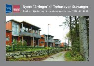
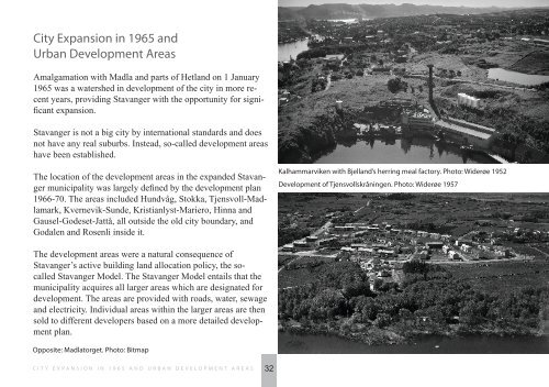
City Expansion in 1965 and<br />
Urban Development Areas<br />
Amalgamation with Madla and parts of Hetland on 1 January<br />
1965 was a watershed in development of the city in more recent<br />
years, providing <strong>Stavanger</strong> with the opportunity for significant<br />
expansion.<br />
<strong>Stavanger</strong> is not a big city by international standards and does<br />
not have any real suburbs. Instead, so-called development areas<br />
have been established.<br />
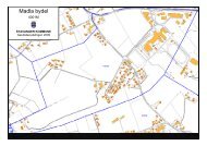
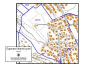
The location of the development areas in the expanded <strong>Stavanger</strong><br />
municipality was largely defined by the development plan<br />
1966-70. The areas included Hundvåg, Stokka, Tjensvoll-Madlamark,<br />
Kvernevik-Sunde, Kristianlyst-Mariero, Hinna and<br />
Gausel-Godeset-Jattå, all outside the old city boundary, and<br />
Godalen and Rosenli inside it.<br />
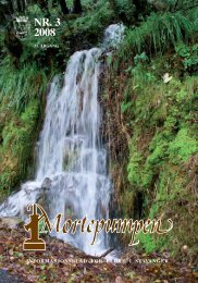
Kalhammarviken with Bjelland’s herring meal factory. Photo: Widerøe 1952<br />
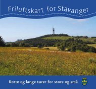
Development of Tjensvollskråningen. Photo: Widerøe 1957<br />
The development areas were a natural consequence of<br />
<strong>Stavanger</strong>’s active building land allocation policy, the socalled<br />
<strong>Stavanger</strong> Model. The <strong>Stavanger</strong> Model entails that the<br />
municipality acquires all larger areas which are designated for<br />
development. The areas are provided with roads, water, sewage<br />
and electricity. Individual areas within the larger areas are then<br />
sold to different developers based on a more detailed development<br />
plan.<br />
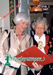
Opposite: Madlatorget. Photo: Bitmap<br />
CITY EXPANSION IN 1965 AND URBAN DEVELOPMENT AREAS<br />
32