Stavanger kommune
Stavanger kommune
Stavanger kommune

You also want an ePaper? Increase the reach of your titles
YUMPU automatically turns print PDFs into web optimized ePapers that Google loves.
Sunde-Kvernevik<br />
When development started almost immediately after expansion<br />
of the city limits in 1965, Sunde and Kvernevik seemed to be<br />
far from town.<br />
Most of Sunde and Kvernevik was developed before 1980.<br />
Given that there were many developers, catering for different<br />
potential buyers, almost all types of houses and building styles<br />
from that period are represented. Developments in society and<br />
increased prosperity after the city’s last recession in the 1960s<br />
are reflected in the number of extensions subsequently built to<br />
the first houses at Kvernevik.<br />
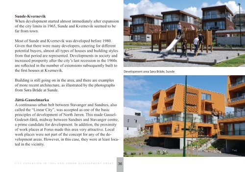
Development area Søra Bråde, Sunde<br />
Building is still going on in the area, and there are examples<br />
of more recent architecture, as illustrated by the photographs<br />
from Søra Bråde at Sunde.<br />
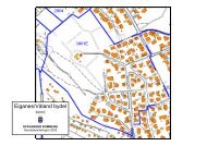
Jåttå-Gauselmarka<br />
A continuous urban belt between <strong>Stavanger</strong> and Sandnes, also<br />
called the “Linear City”, was accepted as one of the basic<br />
principles of development of North Jæren. This made Gausel-<br />
Godeset-Jåttå, midway between Sandnes and <strong>Stavanger</strong> centre,<br />
a prime candidate for development. In addition, the proximity<br />
of work places at Forus made this area very attractive. Local<br />
work places were not part of the concept for any of the development<br />
areas. However, in this case, they were at least located<br />
in the vicinity.<br />
CITY EXPANSION IN 1965 AND URBAN DEVELOPMENT AREAS<br />
36