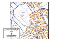
Stavanger kommune
Stavanger kommune
Stavanger kommune

You also want an ePaper? Increase the reach of your titles
YUMPU automatically turns print PDFs into web optimized ePapers that Google loves.
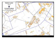
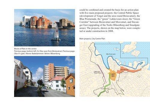
could be combined and created the basis for an action plan<br />
with five main proposed projects: the Central Public Space<br />
(development of Torget and the area round Breiavatnet), the<br />
Blue Promenade, the “green” Løkkeveien street, the “Green<br />
Corridor” between Breiavatnet and Mosvatnet, and <strong>Stavanger</strong><br />
East (upgrading of the Nedre Blåsenborg and Smedgate<br />
areas). The projects, shown on the map below, were completed<br />
or under construction in 2008.<br />
Main projects, City Centre Plan<br />
Blocks of flats in the centre<br />
Previous page, bottom left: St. Olav seen from Breiavatnet. Previous page:<br />
Olav V’s gate. Above: Badedammen. Below: Blåsenborg