SIBER SPIS sept 2011.pdf - IMBER
SIBER SPIS sept 2011.pdf - IMBER
SIBER SPIS sept 2011.pdf - IMBER

You also want an ePaper? Increase the reach of your titles
YUMPU automatically turns print PDFs into web optimized ePapers that Google loves.
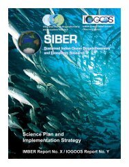
<strong>SIBER</strong><br />
Science Plan and Implementation Strategy<br />
<strong>SIBER</strong> m e t h o d s f o r d a t a<br />
s y n t h e s is a n d m a n a g e m e n t a n d<br />
m o d e l i n g<br />
Me t h o d s f o r d a t a s y n t h e s i s a n d m a n a g e m e n t<br />
<strong>SIBER</strong> will develop a data management policy under the guidance of <strong>IMBER</strong> and IOGOOS,<br />
that will be published on the <strong>SIBER</strong> website. The <strong>SIBER</strong> Data Policy will facilitate the use of<br />
all available data resources (including raw and processed field and laboratory data and model<br />
output), thus reducing fieldwork and research duplication, while respecting the intellectual<br />
property rights of the contributors.<br />
<strong>SIBER</strong> intends to work closely with data management teams from different countries and<br />
projects to promote availability and interoperability of datasets where possible. Linking and<br />
collaborating with other national and international ocean science programs will add significant<br />
value to data mining and syntheses. For example, linking predator and food web community<br />
data to programs, such as CLIOTOP, would facilitate analysis of their distributions in relation<br />
to satellite-observable features.<br />
<strong>SIBER</strong> will promote linkages with all international programs operating in the IO to share<br />
historical data and achieve the goals of each program. Its activities will contribute to the CoML,<br />
CLIVAR, SOLAS, IOCCP-GCP, GEOTRACES, GOOS/IndOOS, etc. <strong>SIBER</strong> data management<br />
and mining efforts will integrate with modeling and fieldwork activities. For example, modeling<br />
efforts will benefit from the identification, compilation and synthesis of existing datasets to<br />
produce regional and basinwide physical, biogeochemical and biological distributions for<br />
model initialization, calibration and verification (see integration section below).<br />
Fi e l d w o r k c o o r d i n a t i o n a n d d e v e l o p m e n t<br />
It is logistically difficult to work in the IO because it is so vast, and the southern IO open ocean is<br />
particularly remote. This problem is compounded by the limited availability of research vessels.<br />
<strong>SIBER</strong> aims to improve the integration of existing and planned field studies by promoting<br />
cross-cutting science activities and the exchange of personnel, expertise, methodologies, data<br />
and equipment. This should increase the efficiency and scientific value of the outcomes of<br />
the individual programs. It will require increased cooperation among the many nations and<br />
regional programs operating in the IO to streamline scientific objectives, integrate physical,<br />
biogeochemical and ecological data, identify key gaps and ensure effective future planning.<br />
<strong>SIBER</strong>’s role will be to: 1) facilitate the fieldwork coordination among nations and programs<br />
to address these issues; 2) identify knowledge gaps from historical data analysis, remote<br />
sensing and modeling; and 3) maximize subsequent international efforts to begin to fill these<br />
gaps. These fieldwork efforts will be an integral part of the parallel initiatives of data syntheses<br />
and model development.<br />
Existing field activities encompass only a small portion of the different biogeographic areas<br />
of the IO, with national programs often targeting restricted geographical regions and the<br />
coastal zone. A particular focus of <strong>SIBER</strong> will be to promote an international effort to improve<br />
geographical coverage of the IO, in both coastal and open ocean areas. This will be facilitated<br />
by increasing the use of satellite data and through deployment of remote instrumentation. The<br />
68