concept design san antonio river improvements project
concept design san antonio river improvements project
concept design san antonio river improvements project

Create successful ePaper yourself
Turn your PDF publications into a flip-book with our unique Google optimized e-Paper software.
MUSEUM (NORTHERN) “PARK” REACH<br />
Invasive plants should be removed<br />
94 SAN ANTONIO RIVER DESIGN GUIDELINES<br />
Erosion problems will be corrected<br />
MUSEUM (NORTHERN) “PARK” REACH<br />
RIVER CHANNEL RESTORATION<br />
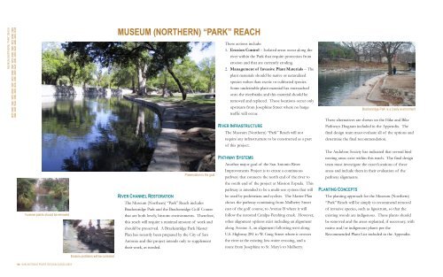
Preservation is the goal<br />
The Museum (Northern) “Park” Reach includes<br />
Brackenridge Park and the Brackenridge Golf Course<br />
that are both lovely, historic environments. Therefore,<br />
this reach will require a minimal amount of work and<br />
should be preserved. A Brackenridge Park Master<br />
Plan has recently been prepared by the City of San<br />
Antonio and this <strong>project</strong> intends only to supplement<br />
their work, as needed.<br />
These actions include:<br />
1. Erosion Control – Isolated areas occur along the<br />
<strong>river</strong> within the Park that require protection from<br />
erosion and that are currently eroding.<br />
2. Management of Invasive Plant Materials – The<br />
plant materials should be native or naturalized<br />
species rather than exotic or cultivated species.<br />
Some undesirable plant material has encroached<br />
onto the <strong>river</strong>banks and this material should be<br />
removed and replaced. These locations occur only<br />
upstream from Josephine Street where no barge<br />
traffic will occur.<br />
RIVER INFRASTRUCTURE<br />
The Museum (Northern) “Park” Reach will not<br />
require any infrastructure to be constructed as a part<br />
of this <strong>project</strong>.<br />
PATHWAY SYSTEMS<br />
Another major goal of the San Antonio River<br />
Improvements Project is to create a continuous<br />
pathway that connects the north end of the <strong>river</strong> to<br />
the south end of the <strong>project</strong> at Mission Espada. This<br />
pathway is intended to be a multi-use system that will<br />
be used by pedestrians and cyclists. The Master Plan<br />
shows the pathway continuing from Mulberry Street<br />
east of the golf course, to Avenue B where it will<br />
follow the restored Catalpa-Pershing creek. However,<br />
other alignment options exist including an alignment<br />
along Avenue A, an alignment following west along<br />
U.S. Highway 281 to W. Craig Street where it crosses<br />
the <strong>river</strong> at the existing low-water crossing, and a<br />
route from Josephine to St. Mary’s to Mulberry.<br />
Brackenridge Park is a lovely environment<br />
These alternatives are shown on the Hike and Bike<br />
Pathways Diagram included in the Appendix. The<br />
final <strong>design</strong> team must evaluate all of the options and<br />
determine the final recommendation.<br />
The Audubon Society has indicated that several bird<br />
nesting areas exist within this reach. The final <strong>design</strong><br />
team must investigate the exact locations of these<br />
areas and include them in their evaluation of the<br />
pathway alignments.<br />
PLANTING CONCEPTS<br />
The planting approach for the Museum (Northern)<br />
“Park” Reach will be simply to recommend removal<br />
of invasive species, such as ligustrum, so that the<br />
existing woods are indigenous. These plants should<br />
be removed and the areas replanted, if necessary, with<br />
native and/or indigenous plants per the<br />
Recommended Plant List included in the Appendix.