State Geological Map at Scale 1
State Geological Map at Scale 1
State Geological Map at Scale 1

Create successful ePaper yourself
Turn your PDF publications into a flip-book with our unique Google optimized e-Paper software.
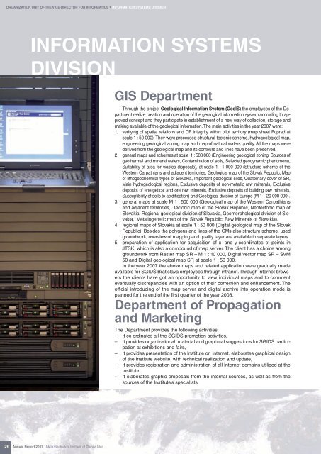
ORGANIZATION UNIT OF THE VICE-DIRECTOR FOR INFORMATICS * INFORMATION SYSTEMS DIVISIONINFORMATION SYSTEMSDIVISIONGIS DepartmentThrough the project <strong>Geological</strong> Inform<strong>at</strong>ion System (GeoIS) the employees of the Departmentrealize cre<strong>at</strong>ion and oper<strong>at</strong>ion of the geological inform<strong>at</strong>ion system according to approvedconcept and they particip<strong>at</strong>e in establishment of a new way of collection, storage andmaking available of the geological inform<strong>at</strong>ion. The main activities in the year 2007 were:1. verifying of sp<strong>at</strong>ial rel<strong>at</strong>ions and DP integrity within pilot territory (map sheet Poprad <strong>at</strong>scale 1 : 50 000). They were processed structural-tectonic scheme, hydrogeological map,engineering geological zoning map and map of n<strong>at</strong>ural w<strong>at</strong>ers quality. All the maps werederived from the geological map and its contours and lines have been preserved.2. general maps and schemes <strong>at</strong> scale 1 : 500 000 (Engineering geological zoning, Sources ofgeothermal and mineral w<strong>at</strong>ers, Contamin<strong>at</strong>ion of soils, Selected geodynamic phenomena,Suitability of area for wastes disposals), <strong>at</strong> scale 1 : 1 000 000 (Structure scheme of theWestern Carp<strong>at</strong>hians and adjacent territories, <strong>Geological</strong> map of the Slovak Republic, <strong>Map</strong>of lithogeochemical types of Slovakia, Important geological sites, Qu<strong>at</strong>ernary cover of SR,Main hydrogeological regions, Exclusive deposits of non-metallic raw minerals, Exclusivedeposits of energetical and ore raw minerals, Exclusive deposits of building raw minerals,Susceptibility of soils to acidific<strong>at</strong>ion) and <strong>Geological</strong> division of Europe (M 1 : 20 000 000).3. general maps <strong>at</strong> scale M 1 : 500 000 (<strong>Geological</strong> map of the Western Carp<strong>at</strong>hiansand adjacent territories, Tectonic map of the Slovak Republic, Neotectonic map ofSlovakia, Regional geological division of Slovakia, Geomorphological division of Slovakia,Metallogenetic map of the Slovak Republic, Raw Minerals of Slovakia).4. regional maps of Slovakia <strong>at</strong> scale 1 : 50 000 (Digital geological map of the SlovakRepublic). Besides the polygons and lines of the GMs also structure scheme, usedgroundwork, overview of mapping and quality layer are available in separ<strong>at</strong>e layers.5. prepar<strong>at</strong>ion of applic<strong>at</strong>ion for acquisition of x- and y-coordin<strong>at</strong>es of points inJTSK, which is also a compound of map server. The client has a choice amonggroundwork from Raster map SR – M 1 : 10 000, Digital vector map SR – SVM50 and Digital geological map SR <strong>at</strong> scale 1 : 50 000.In the year 2007 the above maps and rel<strong>at</strong>ed applic<strong>at</strong>ion were gradually madeavailable for SGIDŠ Br<strong>at</strong>islava employees through intranet. Through internet browsersthe clients have got an opportunity to view individual maps and to commenteventually discrepancies with an option of their correction and enhancement. Theofficial introducing of the map server and digital archive into oper<strong>at</strong>ion mode isplanned for the end of the fi rst quarter of the year 2008.Department of Propag<strong>at</strong>ionand MarketingThe Department provides the following activities:– It co ordin<strong>at</strong>es all the SGIDS promotion activities,– It provides organiz<strong>at</strong>ional, m<strong>at</strong>erial and graphical suggestions for SGIDS particip<strong>at</strong>ion<strong>at</strong> exhibitions and fairs,– It provides present<strong>at</strong>ion of the Institute on Internet, elabor<strong>at</strong>es graphical designof the Institute website, with technical realiz<strong>at</strong>ion and upd<strong>at</strong>e,– It provides registr<strong>at</strong>ion and administr<strong>at</strong>ion of all Internet domains utilised <strong>at</strong> theInstitute,– It elabor<strong>at</strong>es graphic proposals from the internal sources, as well as from thesources of the Institute’s specialists,26Annual Report 2007 <strong>St<strong>at</strong>e</strong> <strong>Geological</strong> Institute of Dionýz Štúr