Lebanon Post-Conflict Environmental Assessment - UNEP
Lebanon Post-Conflict Environmental Assessment - UNEP
Lebanon Post-Conflict Environmental Assessment - UNEP

You also want an ePaper? Increase the reach of your titles
YUMPU automatically turns print PDFs into web optimized ePapers that Google loves.
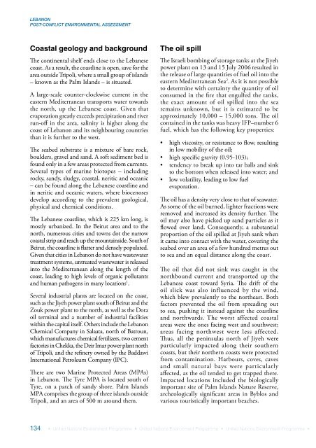
LEBANONPOST-CONFLICT ENVIRONMENTAL ASSESSMENTCoastal geology and backgroundThe continental shelf ends close to the Lebanesecoast. As a result, the coastline is open, save for thearea outside Tripoli, where a small group of islands– known as the Palm Islands – is situated.A large-scale counter-clockwise current in theeastern Mediterranean transports water towardsthe north, up the Lebanese coast. Given thatevaporation greatly exceeds precipitation and riverrun-off in the area, salinity is higher along thecoast of <strong>Lebanon</strong> and its neighbouring countriesthan it is further to the west.The seabed substrate is a mixture of bare rock,boulders, gravel and sand. A soft sediment bed isfound only in a few areas protected from currents.Several types of marine biotopes – includingrocky, sandy, sludgy, coastal, neritic and oceanic– can be found along the Lebanese coastline andin neritic and oceanic waters, where biocenosesdevelop according to the prevalent geological,physical and chemical conditions.The Lebanese coastline, which is 225 km long, ismostly urbanized. In the Beirut area and to thenorth, numerous cities and towns dot the narrowcoastal strip and reach up the mountainside. South ofBeirut, the coastline is flatter and densely populated.Given that cities in <strong>Lebanon</strong> do not have wastewatertreatment systems, untreated wastewater is releasedinto the Mediterranean along the length of thecoast, leading to high levels of organic pollutantsand human pathogens in many locations 1 .Several industrial plants are located on the coast,such as the Jiyeh power plant south of Beirut and theZouk power plant to the north, as well as the Doraoil terminal and a number of industrial facilitieswithin the capital itself. Others include the <strong>Lebanon</strong>Chemical Company in Salaata, north of Batroun,which manufactures chemical fertilizers, two cementfactories in Chekka, the Deir Imar power plant northof Tripoli, and the refinery owned by the BaddawiInternational Petroleum Company (IPC).There are two Marine Protected Areas (MPAs)in <strong>Lebanon</strong>. The Tyre MPA is located south ofTyre, on a patch of sandy shore. Palm IslandsMPA comprises the group of three islands outsideTripoli, and an area of 500 m around them.The oil spillThe Israeli bombing of storage tanks at the Jiyehpower plant on 13 and 15 July 2006 resulted inthe release of large quantities of fuel oil into theeastern Mediterranean Sea 2 . As it is not possibleto determine with certainty the quantity of oilconsumed in the fire that engulfed the tanks,the exact amount of oil spilled into the searemains unknown, but it is estimated to beapproximately 10,000 – 15,000 tons. The oilcontained in the tanks was heavy IFP–number 6fuel, which has the following key properties:• high viscosity, or resistance to flow, resultingin low mobility of the oil;• high specific gravity (0.95-103);• tendency to break up into tar balls and sinkto the bottom when released into water; and• low volatility, leading to low fuelevaporation.The oil has a density very close to that of seawater.As some of the oil burned, lighter fractions wereremoved and increased its density further. Theoil may also have picked up sand particles as itflowed over land. Consequently, a substantialproportion of the oil spilled at Jiyeh sank whenit came into contact with the water, covering theseabed over an area of a few hundred metres outto sea and an equal distance along the coast.The oil that did not sink was caught in thenorthbound current and transported up theLebanese coast toward Syria. The drift of theoil slick was also influenced by the wind,which blew prevalently to the northeast. Bothfactors prevented the oil from spreading outto sea, pushing it instead against the coastlineand northwards. The worst affected coastalareas were the ones facing west and southwest;areas facing northwest were less affected.Thus, all the peninsulas north of Jiyeh wereparticularly impacted along their southerncoasts, but their northern coasts were protectedfrom contamination. Harbours, coves, cavesand small natural bays were particularlyaffected, as the oil tended to get trapped there.Impacted locations included the biologicallyimportant site of Palm Islands Nature Reserve,archeologically significant areas in Byblos andvarious touristically important beaches.134 • United Nations Environment Programme • United Nations Environment Programme • United Nations Environment Programme •