

GEOmedia_3_2016 special issue for INTERGEO

Create successful ePaper yourself
Turn your PDF publications into a flip-book with our unique Google optimized e-Paper software.
<strong>INTERGEO</strong><br />
NEWS<br />
Sun, water and<br />
hydromethane:<br />
possible options<br />
<strong>for</strong> the energy<br />
future of the<br />
Smart Cities<br />
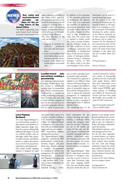
The Italian engineering company<br />
Geocart S.p.A. (www.geocart.net),<br />
in the context of the<br />
urban planning according to<br />
the "Smart Cities" approach,<br />
has focused its attention on the<br />
search <strong>for</strong> new solutions <strong>for</strong> the<br />
production of energy from renewable<br />
sources and resources<br />
and the development of innovative<br />
techniques <strong>for</strong> the monitoring<br />
of energy efficiency.<br />
The final objectives of the<br />
study are threefold:<br />
1. mapping of potential hydroelectric<br />
productivity<br />
from mini and micro-hydro<br />
plants;<br />
2. study on the feasibility of optimal<br />
hydromethane generation<br />
from renewable sources;<br />
3. analysis of the efficient use<br />
of solar resource on an urban<br />
scale.<br />
In addition to the estimation<br />
of the potential productivity<br />
of hydropower, the objective<br />
of the study is to understand<br />
the feasibility of optimal hydromethane<br />
generation from<br />
renewable sources and its use<br />
<strong>for</strong> public transport in urban<br />
areas or high environmental<br />
value areas. The activity aims<br />
to respond to market needs:<br />
the various existing technologies<br />
<strong>for</strong> hydrogen storage are<br />
not fully satisfactory in terms<br />
of efficiency, convenience and<br />
af<strong>for</strong>dability. A fundamental<br />
aspect of the activity is the generation<br />
of hydrogen-methane<br />
mixtures having a maximum<br />
hydrogen content of 30%<br />
by volume, easier to use than<br />
pure hydrogen: in fact, the hydromethane<br />
can be used in a<br />
normal natural gas engine.<br />
For the analysis of the solar<br />
potential of the urban area, the<br />
research is based on 3D mapping<br />
of city buildings, as a further<br />
instrument of knowledge,<br />
including <strong>for</strong> policy makers,<br />
of the effective potential use<br />
of solar resource on building<br />
patrimony, and as a policy instrument<br />
<strong>for</strong> the planning of<br />
new construction areas. In this<br />
context, particular attention is<br />
paid to the study of the energy<br />
exchanges of the urban area<br />
and the so-called urban heat<br />
islands.<br />
www.geocartspa.it<br />
(Source: Geocart)<br />
Location-based data<br />
and services enabling a<br />
geosmartcity<br />
Any smart-city implementation<br />
leveraging location-based data<br />
and services is undoubtedly<br />
reaching faster its sustainability<br />
aims. The EU co-funded project<br />
GeoSmartCity is contributing<br />
to this, establishing a cross-plat<strong>for</strong>m,<br />
re-usable and open hub<br />
in which different categories of<br />
users can discover and access interoperable<br />
geographic in<strong>for</strong>mation,<br />
by means of generic-purpose<br />
as well as <strong>special</strong>ized services<br />
based on open standards.<br />
The GeoSmartCity approach is<br />
applied in two different urban<br />
contexts (the Green-Energy scenario,<br />
to support the implementation<br />
of sustainable energy policies<br />
,and the Underground scenario,<br />
to support the integrated<br />
management of underground<br />
utility infrastructures) and tested<br />
by 11 pilots, consisting of<br />
cities/regions from 8 different<br />
Member States.<br />
The underlying layer of the<br />
overall GeoSmartCity architecture<br />
consists of interoperable<br />
georeferenced and semantically<br />
reach spatial datasets, which<br />
have been harmonized according<br />
to common data models<br />
which extend INSPIRE application<br />
schemas on Buildings<br />
and Utilities & Governmental<br />
Services and have been made<br />
discoverable and accessible by<br />
means of OGC webservices.<br />
http://www.epsilon-italia.it/IT<br />
(Source: Epsilon Italia)<br />
Leica Pegasus<br />
Backpack<br />
The Leica Pegasus:Backpack is<br />
an award-winning wearable reality<br />
capture sensor plat<strong>for</strong>m. A<br />
highly ergonomic design combines<br />
five cameras offering fully<br />
calibrated 360 degrees view and<br />
two LiDAR profilers with an<br />
ultra-light carbon fibre chassis.<br />
It enables extensive and efficient<br />
indoor or outdoor documentation<br />
at a level of accuracy that is<br />
authoritative and professional.<br />
This unique mobile mapping<br />
solution is designed <strong>for</strong> rapid<br />
and regular reality capture. It is<br />
completely portable, enabling it<br />
to be checked in as luggage on<br />
a flight. The Pegasus:Backpack<br />
is designed to act a sensor plat<strong>for</strong>m<br />
with our standard external<br />
trigger and sync port outputs.<br />
BIM – map indoors, outdoors,<br />
underground, anywhere<br />
The Pegasus:Backpack makes<br />
progressive professional BIM<br />
documentation a reality. It synchronises<br />
imagery and point<br />
cloud data, there<strong>for</strong>e assuring<br />
a complete documentation<br />
of a building <strong>for</strong> full life cycle<br />
management. By using SLAM<br />
(Simultaneous Localisation<br />
and Mapping) technology and<br />
a high precision IMU, it ensures<br />
accurate positioning with<br />
GNSS outages.<br />
Industrial training – realitybased<br />
in<strong>for</strong>mation <strong>for</strong> fast<br />
response Knowing and understanding<br />
a landscape be<strong>for</strong>e<br />
rushing into emergency situations<br />
can save lives. Document<br />
any site in 3D models and<br />
images <strong>for</strong> fast, safe and efficient<br />
response. Combined with<br />
Autodesk, Intergraph and other<br />
software, reality-based industrial<br />
training is enhanced with<br />
the most accurate and current<br />
data sets. Safety & security – in<strong>for</strong>med<br />
decisions in emergency<br />
situations<br />
The Pegasus:Backpack helps<br />
you to make better and faster<br />
decisions in emergency situations<br />
due to access to more accurate<br />
data. Evacuation plans<br />
and route mapping benefit<br />
from clear and detailed images<br />
and point clouds that alert authorities<br />
to any changes. Access<br />
densely populated areas, providing<br />
accurate and current mapping<br />
to give city authorities a<br />
clearer and deeper understanding<br />
of the situation.<br />
Natural disaster response – minimise<br />
damage and save lives<br />
For the first time, responders<br />
to natural disasters can capture<br />
disaster area data in 3D on foot.<br />
Faster response times translate<br />
into lives saved and damage<br />
minimised. Capture the critical<br />
data needed to make faster and<br />
better in<strong>for</strong>med decisions that<br />
increases chances of survival and<br />
reconstruction.<br />
Contact us <strong>for</strong> more in<strong>for</strong>mation<br />
or to request a demo.<br />
www.geomatica.it<br />
(Source: Teorema srl)<br />
36 Special Supplement to <strong>GEOmedia</strong> Journal Issue n. 3-<strong>2016</strong>


