CU1703

You also want an ePaper? Increase the reach of your titles
YUMPU automatically turns print PDFs into web optimized ePapers that Google loves.
CASEstudy<br />
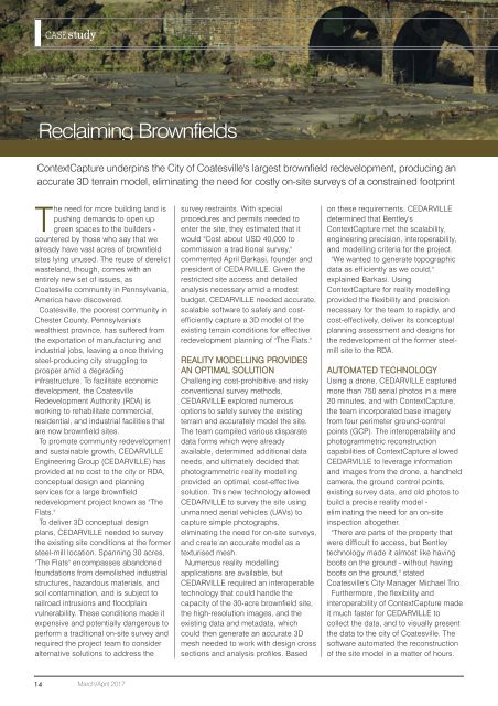
Reclaiming Brownfields<br />
ContextCapture underpins the City of Coatesville's largest brownfield redevelopment, producing an<br />
accurate 3D terrain model, eliminating the need for costly on-site surveys of a constrained footprint<br />
The need for more building land is<br />
pushing demands to open up<br />
green spaces to the builders -<br />
countered by those who say that we<br />
already have vast acres of brownfield<br />
sites lying unused. The reuse of derelict<br />
wasteland, though, comes with an<br />
entirely new set of issues, as<br />
Coatesville community in Pennsylvania,<br />
America have discovered.<br />
Coatesville, the poorest community in<br />
Chester County, Pennsylvania's<br />
wealthiest province, has suffered from<br />
the exportation of manufacturing and<br />
industrial jobs, leaving a once thriving<br />
steel-producing city struggling to<br />
prosper amid a degrading<br />
infrastructure. To facilitate economic<br />
development, the Coatesville<br />
Redevelopment Authority (RDA) is<br />
working to rehabilitate commercial,<br />
residential, and industrial facilities that<br />
are now brownfield sites.<br />
To promote community redevelopment<br />
and sustainable growth, CEDARVILLE<br />
Engineering Group (CEDARVILLE) has<br />
provided at no cost to the city or RDA,<br />
conceptual design and planning<br />
services for a large brownfield<br />
redevelopment project known as "The<br />
Flats."<br />
To deliver 3D conceptual design<br />
plans, CEDARVILLE needed to survey<br />
the existing site conditions at the former<br />
steel-mill location. Spanning 30 acres,<br />
"The Flats" encompasses abandoned<br />
foundations from demolished industrial<br />
structures, hazardous materials, and<br />
soil contamination, and is subject to<br />
railroad intrusions and floodplain<br />
vulnerability. These conditions made it<br />
expensive and potentially dangerous to<br />
perform a traditional on-site survey and<br />
required the project team to consider<br />
alternative solutions to address the<br />
survey restraints. With special<br />
procedures and permits needed to<br />
enter the site, they estimated that it<br />
would "Cost about USD 40,000 to<br />
commission a traditional survey,"<br />
commented April Barkasi, founder and<br />
president of CEDARVILLE. Given the<br />
restricted site access and detailed<br />
analysis necessary amid a modest<br />
budget, CEDARVILLE needed accurate,<br />
scalable software to safely and costefficiently<br />
capture a 3D model of the<br />
existing terrain conditions for effective<br />
redevelopment planning of "The Flats."<br />
REALITY MODELLING PROVIDES<br />
AN OPTIMAL SOLUTION<br />
Challenging cost-prohibitive and risky<br />
conventional survey methods,<br />
CEDARVILLE explored numerous<br />
options to safely survey the existing<br />
terrain and accurately model the site.<br />
The team compiled various disparate<br />
data forms which were already<br />
available, determined additional data<br />
needs, and ultimately decided that<br />
photogrammetric reality modelling<br />
provided an optimal, cost-effective<br />
solution. This new technology allowed<br />
CEDARVILLE to survey the site using<br />
unmanned aerial vehicles (UAVs) to<br />
capture simple photographs,<br />
eliminating the need for on-site surveys,<br />
and create an accurate model as a<br />
texturised mesh.<br />
Numerous reality modelling<br />
applications are available, but<br />
CEDARVILLE required an interoperable<br />
technology that could handle the<br />
capacity of the 30-acre brownfield site,<br />
the high-resolution images, and the<br />
existing data and metadata, which<br />
could then generate an accurate 3D<br />
mesh needed to work with design cross<br />
sections and analysis profiles. Based<br />
on these requirements, CEDARVILLE<br />
determined that Bentley's<br />
ContextCapture met the scalability,<br />
engineering precision, interoperability,<br />
and modelling criteria for the project.<br />
"We wanted to generate topographic<br />
data as efficiently as we could,"<br />
explained Barkasi. Using<br />
ContextCapture for reality modelling<br />
provided the flexibility and precision<br />
necessary for the team to rapidly, and<br />
cost-effectively, deliver its conceptual<br />
planning assessment and designs for<br />
the redevelopment of the former steelmill<br />
site to the RDA.<br />
AUTOMATED TECHNOLOGY<br />
Using a drone, CEDARVILLE captured<br />
more than 750 aerial photos in a mere<br />
20 minutes, and with ContextCapture,<br />
the team incorporated base imagery<br />
from four perimeter ground-control<br />
points (GCP). The interoperability and<br />
photogrammetric reconstruction<br />
capabilities of ContextCapture allowed<br />
CEDARVILLE to leverage information<br />
and images from the drone, a handheld<br />
camera, the ground control points,<br />
existing survey data, and old photos to<br />
build a precise reality model -<br />
eliminating the need for an on-site<br />
inspection altogether.<br />
"There are parts of the property that<br />
were difficult to access, but Bentley<br />
technology made it almost like having<br />
boots on the ground - without having<br />
boots on the ground," stated<br />
Coatesville's City Manager Michael Trio.<br />
Furthermore, the flexibility and<br />
interoperability of ContextCapture made<br />
it much faster for CEDARVILLE to<br />
collect the data, and to visually present<br />
the data to the city of Coatesville. The<br />
software automated the reconstruction<br />
of the site model in a matter of hours.<br />
14<br />
March/April 2017