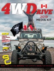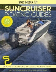
2017 SunCruiser West Coast
West Coast SunCruiser, providing you with safe boating information since 1997.
West Coast SunCruiser, providing you with safe boating information since 1997.

You also want an ePaper? Increase the reach of your titles
YUMPU automatically turns print PDFs into web optimized ePapers that Google loves.
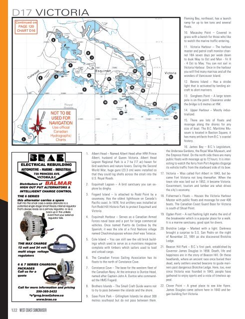
D17 VICTORIA<br />
Continued on<br />
PAGE 120<br />
CHART D16<br />
N<br />
N<br />
20ϒ E. Variation<br />
20ϒ E. Variation<br />
NOT TO BE<br />
USED FOR<br />
NAVIGATION<br />
Use official<br />
Canadian<br />
Hydrographic<br />
Charts<br />
1. Albert Head – Named Albert Head after HRH Prince<br />
Albert, husband of Queen Victoria. Albert Head<br />
Lagoon Regional Park is a 7 ha (17 ac) haven for<br />
bird watchers and nature lovers. During the Second<br />
World War, huge guns (23.3 cm) were installed so<br />
that they could log shells across the strait into the<br />
U.S. Royal Roads.<br />
2. Esquimalt Lagoon – A bird sanctuary you can explore<br />
by dinghy.<br />
3. Fisgard Island – Is attached to Rodd Point by a<br />
causeway. Has the oldest lighthouse on Canada’s<br />
Pacific coast. In 1878, first artillery was installed at<br />
Fort Rodd Hill Historic Park to protect Esquimalt and<br />
Victoria.<br />
4. Esquimalt Harbour – Serves as a Canadian Armed<br />
Forces naval base and a port for large commercial<br />
vehicles. Once named Puerto de Cordova by the<br />
Spanish; it was the site of a First Nations village<br />
named Chachimutupusas whose chief was Tetacus.<br />
5. Cole Island – You can still see the old brick buildings<br />
which used to serve as a munitions magazine<br />
complete with timbers which sailors used to load<br />
and unload cargo.<br />
6. The Canadian Forces Sailing Association has its<br />
floats to the north of Constance Cove.<br />
7. Constance Cove – The base for the western fleet of<br />
the Canadian Navy. At the entrance is Duntze Head,<br />
named after Captain John A. Duntze who commanded<br />
the HMS Fisgard.<br />
8. Brothers Islands – The Small Craft Guide warns not<br />
to try to pass between the islands and the shore.<br />
9. Saxe Point Park – Gillingham Islands lie about 300<br />
metres southeast but do not pass between them.<br />
Fleming Bay, northeast, has a launch<br />
ramp for up to ten tons and several<br />
floats.<br />
10. Macauley Point – Covered in<br />
grass with a bench for those who like<br />
to watch the marine traffic entering.<br />
11. Victoria Harbour – The harbour<br />
master and patrol craft monitor channel<br />
18A seven days per week dawn<br />
to dusk May to Oct and Mon - Fri 8<br />
- 4 Oct to May. You can not sail in<br />
Victoria Harbour. Once in the harbour<br />
you will find many marinas and all the<br />
wonders of Vancouver Island.<br />
12. Berens Island – Has a strobe<br />
light that is activated by landing aircraft<br />
to alert mariners.<br />
13. Songhees Point – A large totem<br />
pole is on the point. Clearance under<br />
the bridge is 6 metres at HW.<br />
14. Upper Harbour – Mostly industrialized.<br />
15. There are lots of floats and<br />
moorage along the shores for any<br />
size of boat. The B.C. Maritime Museum<br />
is located in Bastion Square; it<br />
has many artifacts from B.C.’s coastal<br />
history.<br />
16. James Bay – B.C.’s Legislature,<br />
the Undersea Gardens, the Royal Wax Museum, and<br />
the Empress Hotel. On the north side there are many<br />
public floats with moorage up to 72 hours. It is interesting<br />
to watch the ferry from Port Angeles disgorge<br />
its vehicle traffic from the starboard side of its bow.<br />
17. Victoria – Was called Fort Albert in 1843, but became<br />
Fort Victoria not long thereafter. When the<br />
town site was laid out in 1852, it became Victoria.<br />
Government, tourism and lumber are what drives<br />
the city’s economy.<br />
18. Fisherman’s Floats – Houses the Victoria Harbour<br />
Master with public floats and moorage for over 400<br />
boats. The Canadian <strong>Coast</strong> Guard Base for Victoria<br />
is south of Shoal Point.<br />
19. Ogden Point – A red flashing light marks the end of<br />
the breakwater which is a popular place for a walk.<br />
It is a marine sanctuary, good spot for divers.<br />
20. Brotchie Ledge – Marked with a light. Darkness<br />
brought a surprise to S.S. San Pedro on the night<br />
of November 22, 1891 as she discovered Brotchie<br />
Ledge.<br />
21. Beacon Hill Park – B.C.’s first park, established by<br />
Governor James Douglas in 1858. Death, life and<br />
happiness are in the story of Beacon Hill. On these<br />
headlands, where an ancient race once buried their<br />
dead, early settlers erected beacons to guide mariners<br />
past dangerous Brotchie Ledge. Here, too, ever<br />
since Victoria was founded in 1843, people have<br />
gathered to enjoy sports and a vista of timeless appeal.<br />
22. Clover Point – A great place to see kite flyers.<br />
James Douglas came ashore here in 1843 and began<br />
building Fort Victoria.<br />
122 WEST COAST SUNCRUISER