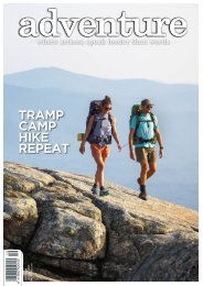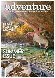
Adventure Magazine
Issue 237: Survival Issue
Issue 237: Survival Issue

Create successful ePaper yourself
Turn your PDF publications into a flip-book with our unique Google optimized e-Paper software.
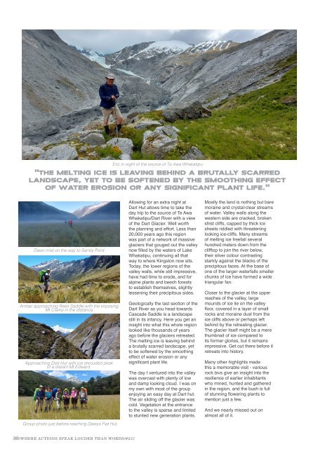
Eric in sight of the source of Te Awa Whakatipu.<br />
"The melting ice is leaving behind a brutally scarred<br />
landscape, yet to be softened by the smoothing effect<br />
of water erosion or any significant plant life."<br />
Dawn mist on the way to Sandy Point<br />
Amber approaching Rees Saddle with the imposing<br />
Mt Clarke in the distance<br />
Approaching Dart Hut with ice shrouded peak<br />
of a distant Mt Edward.<br />
Group photo just before reaching Daleys Flat Hut<br />
Allowing for an extra night at<br />
Dart Hut allows time to take the<br />
day trip to the source of Te Awa<br />
Whakatipu/Dart River with a view<br />
of the Dart Glacier. Well worth<br />
the planning and effort. Less than<br />
20,000 years ago this region<br />
was part of a network of massive<br />
glaciers that gouged out the valley<br />
now filled by the waters of Lake<br />
Whakatipu, continuing all that<br />
way to where Kingston now sits.<br />
Today, the lower regions of the<br />
valley walls, while still impressive,<br />
have had time to erode, and for<br />
alpine plants and beech forests<br />
to establish themselves, slightly<br />
lessening their precipitous sides.<br />
Geologically the last section of the<br />
Dart River as you head towards<br />
Cascade Saddle is a landscape<br />
still in its infancy. Here you get an<br />
insight into what this whole region<br />
looked like thousands of years<br />
ago before the glaciers retreated.<br />
The melting ice is leaving behind<br />
a brutally scarred landscape, yet<br />
to be softened by the smoothing<br />
effect of water erosion or any<br />
significant plant life.<br />
The day I ventured into the valley<br />
was overcast with plenty of low<br />
and damp looking cloud. I was on<br />
my own with most of the group<br />
enjoying an easy day at Dart hut.<br />
The air sliding off the glacier was<br />
cold. Vegetation at the entrance<br />
to the valley is sparse and limited<br />
to stunted new generation plants.<br />
Mostly the land is nothing but bare<br />
moraine and crystal-clear streams<br />
of water. Valley walls along the<br />
western side are cracked, broken<br />
shist cliffs, capped by thick ice<br />
sheets riddled with threatening<br />
looking ice-cliffs. Many streams<br />
of melting ice freefall several<br />
hundred meters down from the<br />
clifftop to join the river below,<br />
their silver colour contrasting<br />
starkly against the blacks of the<br />
precipitous faces. At the base of<br />
one of the larger waterfalls smaller<br />
chunks of ice have formed a wide<br />
triangular fan.<br />
Closer to the glacier at the upper<br />
reaches of the valley, large<br />
mounds of ice lie on the valley<br />
floor, covered in a layer of small<br />
rocks and moraine dust from the<br />
ice cliffs above or perhaps left<br />
behind by the retreating glacier.<br />
The glacier itself might be a mere<br />
thumbnail of ice compared to<br />
its former glories, but it remains<br />
impressive. Get out there before it<br />
retreats into history.<br />
Many other highlights made<br />
this a memorable visit - various<br />
rock bivs give an insight into the<br />
resilience of earlier inhabitants<br />
who mined, hunted and gathered<br />
in the region, and the bush is full<br />
of stunning flowering plants to<br />
mention just a few.<br />
And we nearly missed out on<br />
almost all of it.<br />
30//WHERE ACTIONS SPEAK LOUDER THAN WORDS/#237<br />
BOBO.CO.NZ/SALEWA