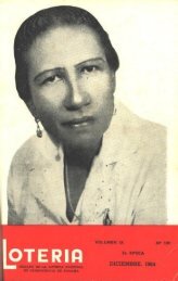
Diciembre Nº 85 - Biblioteca Virtual El Dorado
Diciembre Nº 85 - Biblioteca Virtual El Dorado
Diciembre Nº 85 - Biblioteca Virtual El Dorado

Create successful ePaper yourself
Turn your PDF publications into a flip-book with our unique Google optimized e-Paper software.
104. Petermann, August Heinrich, 1822- 1878<br />
Der Isthmus von Panama im maass$labe von 1 ;200,000. Nach der gronen<br />
aufname von G.M. Totten, 1<strong>85</strong>7. .. und nach den Forschungen. Messungen<br />
u. handschriftlichen Croquis von Dr. Morit: Wagner. (From his Erganzungen<br />
zu Stieler's hand-atlas. Gotha, J. Perthes, 1862).<br />
Carta marítima del reyno de Tierra Firme u Castila de Oro, comprehende<br />
105. López, Juan<br />
el Istmos y la provincias de Panama, Veraguas, Darien y Biruquete. Sevila,<br />
17<strong>85</strong>.<br />
d. map 22, 27, 69.<br />
106. Mapa particular del Golfo e Isthmo de la Darien. ., 1788. N.p. 1788.<br />
Signatura cannot be read.<br />
107. Ruta de Antioquiaa Panama. ., N.p. n.d.<br />
Map of Darien showing political jurisdictions and distribution of Indian<br />
tribes.<br />
108. Roda, Cri$tobal de<br />
Description de Puertovelo y planta de la Ciudad y sus Castilas _ _. 1626.<br />
N.p. 1626.<br />
109. Rodrigues:, Nicolas, captain<br />
Plano Geographico desde la Ciudad de Panama hasta el Rio de Cha9re<br />
1735. N.p. 1735.<br />
110. Restoration of the Church of Sto Anastasius (Old Panama) N.p. n.d.<br />
111. Map of the Province of Choco; sent in a letter frt"m Cali, April 14, 1610,<br />
by Governor Francisco Sarmiento. Shows territory between Rio Cauca and<br />
the Pacific; and from the Magdalena River to Nombre de Dios.<br />
112. Map of Panama and adjacellt territory. N.p. ...ei. iilc~¡ble.<br />
113. An ancient map of P¡¡nama, showing territorial divisions & old cities. N.p.<br />
n.d.<br />
See map 121.<br />
1 14. Plano de la Provincia del Darien del Sur. . _ N.p. n.d.<br />
Map of Darien showing lines of travel. IlIegible.<br />
115. See Map 119.<br />
1 16. Mapa general de la Costa que intermedia entre las Razas Cartagena y Portobelo.<br />
.. (Coa$tal map - Cartagena to Porto Bello. 1761).<br />
Signature on map iIegible.<br />
117. A Plan of the Harbour and part adjacent where the Scots Company ..ere<br />
settled upon the Isthmus of Darien. Reduced from Plan in the "Darien Papers."<br />
118. Sketch map of the Welt Indies and C~ntral America showing the route taken<br />
by the First Expedition to Darien. N.p. n.d.<br />
Route shown ends at Calidonia Bay.<br />
1 19. Plan que com,prahende todo el tareno que ocupaii 105 Gentiles de el Darien y<br />
Calidonia... Santa Fe (de Bogota?) 1784.<br />
Map bears signature of Antonio de la Torre.<br />
120. See Map 129.<br />
~OTERIA 63<br />
--