Verde Galápagos #2
Te invitamos a leer nuestra segunda edición de la revista digital Verde Galápagos.
Te invitamos a leer nuestra segunda edición de la revista digital Verde Galápagos.

Create successful ePaper yourself
Turn your PDF publications into a flip-book with our unique Google optimized e-Paper software.
verdE galápagos<br />
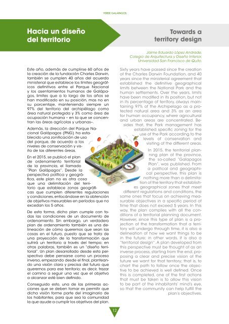
Hacia un diseño<br />
del territorio<br />
Towards a<br />
territory design<br />
Jaime Eduardo López Andrade,<br />
Colegio de Arquitectura y Diseño Interior,<br />
Universidad San Francisco de Quito.<br />
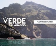
Este año, además de cumplirse 60 años de<br />
la creación de la fundación Charles Darwin,<br />
también se cumplen 40 años del acuerdo<br />
ministerial que establece los límites geográficos<br />
definitivos entre el Parque Nacional<br />
y los asentamientos humanos de <strong>Galápagos</strong>,<br />
limites que a lo largo de los años se<br />
han modificado en su posición, mas no en<br />
su porcentaje, manteniendo siempre un<br />
97% del territorio del archipiélago como<br />
área natural protegida y 3% como área de<br />
ocupación humana – en la que se concentran<br />
las áreas agrícolas y urbanas–.<br />
Además, la dirección del Parque Nacional<br />
<strong>Galápagos</strong> (PNG) ha establecido<br />
una zonificación de uso<br />
del parque, de acuerdo a los<br />
niveles de conservación y visita<br />
de las diferentes áreas.<br />
En el 2015, se publicó el plan<br />
de ordenamiento territorial<br />
de la provincia, el llamado<br />
“Plan <strong>Galápagos</strong>”. Desde la<br />
perspectiva política y geográfica,<br />
este plan no es otra cosa<br />
que una delimitación del territorio<br />
que establece zonas geográficas<br />
que cumplen diferentes regulaciones<br />
y condiciones, enfocándose en la obtención<br />
de objetivos mesurables en períodos que no<br />
excedan los 5 años.<br />
De esta forma, dicho plan cumple con todas<br />
las condiciones de un documento de<br />
ordenamiento. Sin embargo, un verdadero<br />
plan de ordenamiento también es una delineación<br />
de cómo queremos que sean las<br />
cosas en el futuro, puesto que se trata de<br />
una proyección de la transformación que<br />
sufrirá un territorio a través del tiempo; en<br />
otras palabras, también es un “diseño territorial”.<br />
Un plan desarrollado desde esta perspectiva<br />
debe pensarse como un proceso<br />
inverso, empezando desde el final, planteando<br />
una visión clara y precisa del futuro que<br />
queremos para ese territorio; es decir, trazar<br />
el camino a seguir una vez que el objetivo<br />
a alcanzar esté bien definido.<br />
Conseguido esto, una de las primeras acciones<br />
que se deben tomar es permitir que<br />
dicha visión forme parte del imaginario de<br />
los habitantes, para que sea la comunidad<br />
la que ayude a cumplir los objetivos del plan.<br />
Sixty years have passed since the creation<br />
of the Charles Darwin Foundation, and 40<br />
years since the ministerial agreement that<br />
established the definitive geographical<br />
limits between the National Park and the<br />
human settlements. Over the years, limits<br />
have been modified in its position, but not<br />
in its percentage of territory, always maintaining<br />
97% of the Archipelago as a protected<br />
natural area and 3% as an area<br />
for human occupancy, where agricultural<br />
and urban areas are concentrated. Besides<br />
that, the Park management has<br />
established specific zoning for the<br />
use of the Park according to the<br />
levels of conservation and<br />
visiting of the different areas.<br />
In 2015, the territorial planning<br />
plan of the province,<br />
the so-called “Galapagos<br />
Plan”, was published. From<br />
a political and geographical<br />
perspective, this plan is<br />
nothing more than a delimitation<br />
of the territory that establishes<br />
geographical zones that meet<br />
different regulations and conditions, the<br />
same ones that focus on achieving measurable<br />
objectives in a specific period of<br />
time that does not exceed 5 years. In this<br />
way, the plan complies with all the conditions<br />
of a territorial planning document.<br />
However, since this type of plan is a projection<br />
of the transformation that a territory<br />
will undergo through time, it is also a<br />
delineation of how we want things to be<br />
in the future; in other words, it is also a<br />
“territorial design”. A plan developed from<br />
this perspective must be thought of as an<br />
inverse process, starting from the end, proposing<br />
a clear and precise vision of the<br />
future we want for that territory; that is, to<br />
chart the path to follow once the objective<br />
to be achieved is well defined. Once<br />
this is completed, one of the first actions<br />
that must be taken is to allow this vision<br />
to be part of the inhabitants’ mind’s eye,<br />
so that the community can help fulfill the<br />
plan’s objectives.<br />
12