FRENCH PAVILION - Ambassade de France
FRENCH PAVILION - Ambassade de France
FRENCH PAVILION - Ambassade de France

Create successful ePaper yourself
Turn your PDF publications into a flip-book with our unique Google optimized e-Paper software.
G-TeC<br />
le Vaisseau,<br />
120, boulevard amiral Mouchez<br />
76600 le HaVRe - FRanCe<br />
Tel: +33 (0)2 35 25 44 47<br />
Fax: +33 (0)9 72 11 68 21<br />
www.g-tec.eu<br />
COnTaCTS<br />
Philippe THOIRON<br />
Director<br />
Prt: + 33 (0)6 78 70 15 47<br />
pthoiron@g-teceu<br />
Caroline DEFOuR<br />
Market Development<br />
Tel: + 33 (0)2 35 25 44 47<br />
c<strong>de</strong>four@g-teceu<br />
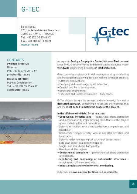
As expert in geology, geophysics, geotechnics and Environment<br />
since 1993, G-tec intervenes at different stages in several major<br />
worldwi<strong>de</strong> engineering projects, on land and at sea.<br />
G-tec provi<strong>de</strong>s assistance in risk management by conducting<br />
site investigations allowing <strong>de</strong>cision making for major projects:<br />
• Offshore Renewables,<br />
• Dredging and marine aggregate extraction,<br />
• Coastal and Ports <strong>de</strong>velopment,<br />
• Structural engineering,<br />
• Pipelines and Cables installation - inspections.<br />
G-Tec always <strong>de</strong>signs its surveys and site investigation with a<br />
<strong>de</strong>dicated approach, combining if necessary the methods that<br />
are the most suited to match the scope of the project.<br />
In the offshore wind field, g-tec realizes:<br />
• geophysical investigations – subsurface characterization<br />
and i<strong>de</strong>ntification by implementing tools that suit the project<br />
goals, including (but not restricting):<br />
- Seismic refraction: rock characterization, compactness and<br />
rippability;<br />
- Gradiometer magnetometry: wrecks and UXO <strong>de</strong>tection and<br />
localization;<br />
- Seismic reflection: geological structural assessment;<br />
- Si<strong>de</strong> scan sonar: sea bottom mapping;<br />
- Single- and multibeam bathymetry;<br />
- Geophysical diagraphies.<br />
• geotechnical campaigns - geomechanical characterization<br />
of materials.<br />
• Monitoring and positioning of sub-aquatic structures -<br />
imaging with different methods.<br />
• Impact studies and environmental monitoring.<br />
G-tec has its own nautical facilities and equipments.<br />
25