reese creek zoning district regulations and map - Gallatin County ...
reese creek zoning district regulations and map - Gallatin County ...
reese creek zoning district regulations and map - Gallatin County ...
Create successful ePaper yourself
Turn your PDF publications into a flip-book with our unique Google optimized e-Paper software.
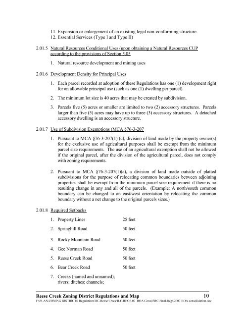
11. Expansion or enlargement of an existing legal non-conforming structure.<br />
12. Essential Services (Type I <strong>and</strong> Type II)<br />
2.01.5 Natural Resources Conditional Uses (upon obtaining a Natural Resources CUP<br />
according to the provisions of Section 5.05<br />
1. Natural resource development <strong>and</strong> mining uses<br />
2.01.6 Development Density for Principal Uses<br />
1. Each parcel recorded at adoption of these Regulations has one (1) development right<br />
for an allowable principal use (such as one (1) dwelling per parcel).<br />
2. The minimum lot size is 40 acres that may be created by subdivision.<br />
3. Parcels five (5) acres or smaller are limited to two (2) accessory structures. Parcels<br />
larger than five (5) acres may have up to three (3) accessory structures. A detached<br />
accessory dwelling is an accessory structure.<br />
2.01.7 Use of Subdivision Exemptions (MCA §76-3-207<br />
1. Pursuant to MCA §76-3-207(1) (c), division of l<strong>and</strong> made by the property owner(s)<br />
for the exclusive use of agricultural purposes shall be exempt from the minimum<br />
parcel size requirements. The use of an agricultural exemption shall not be allowed<br />
if the original parcel, after the division of the agricultural parcel, does not comply<br />
with <strong>zoning</strong> requirements.<br />
2. Pursuant to MCA §76-3-207(1)(a), a division of l<strong>and</strong> made outside of platted<br />
subdivisions for the purpose of relocating common boundaries between adjoining<br />
properties shall be exempt from the minimum parcel size requirement if there is no<br />
resulting change in any <strong>and</strong> all of the parcels. (Example: A north/south common<br />
boundary can be changed to an east/west orientation by relocating the common<br />
boundary without a net change to the original parcels sizes.)<br />
2.01.8 Required Setbacks<br />
1. Property Lines 25 feet<br />
2. Springhill Road 50 feet<br />
3. Rocky Mountain Road 50 feet<br />
4. Gee Norman Road 50 feet<br />
5. Reese Creek Road 50 feet<br />
6. Bear Creek Road 50 feet<br />
7. Creeks (named <strong>and</strong> unnamed);<br />
rivers; ditches; channels;<br />
Reese Creek Zoning District Regulations <strong>and</strong> Map 10<br />
F:\PLAN\ZONING DISTRICTS Regulations\RC.Reese Creek\R.C.REGS.07 BOA Consol\RC.Final.Regs.2007 BOA consolidation.doc


