reese creek zoning district regulations and map - Gallatin County ...
reese creek zoning district regulations and map - Gallatin County ...
reese creek zoning district regulations and map - Gallatin County ...
You also want an ePaper? Increase the reach of your titles
YUMPU automatically turns print PDFs into web optimized ePapers that Google loves.
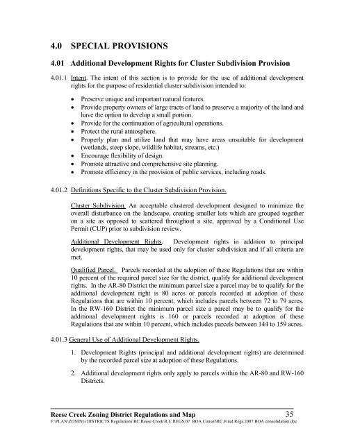
4.0 SPECIAL PROVISIONS<br />
4.01 Additional Development Rights for Cluster Subdivision Provision<br />
4.01.1 Intent. The intent of this section is to provide for the use of additional development<br />
rights for the purpose of residential cluster subdivision intended to:<br />
Preserve unique <strong>and</strong> important natural features.<br />
Provide property owners of large tracts of l<strong>and</strong> to preserve a majority of the l<strong>and</strong> <strong>and</strong><br />
have the option to develop a small portion.<br />
Provide for the continuation of agricultural operations.<br />
Protect the rural atmosphere.<br />
Properly plan <strong>and</strong> utilize l<strong>and</strong> that may have areas unsuitable for development<br />
(wetl<strong>and</strong>s, steep slope, wildlife habitat, streams, etc.)<br />
Encourage flexibility of design.<br />
Promote attractive <strong>and</strong> comprehensive site planning.<br />
Promote efficiency in the provision of public services, including roads.<br />
4.01.2 Definitions Specific to the Cluster Subdivision Provision.<br />
Cluster Subdivision. An acceptable clustered development designed to minimize the<br />
overall disturbance on the l<strong>and</strong>scape, creating smaller lots which are grouped together<br />
on a site as opposed to scattered throughout a site, approved by a Conditional Use<br />
Permit (CUP) prior to subdivision review.<br />
Additional Development Rights. Development rights in addition to principal<br />
development rights, that may be used only for cluster subdivision <strong>and</strong> if all criteria are<br />
met.<br />
Qualified Parcel. Parcels recorded at the adoption of these Regulations that are within<br />
10 percent of the required parcel size for the <strong>district</strong>, qualify for additional development<br />
rights. In the AR-80 District the minimum parcel size a parcel may be to qualify for the<br />
additional development right is 80 acres or parcels recorded at adoption of these<br />
Regulations that are within 10 percent, which includes parcels between 72 to 79 acres.<br />
In the RW-160 District the minimum parcel size a parcel may be to qualify for the<br />
additional development rights is 160 or parcels recorded at adoption of these<br />
Regulations that are within 10 percent, which includes parcels between 144 to 159 acres.<br />
4.01.3 General Use of Additional Development Rights.<br />
1. Development Rights (principal <strong>and</strong> additional development rights) are determined<br />
by the recorded parcel size at adoption of these Regulations.<br />
2. Additional development rights only apply to parcels within the AR-80 <strong>and</strong> RW-160<br />
Districts.<br />
Reese Creek Zoning District Regulations <strong>and</strong> Map 35<br />
F:\PLAN\ZONING DISTRICTS Regulations\RC.Reese Creek\R.C.REGS.07 BOA Consol\RC.Final.Regs.2007 BOA consolidation.doc


