Route 104 Corridor Trail Feasibility Study - Genesee Transportation ...
Route 104 Corridor Trail Feasibility Study - Genesee Transportation ...
Route 104 Corridor Trail Feasibility Study - Genesee Transportation ...

You also want an ePaper? Increase the reach of your titles
YUMPU automatically turns print PDFs into web optimized ePapers that Google loves.
INVENTORY AND ANALYSIS<br />
4<br />
<strong>Route</strong> <strong>104</strong> <strong>Corridor</strong> <strong>Trail</strong> <strong>Feasibility</strong> <strong>Study</strong><br />
General Characteristics of <strong>Study</strong> Area Streams. A<br />
stable stream can be generally defined as a stream that<br />
transports sediment load while maintaining stream<br />
geometry and does not aggrade or degrade (Rosgen,<br />
1996). Although many of the streams within the study<br />
area have been engineered due to their proximity to<br />
<strong>Route</strong> <strong>104</strong>, these streams seem to be in stable<br />
condition. Based on preliminary observations, in most<br />
cases no eroded, undercut banks were observed. A<br />
more detailed analysis is needed to accurately predict<br />
channel stability. Streams were assessed in close<br />
proximity to <strong>Route</strong> <strong>104</strong>, but typically the waterways<br />
become more scenic and naturalized further away from<br />
the highway.<br />
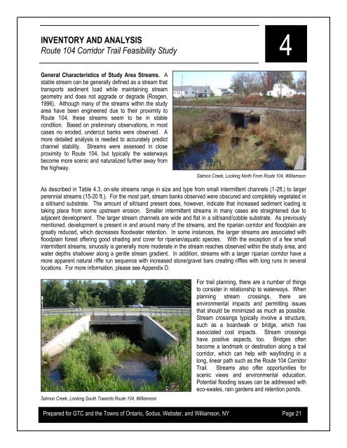
Salmon Creek, Looking North From <strong>Route</strong> <strong>104</strong>, Williamson<br />
As described in Table 4.3, on-site streams range in size and type from small intermittent channels (1-2ft.) to larger<br />
perennial streams (15-20 ft.). For the most part, stream banks observed were obscured and completely vegetated in<br />
a silt/sand substrate. The amount of silt/sand present does, however, indicate that increased sediment loading is<br />
taking place from some upstream erosion. Smaller intermittent streams in many cases are straightened due to<br />
adjacent development. The larger stream channels are wide and flat in a silt/sand/cobble substrate. As previously<br />
mentioned, development is present in and around many of the streams, and the riparian corridor and floodplain are<br />
greatly reduced, which decreases floodwater retention. In some instances, the larger streams are associated with<br />
floodplain forest offering good shading and cover for riparian/aquatic species. With the exception of a few small<br />
intermittent streams, sinuosity is generally more moderate in the stream reaches observed within the study area, and<br />
water depths shallower along a gentle stream gradient. In addition, streams with a larger riparian corridor have a<br />
more apparent natural riffle run sequence with increased stone/gravel bars creating riffles with long runs in several<br />
locations. For more information, please see Appendix D.<br />
Salmon Creek, Looking South Towards <strong>Route</strong> <strong>104</strong>, Williamson<br />
For trail planning, there are a number of things<br />
to consider in relationship to waterways. When<br />
planning stream crossings, there are<br />
environmental impacts and permitting issues<br />
that should be minimized as much as possible.<br />
Stream crossings typically involve a structure,<br />
such as a boardwalk or bridge, which has<br />
associated cost impacts. Stream crossings<br />
have positive aspects, too. Bridges often<br />
become a landmark or destination along a trail<br />
corridor, which can help with wayfinding in a<br />
long, linear path such as the <strong>Route</strong> <strong>104</strong> <strong>Corridor</strong><br />
<strong>Trail</strong>. Streams also offer opportunities for<br />
scenic views and environmental education.<br />
Potential flooding issues can be addressed with<br />
eco-swales, rain gardens and retention ponds.<br />
Prepared for GTC and the Towns of Ontario, Sodus, Webster, and Williamson, NY Page 21