Route 104 Corridor Trail Feasibility Study - Genesee Transportation ...
Route 104 Corridor Trail Feasibility Study - Genesee Transportation ...
Route 104 Corridor Trail Feasibility Study - Genesee Transportation ...

Create successful ePaper yourself
Turn your PDF publications into a flip-book with our unique Google optimized e-Paper software.
INVENTORY AND ANALYSIS<br />
4<br />
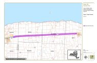
<strong>Route</strong> <strong>104</strong> <strong>Corridor</strong> <strong>Trail</strong> <strong>Feasibility</strong> <strong>Study</strong><br />
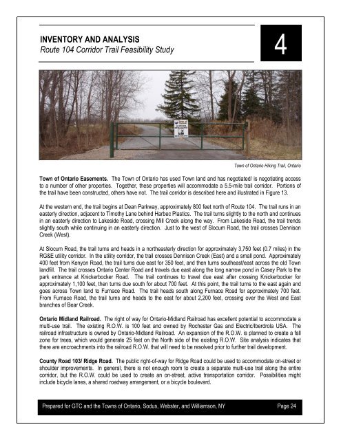
Town of Ontario Hiking <strong>Trail</strong>, Ontario<br />
Town of Ontario Easements. The Town of Ontario has used Town land and has negotiated/ is negotiating access<br />
to a number of other properties. Together, these properties will accommodate a 5.5-mile trail corridor. Portions of<br />
the trail have been constructed, others have not. The trail corridor is described here and illustrated in Figure 13.<br />
At the western end, the trail begins at Dean Parkway, approximately 800 feet north of <strong>Route</strong> <strong>104</strong>. The trail runs in an<br />
easterly direction, adjacent to Timothy Lane behind Harbec Plastics. The trail turns slightly to the north and continues<br />
in an easterly direction to Lakeside Road, crossing Mill Creek along the way. From Lakeside Road, the trail trends<br />
slightly south while continuing in an easterly direction. Just to the west of Slocum Road, the trail crosses Dennison<br />
Creek (West).<br />
At Slocum Road, the trail turns and heads in a northeasterly direction for approximately 3,750 feet (0.7 miles) in the<br />
RG&E utility corridor. In the utility corridor, the trail crosses Dennison Creek (East) and a small pond. Approximately<br />
400 feet from Kenyon Road, the trail turns due east for 350 feet, and then turns southeast/east across the old Town<br />
landfill. The trail crosses Ontario Center Road and travels due east along the long narrow pond in Casey Park to the<br />
park entrance at Knickerbocker Road. The trail continues to travel due east after crossing Knickerbocker for<br />
approximately 1,100 feet, then turns due south for about 700 feet. At this point, the trail turns to the east again and<br />
goes across Town land to Furnace Road. The trail heads south along Furnace Road for approximately 700 feet.<br />
From Furnace Road, the trail turns and heads to the east for about 2,200 feet, crossing over the West and East<br />
branches of Bear Creek.<br />
Ontario Midland Railroad. The right of way for Ontario-Midland Railroad has excellent potential to accommodate a<br />
multi-use trail. The existing R.O.W. is 100 feet and owned by Rochester Gas and Electric/Iberdrola USA. The<br />
railroad infrastructure is owned by Ontario-Midland Railroad. An expansion of the R.O.W. is planned to create a fall<br />
zone for trees, which would generate 25 feet on the North side of the existing R.O.W. Site analysis indicates that<br />
there are encroachments into the railroad R.O.W. that will need to be resolved prior to further trail development.<br />
County Road 103/ Ridge Road. The public right-of-way for Ridge Road could be used to accommodate on-street or<br />
shoulder improvements. In general, there is not enough room to create a separate multi-use trail along the entire<br />
corridor, but the R.O.W. could be used to create an on-street, active transportation corridor. Possibilities might<br />
include bicycle lanes, a shared roadway arrangement, or a bicycle boulevard.<br />
Prepared for GTC and the Towns of Ontario, Sodus, Webster, and Williamson, NY Page 24