download the full article here - E-International Scientific Research ...
download the full article here - E-International Scientific Research ...
download the full article here - E-International Scientific Research ...

Create successful ePaper yourself
Turn your PDF publications into a flip-book with our unique Google optimized e-Paper software.
E-<strong>International</strong> <strong>Scientific</strong> <strong>Research</strong> Journal<br />
ISSN: 2094-1749 Volume: 3 Issue: 2, 2011<br />
Materials and Methods<br />
Site Identification and Characterization<br />
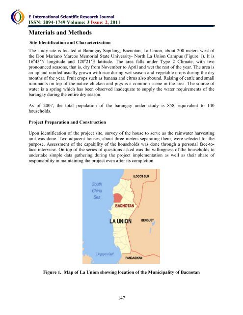
The study site is located at Barangay Sapilang, Bacnotan, La Union, about 200 meters west of<br />
<strong>the</strong> Don Mariano Marcos Memorial State University- North La Union Campus (Figure 1). It is<br />
16 o 43’N longitude and 120 o 21’E latitude. The area falls under Type 2 Climate, with two<br />
pronounced seasons, that is, dry from November to April and wet <strong>the</strong> rest of <strong>the</strong> year. The area is<br />
an upland rainfed usually grown with rice during wet season and vegetable crops during <strong>the</strong> dry<br />
months of <strong>the</strong> year. Fruit crops such as banana and citrus also abound. Raising of cattle and small<br />
ruminants on top of <strong>the</strong> native chicken and pigs is a common scene in <strong>the</strong> area. The source of<br />
water is a spring which has been observed inadequate to supply <strong>the</strong> water requirements of <strong>the</strong><br />
barangay during <strong>the</strong> entire dry season.<br />
As of 2007, <strong>the</strong> total population of <strong>the</strong> barangay under study is 858, equivalent to 140<br />
households.<br />
Project Preparation and Construction<br />
Upon identification of <strong>the</strong> project site, survey of <strong>the</strong> house to serve as <strong>the</strong> rainwater harvesting<br />
unit was done. Two adjacent houses, about three meters separating <strong>the</strong>m, were selected for <strong>the</strong><br />
purpose. Assessment of <strong>the</strong> capability of <strong>the</strong> households was done through a personal face-toface<br />
interview. On top of <strong>the</strong> series of questions asked was <strong>the</strong> willingness of <strong>the</strong> households to<br />
undertake simple data ga<strong>the</strong>ring during <strong>the</strong> project implementation as well as <strong>the</strong>ir share of<br />
responsibility in maintaining <strong>the</strong> project even after its completion.<br />
Figure 1. Map of La Union showing location of <strong>the</strong> Municipality of Bacnotan<br />
147