Report of Research, Field Investigation and Survey of Robert D ...
Report of Research, Field Investigation and Survey of Robert D ...
Report of Research, Field Investigation and Survey of Robert D ...
Create successful ePaper yourself
Turn your PDF publications into a flip-book with our unique Google optimized e-Paper software.
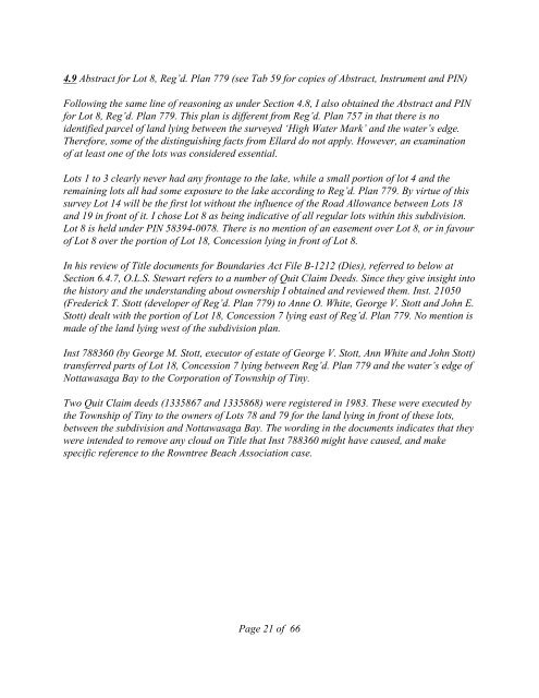
4.9 Abstract for Lot 8, Reg’d. Plan 779 (see Tab 59 for copies <strong>of</strong> Abstract, Instrument <strong>and</strong> PIN)<br />
Following the same line <strong>of</strong> reasoning as under Section 4.8, I also obtained the Abstract <strong>and</strong> PIN<br />
for Lot 8, Reg’d. Plan 779. This plan is different from Reg’d. Plan 757 in that there is no<br />
identified parcel <strong>of</strong> l<strong>and</strong> lying between the surveyed ‘High Water Mark’ <strong>and</strong> the water’s edge.<br />
Therefore, some <strong>of</strong> the distinguishing facts from Ellard do not apply. However, an examination<br />
<strong>of</strong> at least one <strong>of</strong> the lots was considered essential.<br />
Lots 1 to 3 clearly never had any frontage to the lake, while a small portion <strong>of</strong> lot 4 <strong>and</strong> the<br />
remaining lots all had some exposure to the lake according to Reg’d. Plan 779. By virtue <strong>of</strong> this<br />
survey Lot 14 will be the first lot without the influence <strong>of</strong> the Road Allowance between Lots 18<br />
<strong>and</strong> 19 in front <strong>of</strong> it. I chose Lot 8 as being indicative <strong>of</strong> all regular lots within this subdivision.<br />
Lot 8 is held under PIN 58394-0078. There is no mention <strong>of</strong> an easement over Lot 8, or in favour<br />
<strong>of</strong> Lot 8 over the portion <strong>of</strong> Lot 18, Concession lying in front <strong>of</strong> Lot 8.<br />
In his review <strong>of</strong> Title documents for Boundaries Act File B-1212 (Dies), referred to below at<br />
Section 6.4.7, O.L.S. Stewart refers to a number <strong>of</strong> Quit Claim Deeds. Since they give insight into<br />
the history <strong>and</strong> the underst<strong>and</strong>ing about ownership I obtained <strong>and</strong> reviewed them. Inst. 21050<br />
(Frederick T. Stott (developer <strong>of</strong> Reg’d. Plan 779) to Anne O. White, George V. Stott <strong>and</strong> John E.<br />
Stott) dealt with the portion <strong>of</strong> Lot 18, Concession 7 lying east <strong>of</strong> Reg’d. Plan 779. No mention is<br />
made <strong>of</strong> the l<strong>and</strong> lying west <strong>of</strong> the subdivision plan.<br />
Inst 788360 (by George M. Stott, executor <strong>of</strong> estate <strong>of</strong> George V. Stott, Ann White <strong>and</strong> John Stott)<br />
transferred parts <strong>of</strong> Lot 18, Concession 7 lying between Reg’d. Plan 779 <strong>and</strong> the water’s edge <strong>of</strong><br />
Nottawasaga Bay to the Corporation <strong>of</strong> Township <strong>of</strong> Tiny.<br />
Two Quit Claim deeds (1335867 <strong>and</strong> 1335868) were registered in 1983. These were executed by<br />
the Township <strong>of</strong> Tiny to the owners <strong>of</strong> Lots 78 <strong>and</strong> 79 for the l<strong>and</strong> lying in front <strong>of</strong> these lots,<br />
between the subdivision <strong>and</strong> Nottawasaga Bay. The wording in the documents indicates that they<br />
were intended to remove any cloud on Title that Inst 788360 might have caused, <strong>and</strong> make<br />
specific reference to the Rowntree Beach Association case.<br />
Page 21 <strong>of</strong> 66


