Botryodiplodia sp. - Crops for the Future
Botryodiplodia sp. - Crops for the Future
Botryodiplodia sp. - Crops for the Future

You also want an ePaper? Increase the reach of your titles
YUMPU automatically turns print PDFs into web optimized ePapers that Google loves.
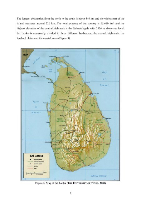
The longest destination from <strong>the</strong> north to <strong>the</strong> south is about 440 km and <strong>the</strong> widest part of <strong>the</strong><br />
island measures around 220 km. The total expanse of <strong>the</strong> country is 65,610 km² and <strong>the</strong><br />
highest elevation of <strong>the</strong> central highlands is <strong>the</strong> Pidurutalagala with 2524 m above sea level.<br />
Sri Lanka is commonly divided in three different landscapes: <strong>the</strong> central highlands, <strong>the</strong><br />
lowland plains and <strong>the</strong> coastal areas (Figure 3).<br />
Figure 3: Map of Sri Lanka (THE UNIVERSITY OF TEXAS, 2000)<br />
7