quakers_walk_planning_brief.pdf Quakers Walk ... - Wiltshire Council
quakers_walk_planning_brief.pdf Quakers Walk ... - Wiltshire Council
quakers_walk_planning_brief.pdf Quakers Walk ... - Wiltshire Council

Create successful ePaper yourself
Turn your PDF publications into a flip-book with our unique Google optimized e-Paper software.
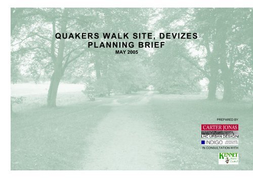
QUAKERS WALK SITE, DEVIZES<br />
PLANNING BRIEF<br />
MAY 2005<br />
PREPARED BY<br />
IN CONSULTATION WITH
QUAKERS WALK, DEVIZES<br />
FOREWORD<br />
This Planning Brief has been prepared to accompany an outline <strong>planning</strong> application to be<br />
submitted for the <strong>Quakers</strong> <strong>Walk</strong> site, Devizes. It will guide the preparation of detailed plans<br />
for the site, ensuring compliance with policies in the Kennet Local Plan 2011.<br />
The Planning Brief has been prepared by Carter Jonas on behalf of the Society of<br />
Merchant Venturers, in association with LHC Urban Design and INDIGO Landscape<br />
Architects, and in consultation with officers at Kennet District <strong>Council</strong> and <strong>Wiltshire</strong> County<br />
<strong>Council</strong>.<br />
When preparing the Planning Brief two stages of local consultation and community<br />
engagement took place. The first stage involved an exhibition and workshops to discuss<br />
the main issues to be addressed in the Planning Brief (organised by Concensus on behalf<br />
of Carter Jonas). The second period of consultation involved circulating a draft <strong>brief</strong> for<br />
comment. Full reports of these events can be found in the “<strong>Quakers</strong> <strong>Walk</strong> Planning Brief:<br />
Statement of Consultation”.<br />
On the 26 th May 2005, the Planning Policies Executive Committee of Kennet District<br />
<strong>Council</strong> considered the content of the Planning Brief and resolved to approve it as an<br />
emerging Supplementary Planning Document (SPD) for the purposes of development<br />
control. It was approved as an emerging SPD because although the process used so far in<br />
production of the <strong>brief</strong> closely follows guidance on preparing SPD, it has not been subject<br />
to a sustainability appraisal.<br />
This work will be carried out as soon as possible and the results of the sustainability<br />
appraisal made available for comment, before any further amendments to the Planning<br />
Brief are made (as necessary). At this time, the <strong>Council</strong> will reconsider the <strong>Quakers</strong> <strong>Walk</strong><br />
Planning Brief with a view to adopting it as a Supplementary Planning Document.<br />
Ref: 04744<br />
May 2005<br />
Issue Number 1
QUAKERS WALK, DEVIZES<br />
"Where people live has a major effect on their life. If where they live is<br />
well-planned, well-designed and well-managed, their quality of life is<br />
likely to be a great deal better than that of those who live elsewhere.<br />
Yet too many housing estates are designed for nowhere in particular.<br />
They can be soulless places and dispiriting. All too often they are not<br />
well-connected to local services and promote dependency on the car.<br />
Our policy guidance for the <strong>planning</strong> of new housing sets out a<br />
blueprint for a new and better approach. It forges a new link between<br />
<strong>planning</strong> and design to promote better living environments. The prize<br />
is a better quality of life for all and the key is good design."<br />
Foreword: By Design: Better Places to Live. A Companion Guide to PPG3.<br />
Ref: 04744<br />
May 2005<br />
Issue Number 1
QUAKERS WALK, DEVIZES<br />
CONTENTS<br />
1.0 INTRODUCTION<br />
2.0 SITE CONTEXT AND SETTING<br />
3.0 SITE CONSTRAINTS AND OPPORTUNITIES<br />
4.0 PLANNING POLICY<br />
5.0 STATEMENT OF DESIGN PRINCIPLES<br />
6.0 CONCEPT PLAN<br />
APPENDICES<br />
1. TABLE SUMMARISING THE COMMENTS AND<br />
CONCERNS ON EMERGING DEVELOPMENT<br />
PROPOSALS<br />
2. ECOLOGICAL SURVEY (SUMMARY)<br />
3. RELEVANT KENNET LOCAL PLAN POLICES<br />
4. PROPOSED JUNCTION ALIGNMENT BETWEEN<br />
QUAKERS WALK SITE AND LONDON ROAD<br />
Ref: 04744<br />
May 2005<br />
Issue Number 1
QUAKERS WALK, DEVIZES<br />
1.0 INTRODUCTION<br />
Purpose of this Planning Brief<br />
1.1 In April 2004, Kennet District <strong>Council</strong> adopted its<br />
Replacement Local Plan. Policies HC9 and HC38 (and<br />
Inset Map 1- Devizes) specifically identify the <strong>Quakers</strong><br />
<strong>Walk</strong> site for development, to comprise approximately<br />
230 residential units and a new primary school. The site<br />
area extends to approximately 11 hectares and is<br />
situated to the north east of Devizes.<br />
1.2 The purpose of this Planning Brief is to establish the<br />
principles that will guide development of the <strong>Quakers</strong><br />
<strong>Walk</strong> site. It has been prepared by Carter Jonas LLP and<br />
LHC Urban Design, in consultation with Kennet District<br />
<strong>Council</strong>, on behalf of the Society of Merchant Venturers.<br />
1.3 This Planning Brief fulfils the requirements of Local Plan<br />
Policy PD1 and the supporting text relating to Planning<br />
Briefs and Statements of Design Principles. It also<br />
addresses the specific requirements of Policy HC9 and<br />
other relevant policies contained within the Kennet Local<br />
Plan.<br />
1.4 Comments received from local residents at the public<br />
consultation events held in early 2005 have had a<br />
significant influence on the development principles<br />
contained within this Planning Brief. A key objective for<br />
the Planning Brief will be to ensure that the impact of<br />
new development on the immediate surrounding<br />
environment is kept to a minimum, whilst at the same<br />
time maximising local community benefits.<br />
The Consultation Process<br />
1.5 This Planning Brief has been prepared following detailed<br />
discussions with Officers at Kennet District <strong>Council</strong>,<br />
<strong>Wiltshire</strong> County <strong>Council</strong> (as Highways Authority and<br />
Education Authority) and other key stakeholders. An<br />
assessment of the site and surrounding area has been<br />
undertaken and a comprehensive programme of public<br />
consultation completed during January and April 2005.<br />
The consultation programme accords with guidance in<br />
Planning Policy Statement 12 and the emerging Kennet<br />
Statement of Community Involvement.<br />
Figure 1.1: Site in context<br />
(Source Kennet Local Plan)<br />
Figure 1.2: Devizes public<br />
consultation<br />
FIGURE 1.2<br />
FIGURE 1.1<br />
Ref: 04744<br />
May 2005<br />
Issue Number 1
QUAKERS WALK, DEVIZES<br />
1.6 It was agreed with Kennet District <strong>Council</strong> that the initial<br />
consultation programme would consist of a public<br />
exhibition, supplemented by two discussion forums.<br />
Consensus were appointed by Carter Jonas LLP to<br />
organise the consultation process and act as<br />
independent facilitators.<br />
1.7 A letter explaining the purpose of the consultation and<br />
inviting residents to attend the Public Exhibition was sent<br />
to 400 properties in the <strong>Quakers</strong> <strong>Walk</strong> area on the 16 th<br />
December 2004. The letter explained that anyone<br />
attending the exhibition would have the opportunity to<br />
register to participate in one of two discussion forums.<br />
1.8 A number of local service providers, specialist groups<br />
and other influential third parties were also invited to<br />
attend the exhibition. These included:<br />
• Bishops Canning Parish <strong>Council</strong><br />
• Devizes Town <strong>Council</strong><br />
• Roundway Parish <strong>Council</strong><br />
• All district councillors representing Devizes, Roundway<br />
and Bishops Cannings<br />
• All county councillors representing Devizes<br />
• Devizes Community Area Partnership<br />
• Community First<br />
• Devizes & Marlborough Friends of the Earth<br />
• Kennet CPRE<br />
• Devizes Chamber of Commerce<br />
• Devizes Development Partnership<br />
• Trust for Devizes<br />
• Kennet National Trust Association<br />
• <strong>Wiltshire</strong> Wildlife Trust<br />
• Sarsen Housing Association<br />
• Devizes Sports Club<br />
• Kennet & North Wilts Primary Care Trust<br />
• <strong>Wiltshire</strong> association of Local <strong>Council</strong>s<br />
• The Environment Agency<br />
• Wessex Water<br />
• Diocese of Salisbury<br />
• Roundway Mill Boundary Residents Group<br />
• Roundway Park Group<br />
• The Police Authority (Estates Department)<br />
• <strong>Wiltshire</strong> County <strong>Council</strong> (Education and Highways)<br />
• St Peter’s School (Governors)<br />
1.9 A news release was issued to the local media, which<br />
attracted editorial coverage in the Gazette & Herald and<br />
the Devizes & Vale of Pewsey News. The exhibition<br />
was also the subject of two interviews on BBC Radio<br />
<strong>Wiltshire</strong>.<br />
1.10 The public exhibition took place on Saturday 22nd<br />
January 2005 from 10.00 am until 4.00 pm, at the<br />
Devizes Cadet Centre, Le Marchant Barracks. This<br />
venue was chosen as it is within reasonable <strong>walk</strong>ing<br />
distance of the <strong>Quakers</strong> <strong>Walk</strong> neighbourhood. In excess<br />
of 150 people attended the exhibition and 78 registered<br />
to participate in one of the two discussion forums. A<br />
record of all the comments made using the feedback<br />
forms is provided in the Statement of Community<br />
Engagement, prepared by Consensus.<br />
1.11 The discussion forums took place during the evening of<br />
1 st and 2 nd February 2005, at the Devizes Corn<br />
Exchange. 31 people registered to attend the forum on<br />
the 1 st February (21 attended) and 32 people registered<br />
to attend the forum on the 2 nd February (25 attended).<br />
The objective of each forum was to provide interested<br />
parties with a more open and dynamic environment<br />
within which to communicate their views on the<br />
emerging proposals and where possible, to explore and<br />
expound their concerns, issues and aspirations in<br />
greater detail.<br />
1.12 A table summarising the key concerns and comments of<br />
local residents is provided at Appendix 1.<br />
1.13 The output from the consultation process and<br />
discussions with Kennet District <strong>Council</strong> and key<br />
stakeholders was a Draft Planning Brief.<br />
Figure 1.3: Public Exhibition<br />
Board 4: Primary School<br />
Issues.<br />
FIGURE 1.3<br />
Ref: 04744<br />
May 2005<br />
Issue Number 1
QUAKERS WALK, DEVIZES<br />
1.14 The Draft Planning Brief was made available to local<br />
residents and key stakeholders, and was subject to a<br />
three-week period of consultation (ending on 29 th April<br />
2005). A total of 20 responses were received, in addition<br />
to the detailed comments made by Officers at Kennet<br />
District <strong>Council</strong>.<br />
Figure 1.4: North end of the<br />
<strong>Quakers</strong> <strong>Walk</strong> site.<br />
1.15 The comments were given careful consideration and<br />
resulted in a number of changes to the Planning Brief.<br />
Format of the Planning Brief<br />
1.16 The format of the Planning Brief is as follows:<br />
• Section 2.0 – Site Context and Setting<br />
A summary of the principal influences on the <strong>Quakers</strong><br />
<strong>Walk</strong> site, in terms of its landscape setting and<br />
relationship with other elements of the townscape and<br />
adjoining countryside.<br />
FIGURE 1.4<br />
• Section 3.0 – Planning Policy<br />
The key requirements and restrictions on development<br />
of the <strong>Quakers</strong> <strong>Walk</strong> site, as outlined in national,<br />
regional and local <strong>planning</strong> policy guidance.<br />
• Section 4.0 – Site Constraints and Opportunities<br />
A review of the principal constraints to the form and<br />
layout of development on the <strong>Quakers</strong> <strong>Walk</strong> site, as well<br />
as a summary of the main community benefits<br />
associated with proposed development.<br />
• Section 5.0 – Statement of Design Principles<br />
Taking into account the site context and setting, relevant<br />
opportunities and constraints and <strong>planning</strong> policy, this<br />
section outlines the design framework for future<br />
development of the <strong>Quakers</strong> <strong>Walk</strong> Site.<br />
• Section 6.0 – Concept Plan<br />
This section summarises the proposed design concept<br />
for the <strong>Quakers</strong> <strong>Walk</strong> site. Ref: 04744<br />
May 2005<br />
Issue Number 1
QUAKERS WALK, DEVIZES<br />
2.0 SITE CONTEXT AND SETTING<br />
The Devizes Urban Area<br />
2.1 Devizes lies within a landscape of gently rolling chalk<br />
down and hills, adjacent to the Kennet and Avon Canal.<br />
It is the largest settlement in Kennet District and also<br />
offers the widest employment base and range of<br />
services and facilities.<br />
The <strong>Quakers</strong> <strong>Walk</strong> Site<br />
2.2 The <strong>Quakers</strong> <strong>Walk</strong> site is located to the north east of<br />
Devizes, under 1km from the town centre. A wide range<br />
of local facilities and services are within reasonable<br />
<strong>walk</strong>ing and cycling distance. Local employment<br />
opportunities are available in and around the town centre<br />
and at Hopton Industrial Estate.<br />
2.3 The subject site is bounded to the north and east by<br />
residential development (Roundway Park and<br />
Parkfields), to the south by agricultural land (with a<br />
Sports Club and allotments beyond) and to the west by<br />
<strong>Quakers</strong> <strong>Walk</strong> (an attractive tree-lined footpath). The site<br />
slopes gently down from north to south, with a west<br />
facing bowl in the south west corner. It is currently in<br />
agricultural use (with no significant vegetation) and is of<br />
limited ecological value (see summary of the Ecological<br />
Survey attached as Appendix 2). The most significant<br />
vegetation lies on adjacent land and includes the planted<br />
broadleaf trees along <strong>Quakers</strong> <strong>Walk</strong>, woodland blocks<br />
on the Roundway Estate and remnant parkland trees<br />
within the Estate and along Roundway Park to the north.<br />
2.4 Native wildlife currently frequents the site, including Roe<br />
Deer, Hares, Foxes and Badgers. No Badger sets have<br />
been identified within or adjacent to the proposed<br />
development.<br />
2.5 The site does not lie within or adjacent to a Conservation<br />
Area and the only Listed structures in the immediate<br />
vicinity of the site are <strong>Quakers</strong> Lodge and the Lodge<br />
Gates, to the south-west. The Lodge Gates denote the<br />
entry to the bridge crossing the canal.<br />
2.6 Access to the site is currently from Roundway Park to<br />
the north and <strong>Quakers</strong> <strong>Walk</strong> to the west.<br />
FIGURE 2.1<br />
Figure 2.1: Aerial view of<br />
site<br />
Figure 2.2: <strong>Quakers</strong> <strong>Walk</strong><br />
FIGURE 2.2<br />
Ref: 04744<br />
May 2005<br />
Issue Number 1
QUAKERS WALK, DEVIZES<br />
The Context and Setting of the <strong>Quakers</strong> <strong>Walk</strong> Site<br />
2.7 Proposals for development of the <strong>Quakers</strong> <strong>Walk</strong> site will<br />
need to respect the existing form and character of the<br />
Devizes urban area. In particular, proposals should<br />
respect the character and use of adjoining land.<br />
Figure 2.3: Typical street in<br />
Devizes town centre.<br />
Figure 2.4: Devizes Market<br />
Square<br />
Local Vernacular Qualities<br />
2.8 The main vernacular design features that characterise<br />
Devizes are summarised below:<br />
• Buildings are mostly red brick, with some important<br />
buildings in the historic core constructed of stone.<br />
• Roofs are predominately slate and clay tiles.<br />
• Brick buildings commonly feature attractive detailing,<br />
such as stone window sills and lintels.<br />
FIGURE 2.3<br />
• There are many examples of porches and arched<br />
entrance ways, which articulate the façade and give a<br />
welcoming appearance.<br />
• Variations in the massing of buildings and roof size and<br />
pitch create visual interest. The grouping of buildings is<br />
used to define landmark structures in key locations, or to<br />
create a sense of place in public areas.<br />
• Access to mews and courtyard parking is generally via<br />
archways in buildings, ensuring continuous frontages<br />
and maintaining the rhythm of the street.<br />
• There is generally a strong relationship between<br />
buildings and the street with minimal or no set backs of<br />
buildings, producing good definition and containment of<br />
the street.<br />
FIGURE 2.4<br />
Ref: 04744<br />
May 2005<br />
Issue Number 1
QUAKERS WALK, DEVIZES<br />
Adjacent Townscape Character<br />
2.9 Land uses surrounding the <strong>Quakers</strong> <strong>Walk</strong> site will have<br />
a significant bearing on the proposed layout and design<br />
of new development. Key influences will include the<br />
<strong>Quakers</strong> <strong>Walk</strong> footpath, the Police Constabulary HQ and<br />
Helipad, and residential development along Roundway<br />
Park and Parkfields.<br />
Figure 2.5: Police<br />
Constabulary HQ.<br />
Figure 2.6: Land Use<br />
Context<br />
Adjacent uses to the north of the <strong>Quakers</strong> <strong>Walk</strong> Site<br />
• Residential development to the north, adjoining the<br />
<strong>Quakers</strong> <strong>Walk</strong> site, consists of both bungalow and two<br />
storey dwellings sited along a prominent ridgeline,<br />
between the subject site and Roundway Hill.<br />
• The low density housing development on Roundway<br />
Park is characterised by trees and other mature<br />
vegetation.<br />
• Building heights are uniform for each housing type,<br />
giving a consistent character and scale to the streets.<br />
FIGURE 2.5<br />
• Parking is off street with on street parking also available.<br />
• Large front gardens are provided as part of a deep plot<br />
for each dwelling, although the rear gardens of<br />
properties bounding the proposed development area are<br />
relatively shallow.<br />
Adjacent uses to the south and east of the <strong>Quakers</strong><br />
<strong>Walk</strong> site<br />
• Existing three-storey brick buildings associated with the<br />
Police Constabulary complex create a varied skyline.<br />
• Existing light industrial and commercial uses provide the<br />
approach to the site along London Road. Whilst these<br />
are inconsistent with the remaining historic urban fabric,<br />
good levels of landscaping soften their impact. Ref: 04744<br />
FIGURE 2.6<br />
May 2005<br />
Issue Number 1
QUAKERS WALK, DEVIZES<br />
• Adjoining residential development is predominately two<br />
storey. The properties have deep rear gardens,<br />
providing a private buffer between existing homes and<br />
proposed new development.<br />
• Land to the south is in agricultural use. Beyond is the<br />
<strong>Quakers</strong> <strong>Walk</strong> allotment site. These land uses provide a<br />
soft edge to the Devizes urban area.<br />
Figure 2.7: Surrounding<br />
countryside viewed from<br />
Roundway Hill<br />
Figure 2.8: <strong>Walk</strong>ing<br />
distances and main routes<br />
to town centre<br />
Adjacent uses to the west of the <strong>Quakers</strong> <strong>Walk</strong> site<br />
• There is a strong visual connection to the countryside to<br />
the west, with the tree lined <strong>Quakers</strong> <strong>Walk</strong> allowing<br />
broken views of the rural landscape beyond.<br />
• <strong>Quakers</strong> <strong>Walk</strong> is the most important feature of the site,<br />
providing an important pedestrian route and serving to<br />
contain the area of proposed development.<br />
FIGURE 2.7<br />
Movement Patterns<br />
2.10 The principal access to the <strong>Quakers</strong> <strong>Walk</strong> site will be off<br />
London Road (the A361) across Police Authority land.<br />
London Road is the main route serving the town from the<br />
M4 and the north. There is a frequent bus service along<br />
London Road, with a regular service to the town centre<br />
and other key destinations.<br />
2.11 The site has good pedestrian and cycle route<br />
connections to both the town centre and the countryside.<br />
There is scope for these to be enhanced. <strong>Quakers</strong> <strong>Walk</strong><br />
is part of the National Trail and Recreational Footpath<br />
network which extends to the north of Devizes, to<br />
Roundway Hill and beyond. The site is linked directly to<br />
the town centre via existing roads and small alleyways.<br />
2.12 <strong>Quakers</strong> <strong>Walk</strong> is currently owned and maintained by the<br />
Society of Merchant Venturers.<br />
FIGURE 2.8<br />
Ref: 04744<br />
May 2005<br />
Issue Number 1
QUAKERS WALK, DEVIZES<br />
3.0 PLANNING POLICY<br />
3.1 The <strong>planning</strong> policy framework is guided at a national<br />
level through publication of Planning Policy Guidance<br />
Notes (PPGs) and their successors, Planning Policy<br />
Statements (PPSs). This advice filters through Regional<br />
Planning Guidance, into the preparation of the statutory<br />
Development Plan (in this case the <strong>Wiltshire</strong> County<br />
Structure Plan and the Kennet Local Plan).<br />
3.2 The Devizes Strategic Development Brief provides<br />
specific guidance on the contributions that will be sort<br />
towards new infrastructure and services, from the main<br />
new housing developments in the town, including the<br />
<strong>Quakers</strong> <strong>Walk</strong> site.<br />
Planning Policy Guidance and Planning Policy<br />
Statements<br />
3.3 The key PPGs and PPSs of relevance are discussed<br />
<strong>brief</strong>ly below.<br />
PPS 1 – Delivering Sustainable Development<br />
(February 2005)<br />
3.4 This overarching policy statement focuses on the<br />
delivery of sustainable development. It reflects the duty<br />
on regional and local <strong>planning</strong> bodies to contribute<br />
towards sustainable development when preparing<br />
Development Plans.<br />
3.5 In developing a more integrated approach towards<br />
sustainable development, local authorities are advised to<br />
carefully consider the inter-relationship between social<br />
inclusion, protecting and enhancing the environment, the<br />
prudent use of natural resources and economic<br />
development. The location of new development is seen<br />
as central to achieving sustainable settlement patterns.<br />
The guidance seeks to ensure that new housing<br />
development is accessible to a wide range of facilities<br />
and services by foot, bicycle or public transport.<br />
PPG 3 - Housing (March 2000)<br />
3.6 PPG 3 requires that in identifying sites to be allocated for<br />
housing, Local Planning Authorities should follow a<br />
search sequence that starts with the re-use of previously<br />
developed land and buildings within urban areas, then<br />
urban extensions and finally new development around<br />
nodes in good public transport corridors.<br />
3.7 In addition, PPG3 requires that potential housing sites<br />
be assessed against the following criteria (paragraph<br />
31);<br />
• The availability of previously-developed sites and<br />
empty or underused buildings and their suitability for<br />
housing use;<br />
• The location and accessibility of potential<br />
development sites to jobs, shops and services, by<br />
modes other than the car, and the potential for improving<br />
such accessibility;<br />
• The capacity of existing and potential infrastructure,<br />
including public transport, water and sewerage, other<br />
utilities and social infrastructure (such as schools and<br />
hospitals) to absorb further development and the cost of<br />
adding further infrastructure;<br />
• The ability to build communities to support new<br />
physical and social infrastructure and to provide<br />
sufficient demand to sustain appropriate local services<br />
and facilities; and<br />
• The physical and environmental constraints on<br />
development of land, including the level of<br />
contamination, stability and flood risk.<br />
Ref: 04744<br />
May 2005<br />
Issue Number 1
QUAKERS WALK, DEVIZES<br />
3.8 There is also guidance in PPG3 on creating urban<br />
extensions. It suggests that these are likely to be the<br />
next most sustainable option after building on<br />
appropriate sites within urban areas, especially where it<br />
is possible to utilise existing physical and social<br />
infrastructure, there is good access to public transport<br />
(or where new public transport provision can be planned<br />
into the development), and there is good access to jobs,<br />
schools, shopping and leisure facilities (paragraph 67).<br />
3.9 The guidance requires residential development to be<br />
focussed in or on the edge of sustainable settlements. It<br />
promotes efficient use of land resources, with<br />
development densities of at least 30 units per hectare. It<br />
also requires new developments to be of a high quality<br />
design.<br />
PPG 13 – Transport (March 2001)<br />
3.10 PPG13 deals with transport and accessibility. It seeks to<br />
achieve greater integration between <strong>planning</strong> and<br />
transport at the national, regional and local level. Local<br />
authorities are encouraged to actively manage the<br />
pattern of urban growth to make the fullest use of public<br />
transport.<br />
3.11 Local Authorities are encouraged to accommodate<br />
housing principally within existing urban areas, <strong>planning</strong><br />
for increased intensity of development for both housing<br />
and other land uses at locations which are highly<br />
accessible to public transport, and afford opportunities<br />
for cycling and <strong>walk</strong>ing.<br />
<strong>Wiltshire</strong> County Structure Plan<br />
3.12 The <strong>Wiltshire</strong> County Structure Plan 2011 sets out a<br />
framework of broad <strong>planning</strong> policies. Policy PD4<br />
encourages the concentration of new development at<br />
existing towns and settlements (including Devizes). The<br />
Structure Plan establishes a number of goals for<br />
development:<br />
• An attractive and suitably protected environment<br />
• A prosperous and robust economy<br />
• Meeting the needs of the existing and future population<br />
• Good housing and community facilities<br />
• Support for a sustainable pattern of development<br />
3.13 The thrust of guidance contained within the <strong>Wiltshire</strong><br />
Structure Plan is reflected in the Kennet Local Plan 2011<br />
The Kennet Local Plan<br />
3.14 Following a Local Plan Public Inquiry and subsequent<br />
Inspector’s Report, the Kennet Local Plan was adopted<br />
in April 2004. Policies HC9 and HC38 (and Inset Map 1-<br />
Devizes) specifically identify the <strong>Quakers</strong> <strong>Walk</strong> site as<br />
being allocated for development, to comprise<br />
approximately 230 residential units and a new primary<br />
school.<br />
3.15 The Local Plan Inspector concluded that the <strong>Quakers</strong><br />
<strong>Walk</strong> site was required to accommodate development<br />
needs in Devizes. Furthermore, he acknowledged the<br />
need for a new primary school to the north of the town,<br />
to cater for the children generated by new developments<br />
in the area, including the <strong>Quakers</strong> <strong>Walk</strong> site.<br />
3.16 For ease of reference, relevant policies from the Kennet<br />
Local Plan are reproduced at Appendix 3. Policy HC9<br />
aims to ensure that proposed development:<br />
• Retains and respects the quality and appearance of the<br />
footpath known as <strong>Quakers</strong> <strong>Walk</strong> by providing a 35m<br />
landscape buffer between the footpath and<br />
development;<br />
• Includes a comprehensive landscaping scheme to<br />
minimise the potential external impact of the<br />
development on the wider landscape of Roundway Hill<br />
and the potential internal impact of the development on<br />
<strong>Quakers</strong> <strong>Walk</strong>;<br />
Ref: 04744<br />
May 2005<br />
Issue Number 1
QUAKERS WALK, DEVIZES<br />
• Ensures that the use of the allotments immediately<br />
adjacent to the south side of the site is not<br />
compromised;<br />
• Provides a main vehicular access to the site from the<br />
London Road and a secondary access to the site for<br />
public bus services and for emergency purposes<br />
between 52 and 53 Roundway Park;<br />
• Ensures that potential noise disturbance to residents<br />
from the use of the police helipad is minimised through<br />
the design and layout of the scheme;<br />
• Respects the amenity of adjacent land uses / residents;<br />
and<br />
Additionally, not more than 150 houses should be<br />
commenced prior to April 2008.<br />
3.17 The impact of additional traffic on London Road was<br />
considered in detail at the Local Plan Public Inquiry. A<br />
transport Assessment prepared by WSP Development<br />
and agreed with the Highways Authority confirms that<br />
the proposed new junction with London Road is capable<br />
of accommodating the traffic movements associated with<br />
development of the <strong>Quakers</strong> <strong>Walk</strong> site.<br />
3.18 Supporting text to Policy HC9 identifies further issues to<br />
be addressed in the Planning Brief for the <strong>Quakers</strong> <strong>Walk</strong><br />
site. These include:<br />
• The site’s relationship to existing leisure and recreational<br />
facilities.<br />
• Opportunities for improving access to what will be an<br />
extended, existing Sports Club, so that the existing<br />
substandard access off London Road, close to the canal<br />
bridge, can be stopped up.<br />
• The inclusion of a single lane access point for use by<br />
buses off Roundway Park (as part of the emergency<br />
secondary access) protected by a bus gate or similar<br />
device to prohibit use by private vehicles.<br />
3.19 Policy HC2 of the Local Plan includes reference to the<br />
provision of “about 230 dwellings” on the <strong>Quakers</strong> <strong>Walk</strong><br />
site. This level of development complies with national<br />
guidance on densities and was considered in some<br />
detail at the Local Plan Public Inquiry. It was<br />
demonstrated to be acceptable in principle.<br />
3.20 Policy HC28 of the Local Plan enables the Local<br />
Authority to seek to negotiate an element of affordable<br />
housing on large sites. Policy HC30 states that in the<br />
case of the <strong>Quakers</strong> <strong>Walk</strong> site, the Local Authority will<br />
seek to negotiate about 70 subsidised units and 45 low<br />
cost units. Kennet District <strong>Council</strong> will need to be<br />
satisfied that the housing provided will be available for<br />
defined local needs, both initially and on subsequent<br />
change of occupant, through involvement of a<br />
Registered Social Landlord.<br />
3.21 Policy HC29 defines low cost market housing as that<br />
which is offered for sale at or below the lower quartile of<br />
prevailing market values, provided the proposed sale<br />
price is affordable, based on average incomes at the<br />
time of application.<br />
3.22 Policy HC31 requires that new affordable housing be<br />
carefully integrated with the proposed open market<br />
housing, in clusters of not more than 10 units.<br />
Design Issues<br />
3.23 Policies HC5 and HC7 require that development should<br />
be built at a net density of at least 30 dwellings per<br />
hectare and that housing layouts should encourage<br />
pedestrian and cycle movements, provide a mix of<br />
housing types and encourage energy efficiency. In<br />
association with this, Policy AT10 requires on site<br />
provision of car parking in line with the <strong>Council</strong>’s<br />
maximum standards.<br />
Ref: 04744<br />
May 2005<br />
Issue Number 1
QUAKERS WALK, DEVIZES<br />
3.24 Local Plan Policy PD1 and its supporting text offer guidance<br />
on design and development, in particular the potential<br />
range of issues that should be considered in preparation of<br />
a Planning Brief. Applicants for <strong>planning</strong> permission are<br />
expected to submit a Statement of Design Principles, which<br />
demonstrates how the issues listed in Policy PD1 have<br />
been addressed (see Section 5.0 of this Planning Brief).<br />
3.25 Policy HC34 requires the provision of recreational open<br />
space within new residential developments of more than 20<br />
units, at a level of 2.43 hectares per 1,000 new population.<br />
The standards for provision on the <strong>Quakers</strong> <strong>Walk</strong> site are<br />
defined in the Devizes Strategic Development Brief, and<br />
take account of the previous land sold by the Society of<br />
Merchant Venturers to Devizes Sports Club.<br />
3.26 Policy TR22 encourages the use of public art to enhance<br />
design and provide a sense of place<br />
Infrastructure and Services<br />
3.27 Policies HC37, HC42 and HC43 relate to the education,<br />
social, community and service infrastructure requirements<br />
generated by new developments and the need to contribute<br />
to this infrastructure, where necessary. Guidance on the<br />
contributions sought is provided in the Devizes Strategic<br />
Development Brief.<br />
3.28 Policy HC38 allocates land for a new primary school to the<br />
north east of the <strong>Quakers</strong> <strong>Walk</strong> housing site.<br />
3.29 In assessing the wider impacts of development, beyond<br />
those issues to be addressed in the Planning Brief and<br />
Statement of Design Principles, Policy AT1 requires a<br />
Transport Appraisal of new developments.<br />
<strong>Wiltshire</strong> and Swindon Waste Local Plan<br />
3.30 The <strong>Wiltshire</strong> and Swindon Waste Local Plan was adopted<br />
in March 2005. Policy 10 deals with the requirement for<br />
waste audits and Policy 14, the provision of recycling<br />
facilities in new developments. Supplementary Planning<br />
Guidance has been prepared which elaborates upon<br />
these two polcies, ensuring that new housing<br />
developments comply with relevant provisions of the<br />
Waste Local Plan.<br />
Devizes Strategic Development Brief<br />
3.31 The purpose of the Devizes Strategic Development Brief<br />
is to bring together the various policies of the Kennet<br />
District Local Plan that may have a bearing on each of<br />
the main housing allocations in the town. The Strategic<br />
Brief seeks to ensure that the cumulative impacts of<br />
development are mitigated.<br />
3.32 Key issues identified for the <strong>Quakers</strong> <strong>Walk</strong> site include:<br />
• The need for proposals to accord with the scale of<br />
housing indicated in Policy HC2 (i.e. about 230<br />
dwellings).<br />
• The need for new affordable housing provision to<br />
provide additional family homes with gardens and<br />
flexible 2 bedroom accommodation suitable for young<br />
couples.<br />
• The need to enable dual use of sports facilities at the<br />
new <strong>Quakers</strong> <strong>Walk</strong> Primary School. There should be<br />
independent access to changing and indoor sports<br />
facilities.<br />
• Provision of a floodlit multi-use games area as part of<br />
the school development, with consideration given to the<br />
potential for using school buildings to improve the<br />
delivery of health care and advice to the local<br />
community.<br />
• The location of the new primary school and the<br />
possibility that a larger facility is developed (to include<br />
reprovision for the St Peters School catchment).<br />
• Provision of recreational open space at the standards<br />
outlined in Local Plan Policy HC34.<br />
Ref: 04744<br />
May 2005<br />
Issue Number 1
QUAKERS WALK, DEVIZES<br />
• The need for improvements to upgrade <strong>Quakers</strong> <strong>Walk</strong> to<br />
shared use facility for pedestrians and cyclists.<br />
• Provision of a bus gate to restrict access from Roundway<br />
Park into the <strong>Quakers</strong> <strong>Walk</strong> site, and parking restrictions on<br />
Roundway Park.<br />
Figure 3.1:Public Exhibition<br />
Board 4: Primary School<br />
Issues.<br />
Figure 3.2: Area allocated<br />
for primary school in the<br />
Local Plan.<br />
3.33 The <strong>Quakers</strong> <strong>Walk</strong> site is required to provide 1,705sqm of<br />
equipped play area (with no one part of the wider provision to<br />
be less than 400sqm) and 2,255sqm of casual play area (with<br />
no one part of the wider provision to be less than 750sqm).<br />
The requirements are based upon approximately 230 new<br />
residential units. In addition to appropriate play equipment,<br />
the casual play areas should provide an informal meeting<br />
area for teenagers. A financial contribution is required<br />
towards off-site provision of formal sports pitches. These<br />
requirements are based upon development of approximately<br />
230 new residential units.<br />
3.34 In relation to the proposed new primary school, the Strategic<br />
Brief requires that consideration is given to providing an<br />
enlarged facility, to cater for pupils currently attending St<br />
Peter’s School, which is to close. The Local Education<br />
Authority supports the proposal and has requested that<br />
consideration is also given to locating the new school further<br />
to the south (but still within the proposed development area).<br />
A location to the south of the site would be closer to the<br />
existing catchment population for St Peters School, as well as<br />
Devizes Sports Club.<br />
FIGURE 3.1<br />
3.35 A larger primary school will require a 1.45 hectare site (rather<br />
than the 1.2 hectare site identified on the Local Plan<br />
Proposals Map) to accommodate the increase from a 7-form<br />
to a 10-form primary school. In addition to provision of the<br />
site, the <strong>Quakers</strong> <strong>Walk</strong> development will make a substantial<br />
contribution to the construction costs of the new school.<br />
3.36 The Devizes Strategic Development Brief also requires<br />
significant contributions from the <strong>Quakers</strong> <strong>Walk</strong> development<br />
towards secondary education, sustainable transport and FIGURE 3.2<br />
updating of the Devizes SATURN Traffic Model. Ref: 04744<br />
May 2005<br />
Issue Number 1
QUAKERS WALK, DEVIZES<br />
4.0 SITE CONSTRAINTS AND OPPORTUNITIES<br />
4.1 The area allocated for development off <strong>Quakers</strong> <strong>Walk</strong> is<br />
relatively unconstrained, comprising a broadly level area<br />
of agricultural land. However, there are a number of<br />
policy requirements that will influence the form and<br />
layout of proposed development. These policy<br />
requirements are a reflection of the District <strong>Council</strong>’s<br />
desire to minimise the impact of development on<br />
adjacent land uses and the wider environment, whilst at<br />
the same time maximising the associated community<br />
benefits.<br />
4.2 The following constraints are considered to have the<br />
most significant impact on the form of development at<br />
<strong>Quakers</strong> <strong>Walk</strong>.<br />
Site Constraints<br />
Access Requirements<br />
ACCESS TO<br />
ALLOTMENTS<br />
FROM FARM<br />
SECONDARY ACCESS FOR<br />
EMERGENCY VEHICLES AND<br />
PUBLIC TRANSPORT WITH<br />
CONTROLLED ACCESS BY<br />
BUS GATE<br />
PRIMARY ACCESS<br />
FROM LONDON<br />
ROAD<br />
Figure 4.1: Primary and<br />
secondary access to the<br />
<strong>Quakers</strong> <strong>Walk</strong> site.<br />
Figure 4.2: Access already<br />
established in accordance<br />
with Local Plan.<br />
4.3 After detailed consideration at the Local Plan Public<br />
Inquiry, Policy HC9 of the Kennet Local Plan requires<br />
that the principal access to the <strong>Quakers</strong> <strong>Walk</strong> site be<br />
taken off London Road. The Highways Authority is<br />
satisfied that the Transport Assessment prepared by<br />
WSP Development for the Inquiry remains valid, subject<br />
to the possible need for some additional modelling of the<br />
trips generated by users of Devizes Sports Club.<br />
FIGURE 4.1<br />
4.4 The new access road into the site will include a public<br />
footpath that avoids loss of important trees. All existing<br />
specimens will be retained on London Road and at the<br />
access point to the <strong>Quakers</strong> <strong>Walk</strong> site. The proposed<br />
access arrangement, agreed in principle with the County<br />
Highways Authority, is attached as Appendix 4.<br />
PROTECTION OF EXISTING<br />
MATURE TREES<br />
FIGURE 4.2<br />
Ref: 04744<br />
May 2005<br />
Issue Number 1
QUAKERS WALK, DEVIZES<br />
4.5 The secondary access point to the <strong>Quakers</strong> <strong>Walk</strong> site<br />
(for public bus services and emergency vehicles only) is<br />
to be taken between 52 and 53 Roundway Park. This is<br />
a requirement of the Kennet Local Plan. A bus gate will<br />
be used to restrict use of the access to appropriate<br />
vehicles, pedestrians and cyclists.<br />
Figure 4.3: Existing desire<br />
lines.<br />
4.6 The <strong>Quakers</strong> <strong>Walk</strong> footpath is to be preserved and<br />
enhanced, providing an important access and leisure<br />
route to the west of the site. The footpath is to be<br />
upgraded for use by pedestrians, cyclists, pushchair<br />
users and the mobility impaired.<br />
4.7 The three main access points to the <strong>Quakers</strong> <strong>Walk</strong><br />
development area are fixed by the site’s physical<br />
constraints and <strong>planning</strong> policy requirements of the<br />
Kennet Local Plan. Development principles will need to<br />
reflect the location of the principal and secondary<br />
accesses, and the practical role that <strong>Quakers</strong> <strong>Walk</strong> fulfils<br />
in providing a safe and convenient non-vehicular linkage<br />
with the town centre and open countryside to the north.<br />
4.8 Desire lines through the site are created by the various<br />
access points and the relationship of the site with<br />
surrounding destinations. The new vehicular and<br />
pedestrian access points open up the site and connect it<br />
with land uses to the north and east. There will be a<br />
desire for pedestrians to <strong>walk</strong> through the site between<br />
these access points in the most direct route possible. It<br />
should be expected that the site will be used as a<br />
pedestrian route for new residents as well as a through<br />
route for others.<br />
FIGURE 4.3<br />
4.9 The Devizes Strategic Development Brief requires<br />
resident parking restrictions and limited waiting signage<br />
on New Park Road, at the southern end of <strong>Quakers</strong><br />
<strong>Walk</strong>.<br />
Ref: 04744<br />
May 2005<br />
Issue Number 1
QUAKERS WALK, DEVIZES<br />
Devizes Sports Club<br />
4.10 The Kennet Local Plan requires that development of the<br />
<strong>Quakers</strong> <strong>Walk</strong> site facilitates an alternative access for<br />
Devizes Sports Club. The existing access, directly off<br />
London Road, is dangerous, with poor visibility to the<br />
south as vehicles emerge over the canal bridge.<br />
Development proposals for the <strong>Quakers</strong> <strong>Walk</strong> site will<br />
need to reserve an access point along the southern<br />
boundary of the development area.<br />
4.11 Devizes Sports Club has indicated their preference for<br />
the option indicated at figure 4.4. There are, however,<br />
issues for the Sports Club to resolve, as the indicative<br />
new access might compromise use of the existing sports<br />
fields. It is not intended that the <strong>Quakers</strong> <strong>Walk</strong><br />
development will fund or implement the new access road<br />
between the development area and Devizes Sports<br />
Club.<br />
FIGURE 4.4<br />
<strong>Quakers</strong> <strong>Walk</strong><br />
4.12 <strong>Quakers</strong> <strong>Walk</strong> is the most important feature of the site,<br />
providing pedestrian and cycle access to the<br />
development area and a strong physical boundary. It<br />
also has historical significance.<br />
4.13 Policy HC9 of the Kennet Local requires that development<br />
proposals retain and respect the quality and appearance of<br />
<strong>Quakers</strong> <strong>Walk</strong>, by providing a 35-metre landscape buffer<br />
between the footpath and proposed development. A rural<br />
design approach to <strong>Quakers</strong> <strong>Walk</strong> is proposed, in<br />
accordance with the unanimous support received for this<br />
option at the initial consultation events. The key features of<br />
the rural design approach are explained in Section 5.0 of<br />
this Planning Brief.<br />
4.14 <strong>Quakers</strong> <strong>Walk</strong> is currently used by agricultural vehicles,<br />
both to access the agricultural land to the east and west of<br />
<strong>Quakers</strong> <strong>Walk</strong>, and to make deliveries of manure to the<br />
nearby allotments. Continued use of the <strong>Walk</strong> by farm<br />
vehicles would not be compatible with the proposed surface<br />
upgrade and other environmental improvements to <strong>Quakers</strong><br />
<strong>Walk</strong>.<br />
4.15 An alternative access to the land west of <strong>Quakers</strong> <strong>Walk</strong> is<br />
available within the current agricultural holding and a<br />
significant proportion of the land to the east of <strong>Quakers</strong><br />
<strong>Walk</strong> is proposed for development. However, an access to<br />
the remaining area of agricultural land (between the<br />
proposed development area and allotments to the south)<br />
must be retained. Furthermore, there must be vehicular<br />
access to the <strong>Quakers</strong> <strong>Walk</strong> allotments, allowing deliveries<br />
of manure to continue (see Kennet Local Plan Policy HC9).<br />
Landscape Impact<br />
4.16 Survey work undertaken by LHC Urban Design has<br />
identified a natural bowl feature in the south west corner of<br />
the proposed development area. The bowl links visually to<br />
the open land, west of <strong>Quakers</strong> <strong>Walk</strong>. Its presence will<br />
influence the layout of new housing and public open space<br />
within the development area.<br />
4.17 It is a requirement of the Kennet Local Plan that<br />
landscaping proposals address the impact of development<br />
on Roundway Hill. A Landscape Strategy is to be prepared<br />
and submitted with the outline <strong>planning</strong> application for<br />
development of the <strong>Quakers</strong> <strong>Walk</strong> site.<br />
Figure 4.4: Access to<br />
Devizes Sports Club.<br />
Figure 4.5: <strong>Quakers</strong> <strong>Walk</strong><br />
FIGURE 4.5<br />
Ref: 04744<br />
May 2005<br />
Issue Number 1
QUAKERS WALK, DEVIZES<br />
Boundary Treatments with Existing Development<br />
along Roundway Park and Parkfields<br />
4.18 The Kennet Local Plan requires that development<br />
proposals respect the amenity of adjacent land uses and<br />
residents along Roundway Park and Parkfields. There is<br />
no specific requirement for a landscape buffer, although<br />
feedback at the initial consultation events indicated an<br />
underlying aspiration among existing residents to distance<br />
themselves from their new neighbours.<br />
4.19 The proposed boundary treatment along Roundway Park<br />
and Parkfields is discussed in Section 5.0 of this Planning<br />
Brief.<br />
Helicopter Zone<br />
4.20 WSP Development prepared a Noise Assessment to<br />
inform discussions at the Local Plan Public Inquiry. This<br />
principally addressed noise issues associated with the use<br />
of the helipad, within the grounds of the Police<br />
Constabulary HQ.<br />
4.21 A building exclusion zone of 150 metres has been applied<br />
to the helipad. This includes a small area of land at the<br />
south eastern edge of the proposed development area.<br />
No new development of residential or school buildings will<br />
be possible in this area of land. Any new development<br />
near the exclusion zone will need to have regard to the<br />
potential disturbance arising from incoming and outgoing<br />
helicopters.<br />
4.22 The noise assessment concluded that no mitigation<br />
measures were considered necessary. However, as a<br />
design guide, residential properties located close to the<br />
helipad should be orientated such that, as far as possible,<br />
the angle of view to the helipad is minimised. This may<br />
include properties with gable-ends towards the helipad or<br />
angled obliquely.<br />
Flood issues<br />
4.23 The <strong>Quakers</strong> <strong>Walk</strong> site lies within Flood Risk Zone<br />
1 (low risk). Nonetheless, the Environment<br />
Agency has confirmed that a Flood Risk<br />
Assessment will be required for submission<br />
alongside the outline <strong>planning</strong> application. This is<br />
principally to address the potential impact on flood<br />
risk from the surface water drainage from the<br />
development.<br />
FIGURE 4.6<br />
Figure 4.6: Helipad Building<br />
Exclusion Zone<br />
Ref: 04744<br />
May 2005<br />
Issue Number 1
QUAKERS WALK, DEVIZES<br />
Primary School Location<br />
Site Constraints Summary<br />
4.24 Policy HC28 of the Kennet Local Plan and the Devizes<br />
Strategic Development Brief confirm that a new primary<br />
school is required on the <strong>Quakers</strong> <strong>Walk</strong> site to meet the<br />
educational needs arising from the new population<br />
generated by housing proposals in the Local Plan. The<br />
Kennet Local Plan allocates a site in the north east of<br />
the <strong>Quakers</strong> <strong>Walk</strong> development area for provision of a 7-<br />
form primary school. It was agreed with the Local<br />
Education Authority and St Peter’s School Governors at<br />
the initial consultation stage that proposals would be<br />
taken forward for a larger combined school, requiring a<br />
total site area of 1.45 hectares.<br />
Figure 4.7: Site constraints<br />
summary<br />
4.25 In consequence the total area proposed for development<br />
will have some boundary variations from that allocated in<br />
the adopted Kennet Local Plan. This is to accommodate<br />
the increased area required for the enlarged new<br />
primary school (an additional 0.2 hectares). Kennet<br />
District <strong>Council</strong> does not regard this boundary<br />
amendment as a material change. The precise site<br />
boundary for the <strong>Quakers</strong> <strong>Walk</strong> site will be agreed at the<br />
<strong>planning</strong> application stage.<br />
4.26 The preferred location for the new school is discussed in<br />
detail at Section 5.0 of this Planning Brief. The<br />
relationship between the new school, Roundway Park,<br />
the principal access points and boundary treatments with<br />
existing residential development has been carefully<br />
considered.<br />
FIGURE 4.7<br />
Ref: 04744<br />
May 2005<br />
Issue Number 1
QUAKERS WALK, DEVIZES<br />
Site Opportunities<br />
4.27 The <strong>Quakers</strong> <strong>Walk</strong> site has several natural advantages<br />
as a development location. It is in close proximity and<br />
well connected to the town centre. Importantly, there are<br />
good pedestrian and public transport links, with scope<br />
for further enhancement.<br />
4.28 In allocating the site for development, the Inspector at<br />
the Local Plan Public Inquiry observed that ‘<strong>Quakers</strong><br />
<strong>Walk</strong> is definitely the best site (outside the town centre<br />
itself) as far as minimising the number, and length, of<br />
additional car journeys is concerned’.<br />
4.29 Water, electricity and gas supplies are readily available<br />
to the site. Foul and surface water sewers are also<br />
readily available.<br />
4.30 In addition to the above opportunities, development of<br />
the site will deliver a number of important community<br />
benefits. This Planning Brief will play an important role<br />
in ensuring the delivery of these benefits, through<br />
appropriate design, siting and layout of development on<br />
the <strong>Quakers</strong> <strong>Walk</strong> site.<br />
4.31 Key community benefits will include:<br />
• Upgrading of the <strong>Quakers</strong> <strong>Walk</strong> footpath for pedestrians<br />
and cyclists, pushchair users and the mobility impaired.<br />
• Improved pedestrian linkages between <strong>Quakers</strong> <strong>Walk</strong><br />
and residential development to the north and east,<br />
including Roundway Park and Parkfields.<br />
• New casual and formal play areas, including a meeting<br />
place for teenagers.<br />
• The opportunity for an improved access to the Devizes<br />
Sports Club, allowing the existing dangerous access off<br />
London Road to be closed.<br />
• An increased catchment for public transport services<br />
along London Road, and a more efficient route that<br />
avoids the need for buses to travel up and down<br />
Roundway Park.<br />
• The creation of new habitats for local wildlife, in place of<br />
the current agricultural land, which has limited ecological<br />
value.<br />
• A significant contribution to affordable housing<br />
requirements in Devizes, particularly of the type required<br />
for families and young couples.<br />
• Financial contributions towards secondary education,<br />
sustainable transport, community infrastructure and off<br />
site formal sports pitches.<br />
• New pedestrian crossing of London Road, near to the<br />
proposed <strong>Quakers</strong> <strong>Walk</strong> site access.<br />
4.32 The constraints to development and opportunities<br />
summarised above are addressed in the design<br />
framework outlined in Section 5.0 of this Planning Brief.<br />
• Provision of a new primary school with facilities for use<br />
by the local community, including a floodlit multi use<br />
games area.<br />
Ref: 04744<br />
May 2005<br />
Issue Number 1
QUAKERS WALK, DEVIZES<br />
5.0 STATEMENT OF DESIGN PRINCIPLES<br />
5.1 Sections 2.0, 3.0 and 4.0 of this Brief identify the<br />
physical constraints affecting the <strong>Quakers</strong> <strong>Walk</strong> site and<br />
its surroundings and the relevant policy requirements in<br />
the Local Plan and the Devizes Strategic Development<br />
Brief. These present a framework for the site.<br />
5.2 The design principles in this section of the Brief<br />
elaborate upon this framework to create a foundation for<br />
the design of development on the <strong>Quakers</strong> <strong>Walk</strong> site.<br />
5.3 The design principles have been prepared taking<br />
account of the views of local people conveyed at public<br />
consultation events in early 2005. They also reflect the<br />
aspirations of Kennet District <strong>Council</strong>, best practices in<br />
urban design as advocated by the Commission for<br />
Architecture and the Built Environment (CABE) and<br />
Government advice about design within relevant<br />
Planning Policy Guidance Notes.<br />
5.4 The overall objective of the design principles is to<br />
provide the basis for a seamless and sustainable<br />
extension to Devizes, which embraces the town’s local<br />
identity, and creates an exceptional living environment<br />
for existing and future residents.<br />
5.5 The development should create an environment with the<br />
following attributes which are advocated in By Design<br />
(DETR & CABE) 2000, as being representative of high<br />
quality design and positive place making.<br />
CHARACTER: A Place with its own identity.<br />
CONTINUITY & ENCLOSURE: A place where public<br />
and private places are clearly distinguished.<br />
QUALITY OF THE PUBLIC REALM: A place with<br />
attractive and successful outdoor areas.<br />
EASE OF MOVEMENT: A place that is easy to get to<br />
and move through.<br />
LEGIBILITY: A place that has a clear image and is<br />
easy to understand.<br />
ADAPTABLITY: A place that can change easily.<br />
DIVERSITY: A place with variety and choice.<br />
5.6 By Design: Better Places to Live. A Companion Guide<br />
to PPG3 (DETR & CABE) 2001 elaborates upon the<br />
principles in By Design and provides guidance about<br />
achieving better housing design. These guidelines<br />
have also been embodied within the design principles<br />
for the <strong>Quakers</strong> <strong>Walk</strong> site.<br />
Figure 5.1 – 5.3: Images<br />
demonstrating the attributes<br />
advocated in By Design.<br />
Ref: 04744<br />
May 2005<br />
Issue Number 1
QUAKERS WALK, DEVIZES<br />
Design Principles for the <strong>Quakers</strong> <strong>Walk</strong> site<br />
5.7 Movement: A movement framework, which is safe, direct<br />
and attractive to all users (By Design: Better Places to<br />
Live).<br />
Figure 5.4 & 5.5: Pedestrian<br />
priority streets<br />
• Development of the site should facilitate and enhance links<br />
with the town centre as well as residential areas to the north<br />
and east of the town.<br />
• Vehicle speeds should be restricted by design to less than<br />
20mph. The introduction of Homezone streets should also<br />
be explored.<br />
• The proposed street network should be permeable to<br />
pedestrians and cyclists offering choices of routes<br />
throughout the development and in particular good<br />
connections to the proposed school, open space, and<br />
community facilities. The proposed street network should<br />
ensure that the development is well connected to<br />
neighbouring land uses.<br />
FIGURE 5.4<br />
• The development should make the most of its location near<br />
to the town centre and be sustainable in transport terms.<br />
The street network and the design of streets themselves<br />
should encourage <strong>walk</strong>ing, cycling and public transport<br />
ahead of private car use.<br />
• The principle and secondary access to the <strong>Quakers</strong> <strong>Walk</strong><br />
site will be provided in accordance with the Kennet Local<br />
Plan.<br />
• There will be a crossing of <strong>Quakers</strong> <strong>Walk</strong>, allowing farm<br />
vehicles to access the remaining agricultural land and<br />
provide deliveries of manure to the allotments. The crossing<br />
of <strong>Quakers</strong> <strong>Walk</strong> (to the south of the development area) will<br />
be lined with wooden bollards (or similar) to prevent farm<br />
vehicles travelling along <strong>Quakers</strong> <strong>Walk</strong>.<br />
FIGURE 5.5<br />
• Controlled vehicular access will be provided down <strong>Quakers</strong><br />
<strong>Walk</strong> for maintenance of trees, underplanting, and the<br />
footpath surface.<br />
Ref: 04744<br />
May 2005<br />
Issue Number 1
QUAKERS WALK, DEVIZES<br />
5.7 Continued<br />
• The layout of the development should consider<br />
pedestrian desire lines through the site, allowing direct<br />
routes between key entry and exit points.<br />
Figure 5.6: Pedestrian priority<br />
street scene.<br />
Figure 5.7: Access to<br />
allotments.<br />
• A bus service should link to and through the site<br />
connecting with the school site. Bus services currently<br />
travel up Roundway Park, before looping around the<br />
small green and returning to London Road. With a<br />
secondary access in place, services will leave London<br />
Road using the main new access, travel through the<br />
<strong>Quakers</strong> <strong>Walk</strong> development area and then (via the<br />
secondary access) depart along Roundway Park to<br />
London Road. The new routing will result in fewer bus<br />
movements along Roundway Park, with each service<br />
only travelling in one direction along the road (rather<br />
than up and down, as is currently the case.<br />
FIGURE 5.6<br />
• A Green Travel Plan should be prepared for the site.<br />
• Residents should enjoy safe and convenient access to<br />
their vehicles. However, minimising the impacts of cars<br />
within the development will be a key objective. Parking<br />
should be well overlooked by adjoining buildings to<br />
create a secure environment.<br />
• Cycle parking should be provided in secure well<br />
overlooked areas.<br />
• The development will facilitate a new access to Devizes<br />
Sports Club, retaining an access point along the<br />
southern boundary of the development area.<br />
• Parking restrictions are to be imposed on New Park<br />
Road, to the south of <strong>Quakers</strong> <strong>walk</strong>, in accordance with<br />
the Devizes Strategic Development Brief.<br />
• Contributions will be made towards a new crossing of<br />
London Road, in the vicinity of the new main access<br />
serving the <strong>Quakers</strong> <strong>Walk</strong> site.<br />
FIGURE 5.13<br />
FIGURE 5.7<br />
Ref: 04744<br />
May 2005<br />
Issue Number 1
QUAKERS WALK, DEVIZES<br />
5.8 Mix: A rich mix of housing opportunities.<br />
• The development should establish a well-balanced living<br />
environment to compliment the existing make up of<br />
Devizes. A suitable mix of housing types and tenure<br />
should be provided.<br />
Figure 5.8: Density diagram<br />
Figure 5.9: Aerial photo of<br />
Devizes<br />
• The development should recognise the need for<br />
affordable housing in Devizes and provide about 70<br />
subsidised and 45 low cost units. If the total number of<br />
houses on the site increases above the allocation of<br />
about 230 units (as specified in the Local Plan), a prorata<br />
increase in the number of affordable houses will be<br />
sought.<br />
• The average density of residential development should<br />
be approximately 35 dwellings per hectare. The site will<br />
consequently provide about 230 dwellings.<br />
• Higher residential densities should concentrate around<br />
the heart of the development and closer to the town<br />
centre. Densities should reduce towards the northern<br />
area of the site to provide a transition with properties off<br />
Roundway Park. The density of development should<br />
also reduce towards <strong>Quakers</strong> <strong>Walk</strong>.<br />
FIGURE 5.8<br />
• In order to avoid disturbance arising from the adjacent<br />
helicopter pad, a building exclusion zone should be<br />
adhered to.<br />
The location of the school indicated in Figure 5.8 has<br />
been decided following detailed discussions with key<br />
stakeholders and local residents (see paragraphs 1.5-<br />
1.15). The justification for the preferred location is<br />
provided at paragraph 5.17 of this Planning Brief.<br />
FIGURE 5.9<br />
Ref: 04744<br />
May 2005<br />
Issue Number 1
QUAKERS WALK, DEVIZES<br />
5.9 Community: A sense of neighbourhood and<br />
community ownership.<br />
• A significant community open space (square and park)<br />
should be provided at the heart of the development.<br />
• A new primary school should form an integral part and<br />
focus for the new community. This should provide<br />
complimentary facilities for dual community use outside<br />
of school hours and be accessed from the community<br />
square.<br />
PRIMARY<br />
SCHOOL<br />
Figure 5.10: Design concept<br />
showing community square.<br />
Figure 5.11: Public park.<br />
Figure 5.12: Existing urban<br />
form in Devizes town centre.<br />
• In accordance with the requirements of the Devizes<br />
Strategic Development Brief provision should be made<br />
for informal play within the school site. This should<br />
include a floodlit Multi Use Games Area (MUGA).<br />
• Development of the <strong>Quakers</strong> <strong>Walk</strong> site should provide<br />
equipped play areas (totalling 1,705 sq.m. based on 230<br />
houses), casual play areas (totalling 2,255 sq.m. based<br />
on 230 houses). The multi-use games area should be<br />
considered as part of the casual play area provision.<br />
Play space should be provided within close proximity to<br />
the houses in accordance with guidelines in the Devizes<br />
Strategic Development Brief. This might include play<br />
provision within Homezone streets.<br />
COMMUNITY<br />
SQUARE<br />
FIGURE 5.10<br />
FIGURE 5.11<br />
• Development of the <strong>Quakers</strong> <strong>Walk</strong> site should facilitate<br />
an access to the nearby Devizes Sports Club.<br />
5.10 Spatial Structure: A coherent structure of buildings,<br />
spaces, landscape and routes for movement.<br />
• It is important that the design of the proposed<br />
development has a confident urban and landscape<br />
structure, and a clear hierarchy of streets and public<br />
spaces so that it can be easily understood and create a<br />
strong sense of place.<br />
FIGURE 5.12<br />
Ref: 04744<br />
May 2005<br />
Issue Number 1
QUAKERS WALK, DEVIZES<br />
5.11 Place: Attractive and clearly defined public and private spaces,<br />
blocks and plots.<br />
• The layout of the development should be designed to ensure<br />
that there is a clear distinction between public and private<br />
space. There should no ambiguity about the role of space in<br />
the development.<br />
• To achieve successful identity, sense of place and safe /<br />
attractive streets and public spaces, residential perimeter<br />
blocks should be employed.<br />
• Perimeter blocks create a continuous frontage to the street in<br />
order to provide suitable continuity and enclosure.<br />
• Block sizes should not be too large (60-80m) to ensure a fine<br />
grain. Pedestrian movement through the development should<br />
be made easy. As a guide block sizes should ensure that there<br />
is a privacy distance between backs of houses or flats of about<br />
20 metres.<br />
Public Streets<br />
Green<br />
Space<br />
Public<br />
Square<br />
Continuous frontage achieving<br />
continuity and enclosure<br />
Private Gardens<br />
Secure private<br />
parking area<br />
Mews<br />
Development<br />
Figure 5.13: Suitable block<br />
sizes and arrangement<br />
Figure 5.14: Privacy between<br />
housing.<br />
Figure 5.15: Create perimeter<br />
blocks with clear distinction<br />
between public and private<br />
space.<br />
• Block interiors should be of sufficient size to accommodate<br />
private gardens, mews development and servicing of blocks<br />
(including courtyard parking if appropriate) in different<br />
instances.<br />
FIGURE 5.13<br />
Privacy between housing<br />
• Block shapes can vary across the site. Blocks that are broadly<br />
square / rectangular in shape are normally the most flexible.<br />
• Individual dwelling plot sizes will vary across the site as<br />
residential densities change. Narrow plots with a depth of<br />
about 20 metres will generally suit housing in the higher<br />
density areas.<br />
FIGURE 5.14<br />
• Individual dwelling plot sizes will vary across the site as<br />
residential densities change. Narrow plots with a depth of<br />
about 20m will generally suit housing in the higher density<br />
areas.<br />
• Towards <strong>Quakers</strong> <strong>Walk</strong> and Roundway Park, individual<br />
dwellings should incorporate defensible space (front gardens)<br />
and not be back edge of pavement.<br />
FIGURE 5.15<br />
Ref: 04744<br />
May 2005<br />
Issue Number 1
QUAKERS WALK, DEVIZES<br />
5.12 Building Heights, Landmarks, Vistas and Focal Points<br />
• The overall pattern or structure of the development will be<br />
visible from surrounding areas. Particularly from<br />
Roundway Hill to the north. Building height / scale and<br />
massing will be important in defining the development as<br />
a new area of Devizes.<br />
Figure 5.16: Suggested<br />
building heights.<br />
Figure 5.17: Aerial view of<br />
Devizes town centre, just<br />
north of market square<br />
demonstrating building<br />
heights.<br />
• Development should generally be of 2 storeys adjacent to<br />
existing residential streets to the north and east. In areas<br />
where densities will be higher, buildings could be of 3<br />
storeys.<br />
• Three storey (and two-and-a-half storey) will be used as<br />
landmark and gateway features, to provide definition to<br />
the development area.<br />
• It is a characteristic of historic development within Devizes<br />
that there are variations in building height.<br />
• The layout should maximise opportunities to create<br />
positive vistas and view sequences. As well as<br />
opportunities within the site, views towards the town<br />
centre and surrounding countryside will help to capture<br />
the characteristics of the site that make it unique.<br />
FIGURE 5.16<br />
• <strong>Quakers</strong> <strong>Walk</strong> itself provides a positive local landmark in<br />
the area. The new development should be enriched by<br />
local landmarks, which might enhance the legibility of the<br />
development.<br />
• The primary school offers an opportunity to become a<br />
landmark in the area - as the principal public building<br />
‘special’ architectural treatment may be warranted.<br />
• Corner buildings within the development offer<br />
opportunities to mark the townscape differently and create<br />
reference points within the development.<br />
FIGURE 5.17<br />
Ref: 04744<br />
May 2005<br />
Issue Number 1
QUAKERS WALK, DEVIZES<br />
5.13 Building Character and Local Distinctiveness<br />
• Buildings should be designed individually to maximise the<br />
individuality of the living environment and take material /<br />
design cues from local building traditions. Achieving a<br />
development that harnesses the best of modern design<br />
but respects the identity and distinctiveness of Devizes.<br />
Figure 5.18 – 5.22: Images of<br />
Devizes displaying local<br />
character and distinctiveness<br />
• A limited palette of local building materials should be used<br />
for the construction of buildings and walls:<br />
q<br />
q<br />
q<br />
Orange / red brick, or rendered block for walls.<br />
Red or grey clay tiles, or slate tiles for roofs.<br />
A local stone for important buildings<br />
• Buildings should be designed with a particular focus upon<br />
the quality of detailing.<br />
• Boundary treatments should be well designed as they<br />
play an important role in defining space and the quality of<br />
the public realm:<br />
q<br />
The occasions where gardens abut public spaces will<br />
be kept to a minimum. Where boundaries of gardens<br />
do abut public areas, they should be enclosed by<br />
brick or stonewalls, or walls and railings, to maintain<br />
continuity of the building line and ensure suitable<br />
spatial definition.<br />
Ref: 04744<br />
May 2005<br />
Issue Number 1
QUAKERS WALK, DEVIZES<br />
5.14 Adaptability: Housing which is robust and adaptable to<br />
changing requirements.<br />
Housing should be designed so that it can adapt to the<br />
changing requirements of residents over time. Houses<br />
should be capable of easy internal and external<br />
adaptation including extensions into garden space and<br />
use of loft space.<br />
5.15 Sustainability: Minimising resource consumption:<br />
• The development should be designed based upon<br />
principles of good practice in achieving sustainable<br />
design.<br />
• <strong>Walk</strong>ing, cycling and use of public transport are placed<br />
ahead of car use.<br />
• Houses should be of bespoke design and maximise<br />
passive solar gain / energy efficiency.<br />
• Building products, where possible should be sourced<br />
locally.<br />
• Opportunities exist throughout the site to enhance ecology<br />
and biodiversity in the following locations:<br />
5.16 Public Realm and Landscape Design<br />
• Streets: Streets should be designed so that they create a<br />
quality multi-purpose environment. They should offer<br />
priority to pedestrians, parking for cars as appropriate,<br />
quality hard and soft landscaping, a positive interface with<br />
buildings and a safe and secure atmosphere enhancing<br />
real and perceived personal safety.<br />
• Public Open Space: There are a number of opportunities<br />
within the development to create public open space.<br />
These spaces will create the heart of the social<br />
environment and need to be designed with quality and<br />
distinction<br />
• Accessibility: All streets and spaces should be<br />
accessible for people with disabilities.<br />
Figure 5.23: <strong>Quakers</strong> <strong>Walk</strong><br />
q<br />
q<br />
q<br />
Within the 35m landscape buffer between <strong>Quakers</strong><br />
<strong>Walk</strong> and the development.<br />
Within the proposed landscape buffers between the<br />
development and Parkfields / Roundway Park.<br />
Within proposed streets / open spaces throughout the<br />
development.<br />
• Sustainable drainage should be an objective of the<br />
development.<br />
FIGURE 5.23<br />
Ref: 04744<br />
May 2005<br />
Issue Number 1
QUAKERS WALK, DEVIZES<br />
5.17 Primary School Design Issues<br />
• The majority of respondents to the initial consultation<br />
indicated their preference for the new primary school to be<br />
located to the east of the <strong>Quakers</strong> <strong>Walk</strong> development area,<br />
with the main school buildings located to the south east of<br />
the site. The playing fields will then run north, adjacent to<br />
Parkfields and the eastern end of the boundary with<br />
Roundway Park.<br />
Figure 5.24: Possible location<br />
of primary school<br />
• The principal benefits of siting the new primary school in<br />
this location are as follows:<br />
• It is well located in respect of bus access from Roundway<br />
Park.<br />
• Existing neighbouring properties to the north and east<br />
would back onto playing fields rather than new housing.<br />
• The drop-off area is further away from Roundway Park,<br />
deterring parents from parking in this existing residential<br />
area.<br />
• School traffic would avoid the new residential areas.<br />
• The school building is located further to the south of the site<br />
in a more accessible location (particularly for those pupils<br />
that are to be transferred from the existing St Peter’s<br />
School).<br />
FIGURE 5.24<br />
• Sustainable drainage and water efficiency measures should<br />
be incorporated within the development proposals.<br />
Residential Amenity: The layout and siting of the new<br />
primary school will need to be carefully considered at the<br />
detailed <strong>planning</strong> stage, to ensure the adverse impact on<br />
existing residential property is minimised. In particular, the<br />
location and orientation of the MUGA and other community<br />
areas will need to be carefully assessed.<br />
Ref: 04744<br />
May 2005<br />
Issue Number 1
QUAKERS WALK, DEVIZES<br />
Traffic: The location of the school should minimise the<br />
possibility for parents to drop off children along Roundway<br />
Park. School traffic should be directed appropriately, so<br />
as to minimise the impact on new and existing residents.<br />
In accordance with this, a drop off area needs to be<br />
carefully positioned within the layout of the new<br />
development.<br />
Figure 5.25: Indicative<br />
layout of a modern primary<br />
school. :<br />
A School Travel Plan will be prepared by the School<br />
Governors in consultation with <strong>Wiltshire</strong> County <strong>Council</strong>.<br />
This will help reduce the impact of traffic generated by the<br />
new primary school.<br />
Design: The primary school offers an opportunity to<br />
become a landmark in the area. As a principal public<br />
building, ‘special’ architectural treatment may be<br />
warranted.<br />
School Layout: The layout and design of the new school<br />
and associated facilities will be the responsibility of the<br />
Local Education Authority and Diocese of Salisbury.<br />
There will be the opportunity for local residents to<br />
comment on proposals in due course, both before and<br />
after a <strong>planning</strong> application is submitted. Facilities to be<br />
included within the new school development include:<br />
FIGURE 5.25<br />
• Two sports pitches (40m x 60m approx.)<br />
• Informal play area<br />
• Hard court / MUGA (32m x 17m approx.)<br />
• Ten classroom block<br />
• Hall<br />
• Community facilities<br />
• Staff parking<br />
• Drop off area<br />
• Facilities within the school will be available for community<br />
use outside of school hours.<br />
The two sports pitches and the hardcourt play area are<br />
required for the operation of the school and are additional<br />
to the requirements of Policy HC34 of the Local Plan and<br />
Devizes Strategic Development Brief.<br />
Ref: 04744<br />
May 2005<br />
Issue Number 1
QUAKERS WALK, DEVIZES<br />
5.18 Boundary Treatment to East End of Roundway Park<br />
and Parkfields<br />
Based upon the preferred location for the new school,<br />
residents along Roundway Park (to the east of the<br />
proposed emergency and bus access) and Parkfields will<br />
back onto the school and its associated playing fields.<br />
Figure 5.26: Typical section<br />
through east end of<br />
Roundway Park<br />
Figure 5.27: Typical section<br />
through Parkfields<br />
It is important that the boundaries of the school site, where<br />
they adjoin existing housing are designed sensitively. Two<br />
possible solutions are identified in Figures 5.26 and 5.27,<br />
introducing a landscape buffer between existing residential<br />
development and the school playing fields. At the southern<br />
end of the school site, adjacent to the school buildings, a<br />
minimum separation distance of 30m will be maintained<br />
between the new school buildings and existing residential<br />
properties on Parkfields.<br />
Roundway Park<br />
FIGURE 5.26<br />
Parkfields<br />
FIGURE 5.27<br />
Ref: 04744<br />
May 2005<br />
Issue Number 1
QUAKERS WALK, DEVIZES<br />
5.19 Boundary Treatments to West End of Roundway Park<br />
It is important that the boundaries of the development site,<br />
where they adjoin existing housing off Roundway Park, are<br />
designed sensitively. There are a number of alternative<br />
solutions that were considered during the initial consultation<br />
period, but no clear preference emerged. The developer<br />
should therefore undertake further consultation on the<br />
preferred form of boundary treatment, at the detailed<br />
<strong>planning</strong> stage.<br />
Figure 5.28 / 5.29: Typical<br />
sections to west end of<br />
Roundway Park.<br />
There should be a minimum separation of 25 metres<br />
between existing properties on Roundway Park and the<br />
new properties within the <strong>Quakers</strong> <strong>Walk</strong> development area.<br />
The use of land between the properties, and form of<br />
boundary treatment, should be a matter for discussion at<br />
the detailed <strong>planning</strong> stage.<br />
Roundway Park<br />
FIGURE 5.28<br />
Roundway Park<br />
FIGURE 5.29<br />
Ref: 04744<br />
May 2005<br />
Issue Number 1
QUAKERS WALK, DEVIZES<br />
5.20 <strong>Quakers</strong> <strong>Walk</strong><br />
<strong>Quakers</strong> <strong>Walk</strong> is an important historic route, which needs<br />
to be preserved and enhanced. A rural design approach<br />
to the <strong>Walk</strong> should be adopted, the unanimous preference<br />
of those responding to the initial consultation in early<br />
2005. This will help to retain the rural feel to <strong>Quakers</strong><br />
<strong>Walk</strong>, and serve to enhance biodiversity, through creation<br />
of new habitats.<br />
Figure 5.30: Rural design<br />
concept plan<br />
The principal elements of this approach involve:<br />
• An informal edge would be established along the interface<br />
between <strong>Quakers</strong> <strong>Walk</strong> and the new development.<br />
• Inter visibility between <strong>Quakers</strong> <strong>Walk</strong> and the new<br />
development is deliberately interrupted along a large<br />
section of <strong>Quakers</strong> <strong>Walk</strong>. Where development is closer to<br />
<strong>Quakers</strong> <strong>Walk</strong> the housing is screened by both subtle<br />
landform and planting so that the existing rural feel to<br />
<strong>Quakers</strong> <strong>Walk</strong> is maintained.<br />
• Spaces would be maintained with areas of both rough and<br />
mown grass.<br />
Development proposals should respect the requirement<br />
for no built development within 35 metres of <strong>Quakers</strong><br />
<strong>Walk</strong>. Several respondents to the consultation exercise<br />
expressed concern over the impact of lighting on <strong>Quakers</strong><br />
<strong>Walk</strong>. <strong>Wiltshire</strong> County <strong>Council</strong> have previously expressed<br />
a preference for the <strong>Walk</strong> to be lit, providing a safer route<br />
for use by local residents in the early morning and<br />
evenings.<br />
FIGURE 5.30<br />
Ref: 04744<br />
May 2005<br />
Issue Number 1
QUAKERS WALK, DEVIZES<br />
5.21 Lighting of <strong>Quakers</strong> <strong>Walk</strong><br />
Development proposals should reconcile the need for a<br />
safe and convenient pedestrian and cyclist route, with the<br />
need to maintain the rural character of <strong>Quakers</strong> <strong>Walk</strong>.<br />
The section of <strong>Quakers</strong> <strong>Walk</strong> between New Park Road<br />
and the southern end of the development area is likely to<br />
require lighting. This should be low-level lighting,<br />
sensitive to its surroundings.<br />
Adjacent to the proposed development area, an<br />
alternative and lit route will be provided adjacent to new<br />
housing, and running broadly parallel to the <strong>Walk</strong>. This<br />
approach will help maintain the character of <strong>Quakers</strong><br />
<strong>Walk</strong> whilst providing a safe alternative route for local<br />
residents between Roundway Park and the town centre to<br />
the south.<br />
Surface Treatments<br />
The surface of <strong>Quakers</strong> <strong>Walk</strong> should be improved,<br />
enabling its use by pedestrians, cyclists, mobility impaired<br />
and pushchair users. The preferred surfacing treatment is<br />
consolidated gravel, similar to that used on the nearby<br />
canal towpath.<br />
Farm Vehicles on <strong>Quakers</strong> <strong>Walk</strong><br />
Continued use of <strong>Quakers</strong> <strong>Walk</strong> by farm vehicles would<br />
not be compatible with the proposed improvements to<br />
<strong>Quakers</strong> <strong>Walk</strong>. There should be a crossing of the <strong>Walk</strong>,<br />
allowing farm vehicles to access the remaining agricultural<br />
land and provide deliveries of manure to the allotments.<br />
The crossing of <strong>Quakers</strong> <strong>Walk</strong> (to the south of the<br />
development area) will be lined with wooden bollards (or<br />
similar) to prevent farm vehicles travelling along <strong>Quakers</strong><br />
<strong>Walk</strong>.<br />
Interaction with Proposed Development Area<br />
In keeping with the rural design approach, properties will front<br />
the proposed landscape buffer between <strong>Quakers</strong> <strong>Walk</strong> and<br />
the development area (see figure 5.31). The design and<br />
boundary treatments associated with new housing should<br />
compliment the wider landscape strategy for this sensitive<br />
area.<br />
FIGURE 5.31<br />
Figure 5.31: Rural Design<br />
Concept Sections.<br />
Figure 5.32 / 5.33: Surface<br />
treatments<br />
FIGURE 5.32 FIGURE 5.33<br />
Ref: 04744<br />
May 2005<br />
Issue Number 1
QUAKERS WALK, DEVIZES<br />
5.22 Achieving a Quality Natural Landscape<br />
• The <strong>Quakers</strong> <strong>Walk</strong> site has a distinctive landscape<br />
setting. This is a key characteristic. In order to maintain<br />
the essence and identity of the locality, it is important<br />
that the natural landscape forms an integral part of the<br />
new development. There should be a positive inter<br />
relationship between the new townscape and the natural<br />
landscape.<br />
Figure 5.34: Landscape<br />
context of <strong>Quakers</strong> <strong>Walk</strong><br />
Site.<br />
Figure 5.35: Avenue of<br />
trees with bulbs as under<br />
planting (bottom centre)<br />
• Achieving a positive natural landscape is crucial to the<br />
success of the development in order to promote:<br />
q<br />
q<br />
q<br />
q<br />
q<br />
q<br />
Local distinctiveness.<br />
Ecology and bio-diversity.<br />
A natural buffer to existing boundaries.<br />
A suitable setting to <strong>Quakers</strong> <strong>Walk</strong> respecting its<br />
historic role in the landscape.<br />
A positive view of <strong>Quakers</strong> <strong>Walk</strong> itself and the<br />
development when viewed from Roundway Hill.<br />
A high quality public realm.<br />
• A Landscape Strategy is to be prepared and submitted<br />
at the outline <strong>planning</strong> application stage, with the final<br />
landscape scheme to be agreed at the detailed <strong>planning</strong><br />
stage. This is to ensure that landscape issues are<br />
attributed appropriate weight and that the proposed<br />
landscaping scheme is developed alongside design of<br />
the built form.<br />
FIGURE 5.34<br />
5.23 General Planting<br />
• Plant species are to be native or indigenous to the<br />
Devizes area. The tree species selected should be of<br />
medium size so as to not cast large areas of shade in<br />
adjacent gardens.<br />
FIGURE 5.35<br />
• Where planting reinforces the boundaries between<br />
residential properties and areas of public access, the<br />
plant species would be selected to contain a particularly<br />
high percentage of thorny, impenetrable species,<br />
thereby providing additional security for the residents.<br />
Ref: 04744<br />
May 2005<br />
Issue Number 1
QUAKERS WALK, DEVIZES<br />
6.0 PROPOSED CONCEPT<br />
• The school is located in the north east corner of the site,<br />
as allocated in the Local Plan but slightly amended in<br />
terms of shape and size. Some existing residents along<br />
Roundway park and Parkfields would back onto open<br />
playing fields. The focus for development is around a<br />
community square and park, which is situated adjacent<br />
to the school facilities.<br />
Figure 6.1 – 6.6: Images from<br />
Planning Brief<br />
• Higher density residential development is located around<br />
the community square and the bus connections.<br />
Development densities decrease towards <strong>Quakers</strong> <strong>Walk</strong><br />
and the north of the site.<br />
• There are four areas of public open green space, the<br />
community park, within the Building Exclusion Zone, in<br />
the ‘natural bowl’ and in the centre of the housing.<br />
• Vehicular access to the site is restricted towards<br />
<strong>Quakers</strong> <strong>Walk</strong>. There are a variety of pedestrian routes<br />
through the site which follow the natural desire lines. The<br />
shape of the community square and gently curved<br />
streets reflect the character of Devizes town centre.<br />
• Space has been allowed to accommodate a potential<br />
future access road to the Devizes Sports Club.<br />
Ref: 04744<br />
May 2005<br />
Issue Number 1
QUAKERS WALK, DEVIZES<br />
6.1 Summary of Development Objectives: Development of the<br />
<strong>Quakers</strong> <strong>Walk</strong> site should, amongst other goals, secure the<br />
following objectives:<br />
• About 230 new homes for Devizes.<br />
• A mixture of housing types.<br />
• Affordable housing.<br />
• A new primary school.<br />
• New community facilities.<br />
• Dual use of sports facilities.<br />
• New equipped play space.<br />
• New casual play space.<br />
• A new floodlit Multi Use Games Area.<br />
• Retention and enhancement of <strong>Quakers</strong> <strong>Walk</strong>.<br />
• A substantial landscape buffer to <strong>Quakers</strong> <strong>Walk</strong>.<br />
• A comprehensive landscape scheme.<br />
• Maintenance of access to allotments.<br />
• New vehicular access from London Road.<br />
• Bus access to / from Roundway Park.<br />
• Respect for the amenity of existing residents.<br />
• Regard to the effect of the Helipad.<br />
• Improved links with adjacent leisure / recreation facilities<br />
• Energy efficiency.<br />
• A layout which represents high quality urban design.<br />
• A layout which encourages <strong>walk</strong>ing and cycling.<br />
• Sustainable provision for cars.<br />
• A safe and attractive new environment.<br />
• A locally distinctive new place.<br />
• A development well connected to the existing community.<br />
• A significant new community open space.<br />
• Suitable landscaping of ‘natural bowl’<br />
• A positive development when viewed from Roundway Hill.<br />
• Quality architecture respecting local traditions.<br />
• Sustainable credentials.<br />
• A comprehensive high quality landscape and streetscape.<br />
• Retention of mature trees at new London Road access.<br />
• Enhanced Biodiversity<br />
• Substantial contributions towards secondary / adult education<br />
and sustainable transport<br />
Figure 6.8 – 6.10: Images<br />
from Planning Brief<br />
Ref: 04744<br />
May 2005<br />
Issue Number 1
QUAKERS WALK, DEVIZES<br />
6.2 Proposed Concept Plan<br />
• Site area: Approximately 11 Hectares.<br />
• Approximately 230 residential units.<br />
• Affordable housing for defined social needs.<br />
• Net residential density of about 35 dwellings per<br />
hectare (6.6 Hectares).<br />
• New primary school (1.45 Hectares)<br />
• Formal and informal public open space.<br />
• Equipped play areas (1,705 sq.m.)<br />
• Casual play areas including MUGA (2,255 sq.m.)<br />
Figure 6.11: Proposed<br />
concept plan.<br />
6.3 Proposed Section 106 Contributions<br />
The developer of the <strong>Quakers</strong> <strong>Walk</strong> site will need to<br />
make financial contributions towards the following new<br />
infrastructure, and as appropriate, its long term<br />
maintenance:<br />
• Primary and Secondary Education<br />
• Affordable Housing<br />
• Maintenance of on-site equipped and casual play<br />
areas<br />
• Off-site contributions to adult recreation<br />
• Long-term maintenance of other open spaces<br />
• Household recycling facilities<br />
• Sustainable transport<br />
In addition, contributions will need to be made towards<br />
the new SATURN traffic model for Devizes, to be<br />
prepared by <strong>Wiltshire</strong> County <strong>Council</strong>.<br />
Wessex Water will require off-site contributions<br />
towards the extensive mains reinforcement that is<br />
required to serve the cumulative effect all development<br />
identified for Devizes within the current Local Plan<br />
period. If required, the developer will also need to<br />
make appropriate arrangements for long-term<br />
monitoring and maintenance of ponds and swales<br />
associated with any surface water drainage scheme.<br />
FIGURE 6.11<br />
Ref: 04744<br />
May 2005<br />
Issue Number 1
APPENDIX 1: CORE ISSUES & CONCERNS<br />
1. <strong>Quakers</strong> <strong>Walk</strong> • Conservation of <strong>Quakers</strong> <strong>Walk</strong> for wildlife and the community in its current form.<br />
• Strong resistance to ‘urbanisation ‘of current form and character.<br />
• Mixed views on the desirability, purpose and value of lighting along <strong>Quakers</strong> <strong>Walk</strong>.<br />
• Proximity of new housing would drive wildlife away.<br />
• Mixed views on the impact that current farming activities have on the surface conditions along <strong>Quakers</strong> <strong>Walk</strong><br />
• Strong desire to retain peaceful, rural feel to the ‘<strong>Walk</strong>’.<br />
• Protection of vehicular access to allotments. (Deliveries).<br />
2. Traffic • Impact of additional traffic on London Road.<br />
• Roundway Park too narrow for excessive traffic and larger vehicles such as buses.<br />
• Parents dropping off and picking up children in Roundway Park.<br />
• Lack of a suitable junction with London Road.<br />
• Lack of suitable crossing points across London Road for parents and children.<br />
3. The New<br />
School<br />
• Case for a new school in this location not proven.<br />
• Competing views on the preferred location.<br />
• Existing schools in the area have a need for new pupils.<br />
• Concerns over ‘extended’ school hours, particularly among near neighbours.<br />
• Impact of noise, vandalism, mischief in quiet residential area.<br />
4. The Helicopter • Concerns regarding proximity of helicopter pad to new school<br />
• Greater concern that the new school and new community will (eventually) lobby for helicopter to be relocated<br />
elsewhere and that this service will be lost to the local community.<br />
5. Housing • Height and proximity of new homes should be restricted where close to existing properties.<br />
• Mixed views on the desirability/purpose of proposed boundary treatments.<br />
• Concerns regarding shadowing and overlooking.<br />
• ‘Buffer zone’ should be established between new and existing properties.<br />
• The <strong>brief</strong> should clearly set out the mix of house types, density and provision/location of affordable units.<br />
• Design must be of the highest quality and not just ‘standard‘ house-types.
6. Facilities and<br />
Infrastructure<br />
• Impact on existing GP and facilities (Hospital being closed).<br />
• Concerns regarding existing sewage capacity.<br />
• Concerns regarding potential flooding on selected parts of the site.<br />
• Impact on emergency services.<br />
7. Other Issues • Impact of Development on views to Roundway Hill.<br />
• Access to employment opportunities (Devizes is a dormitory town).<br />
• An improved access for Devizes Sports Club.
APPENDIX 2: ECOLOGICAL SURVEY SUMMARY
APPENDIX 3<br />
The following are the principal policies which relate to the <strong>Quakers</strong> <strong>Walk</strong> site as set out in the Kennet District Plan, adopted April 2004.<br />
Policy PD1<br />
DEVELOPMENT AND DESIGN<br />
A. General Application<br />
A high standard of design will be expected in new developments, extensions or alterations to existing buildings, changes of use and in proposals<br />
affecting the landscape and environment, to ensure that the character, appearance and environmental quality of the Kennet area is maintained or<br />
enhanced, and to promote safety and compatibility between adjoining land uses.<br />
B. Considerations<br />
In order to achieve high standards of design, all development proposals should adequately address the factors listed below, where they are<br />
relevant to the development under consideration:-<br />
1) Sustainable design principles;<br />
2) Scale, height, massing and density of development;<br />
3) Relationship to townscape and landscape context and related ecology;<br />
4) Layout, servicing and access arrangements, and road safety;<br />
5) How the development contributes to the creation of a well used, attractive and safe<br />
public realm;<br />
6) Landscape proposals;<br />
7) Relationship to historic features;<br />
8) Elevational treatment;<br />
9) Building materials, colour and detailing; and<br />
10) The impact on residential amenity, including that caused by reason of noise and disturbance.<br />
Paragraph 1.19<br />
Planning Applications for developments on the key development sites will be expected to be supported by a Planning Brief, prepared in<br />
consultation with the Local Planning Authority. The Planning Brief should include the following elements:-<br />
• Appraisal of the site's context and setting;
• Review of relevant policies and guidance;<br />
• Indication of the measures proposed to meet the impact of the development to be provided as Planning Obligations and details of any<br />
mitigation measures required;<br />
• Statement of Design Principles, as described in paragraph 1.21, including detailed design proposals, where appropriate to the scale of the<br />
proposed development; and<br />
• Details of public consultation (to include consultation with part owners of allocated<br />
mixed-use sites) where such consultation has been undertaken.<br />
Policy HC2<br />
HOUSING ALLOCATIONS<br />
To meet the strategic housing requirements of the District the Local Plan allocates land for housing in the locations listed below and as shown on<br />
the Inset Maps. <strong>Quakers</strong> <strong>Walk</strong>, Devizes about 230 dwellings.<br />
Policy HC7<br />
HOUSING LAYOUT<br />
Residential development that, is in accordance with other policies and proposals of the Plan, will be permitted where the proposal promotes<br />
sustainable development objectives by:-<br />
a) providing a network of streets, cycle paths and footpaths within the site which are linked to existing streets, cycle paths and footpaths to<br />
reduce the need to travel and reduce the distance travelled by private car;<br />
b) connecting to an existing public transport route to ensure the site is served by alternatives to the private car;<br />
c) ensuring public and private space is designed to encourage social/community interaction;<br />
d) including a mix of uses and house types to introduce variety and interest in the street scene;<br />
e) using topography and aspect of the site to maximise solar gain and reduce energy consumption; and<br />
f) ensuring that natural resources and materials, which exist throughout the life of the development, are reused and re-cycled whenever possible.<br />
The size and location of the site will be a consideration when assessing the degree to which a site can incorporate each of the elements listed<br />
above.<br />
Policy HC8<br />
POTENTIAL IMPACT OF DEVELOPMENT
Proposals for housing development on each of the sites listed in Policy HC2 will need to address the potential impact of development on transport<br />
(including <strong>walk</strong>ing, cycling and public transport), local communities and amenities (including affordable housing and recreation space), education,<br />
services and locally important natural features in accordance with policies PD1, AT2, HC30, HC34, HC37, HC42 and HC43 and other relevant<br />
detailed<br />
policies of the Plan. Additionally proposals at <strong>Quakers</strong> <strong>Walk</strong>, Roundway Mill, the former Le Marchant Barracks, Naughton Avenue and at the North<br />
Gate/Wharf/Devizes Hospital will need to take into account the potential cumulative impact of these proposals, which are in close proximity, to<br />
each other of the listed services and amenities.<br />
Policy HC9<br />
QUAKERS WALK<br />
The Local Plan allocates land for housing on a 9.8ha site at <strong>Quakers</strong> <strong>Walk</strong>, London Road, Devizes as shown on Inset Map 1. Development of this<br />
site should:-<br />
a) retain and respect the quality and appearance of the footpath known as <strong>Quakers</strong> <strong>Walk</strong> by providing a landscape buffer of minimum width 35<br />
metres between the footpath and development;<br />
b) include a comprehensive landscaping scheme to minimize the potential external impact of the development on the wider landscape of<br />
Roundway Hill and the potential internal impact of the development on <strong>Quakers</strong> <strong>Walk</strong>;<br />
c) ensure that the use of the allotments immediately adjacent to the south side of the site is not compromised;<br />
d) provide a main vehicular access to the site from the London Road and a secondary access to the site for public bus services and for<br />
emergency purposes between 52 and 53 Roundway Park;<br />
e) ensure that potential noise disturbance to residents from the use of the police helipad is minimised through the design and layout of the<br />
scheme;<br />
f) respect the amenity of adjacent land uses/residents; and<br />
g) not commence on more than 150 of the houses prior to April 2008.<br />
Policy HC29<br />
DEFINITION OF AFFORDABLE HOUSING<br />
Where an element of affordable housing is included in a <strong>planning</strong> application, in accordance with the policies of this Plan, the type of affordable<br />
units provided will need to comply with the Plan's definition of affordable housing. For the purposes of this Plan, affordable housing is defined as:<br />
a) subsidised housing provided by a Registered Social Landlord, village trust or similar body which has the benefit of Social Housing Grant either<br />
for letting at affordable rents or for sale on a shared ownership basis; or
) low cost market housing which is offered for sale at or below the lower quartile of prevailing market values, provided the proposed sale price is<br />
affordable based on average incomes at the time of application.<br />
Policy HC30<br />
AFFORDABLE HOUSING ON LARGE SITES<br />
Where a local need has been established, the Local Planning Authority will negotiate with developers to secure an element of affordable housing<br />
on each of the allocated housing sites listed in Policy HC2 and unforseen housing sites involving 25 dwellings or more or 1<br />
hectare (irrespective of the number of dwellings) of land that come forward in Devizes, Marlborough, Tidworth, Pewsey, Market Lavington and<br />
Ludgershall. Additionally, within Marlborough, where acute pressure for affordable housing can be shown, the Local Planning Authority will also<br />
seek to negotiate an element of affordable housing on sites involving 15 or more houses or half a hectare of land<br />
(irrespective of the number of dwellings).<br />
The Local Planning Authority will seek to negotiate about a 30% 'subsidised' affordable housing contribution and a 20% low cost market housing<br />
contribution on appropriate unforeseen housing sites subject to evidence of local housing need supporting this level of provision and individual site<br />
characteristics.<br />
In relation to the sites listed in Policy HC2 the Local Planning Authority will<br />
seek to negotiate the following levels of provision:<br />
Subsidised<br />
Low Cost<br />
<strong>Quakers</strong> <strong>Walk</strong>, Devizes about 70 about 45<br />
The North Gate/<br />
Wharf/Hospital, Devizes, about 45 about 30<br />
Roundway Mill, Devizes about 10<br />
Former Le Marchant Barracks, Devizes about 15 about 10<br />
Naughton Avenue, Devizes about 30 about 20<br />
Chopping Knife Lane, Marlborough about 45 about 30<br />
Garden Centre, Granby Gardens, Ludgershall about 40 about 25<br />
Pewsey Hospital, Phase II about 33 about 22<br />
Broomcroft Road/Avonside area, Pewsey about 10<br />
NE Quadrant, Tidworth about 45 about 30<br />
The Local Planning Authority will need to be satisfied that the subsidised affordable housing provided under this policy will always be available for<br />
defined local needs, both initially and
on subsequent change of occupant. In the case of 'subsidised' affordable housing this should be through the involvement of a Registered Social<br />
Landlord, village trust or similar body and secured by the use of <strong>planning</strong> conditions or obligations.<br />
Policy HC31<br />
INTEGRATION OF AFFORDABLE HOUSING<br />
Planning permission will only be granted where the affordable housing provided in accordance with policy HC30 is:<br />
a) carefully integrated within the overall development;<br />
b) distributed in accordance with design principles established in policy PD1;<br />
c) clustered in small groups of housing of not more than about 10 dwellings; and<br />
d) the size and type of individual houses proposed reflects local needs.<br />
The level of acceptable integration may vary to reflect the size of the housing site, the form of development proposed and the type of affordable<br />
housing proposed.<br />
Policy HC34<br />
RECREATION PROVISION ON LARGE HOUSING SITES<br />
In new residential developments of 20 or more dwelling units recreational open space will be required to be provided on the basis of 2.43 ha/1000<br />
people, comprising:<br />
a. equipped play space - 0.31ha/1000 people<br />
b. casual play space - 0.41ha/1000 people<br />
c. formal sports/pitches - 1.71 ha/1000 people<br />
Policy HC38<br />
NEW PRIMARY SCHOOL IN DEVIZES<br />
The Local Plan allocates land for educational purposes at Devizes as indicated on Inset Map 1. to meet the primary education needs arising from<br />
the new population generated by housing proposals at <strong>Quakers</strong> <strong>Walk</strong>, Roundway Mill, Le Marchant Barracks, Naughton Avenue, and the North
Gate/the Wharf/Devizes Hospital. Proposals for alternative forms of development, other than community uses, will not be permitted within this<br />
area. Each of these housing sites should contribute to the development of the new school.
APPENDIX 4: WSP ROAD LAYOUT PLAN