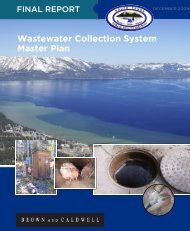
October 2009 - South Tahoe Public Utility District
October 2009 - South Tahoe Public Utility District
October 2009 - South Tahoe Public Utility District

You also want an ePaper? Increase the reach of your titles
YUMPU automatically turns print PDFs into web optimized ePapers that Google loves.
Section 2: Study Area<br />
2.1 Description and Boundaries<br />
The <strong>District</strong>‟s fresh water and recycled water facilities are located in northeastern Alpine County<br />
on the eastern slope of the Sierra Nevada. Although all operations are within Alpine County,<br />
California, the closest urban areas are the towns Minden and Gardnerville located 20 miles<br />
north of Alpine County in Douglas County, Nevada. The <strong>South</strong> <strong>Tahoe</strong> <strong>Public</strong> <strong>Utility</strong> <strong>District</strong><br />
service area is 25 miles away in El Dorado County, California.<br />
The recycled water system begins at the <strong>District</strong>‟s wastewater treatment plant in <strong>South</strong> Lake<br />
<strong>Tahoe</strong>, where filtered secondary treated wastewater (recycled water) is pumped out of the Lake<br />
<strong>Tahoe</strong> basin along Hwy 89 over Luther Pass to Hwy 88 in Hope Valley then along the West<br />
Fork of the Carson River to Harvey Place Reservoir southeast of Woodfords, California. A map<br />
of the <strong>District</strong>‟s service area boundaries is presented in Figure 2.1 (at the end of Section 2).<br />
Recycled water from the reservoir is conveyed in the Diamond Ditch for the irrigation of<br />
ranchlands in Wade Valley and to the north along Hwy 88 to the Nevada border.<br />
2.2 Land Use<br />
The general land use patterns in Alpine County reflect the rural agricultural values of the people<br />
that first homesteaded much of the area. The County consists of largely government-owned<br />
lands, leaving a small portion of the County along the West Fork of the Carson River and Indian<br />
Creek and Diamond Valley as privately-owned agricultural lands. Due to elevation and climate,<br />
the majority of agriculture is limited to pasture grasses and some alfalfa crops. Few if any crops<br />
are grown for human consumption.<br />
Even though there is a long-standing history of family ranching maintaining the rural community<br />
lifestyle, there is the possibility of land use change resulting from semi-rural development. A<br />
trend of large ranches subdividing into 5- to 20-acre parcels for home sites has been witnessed<br />
in the nearby Carson Valley and along the West Fork of the Carson River in Alpine County,<br />
California.<br />
2.2.1 Existing Land Use<br />
The existing land use patterns in the study area in Alpine County consist of a mix of low density<br />
rural residential and agricultural (open space and mixed rural residential zoning allowing 5 and<br />
10 acre home sites). The area known as River Ranch Estates along the West Fork of the<br />
Carson River was once a working ranch but was subdivided and is no longer feasible to flood<br />
irrigate with recycled water due to the density of domestic wells and houses. Once the irrigation<br />
setbacks specified under Title 22 are applied, too little land is available for irrigation to warrant<br />
recycled water irrigation using conventional flood irrigation methods<br />
Fortunately, the largest contiguous tracts of land available for recycled water application are<br />
supporting land uses that are consistent with the historic use and supportive of recycled water<br />
application. The lands adjacent to <strong>District</strong> owned lands in Diamond Valley include a mix of<br />
Forest Service (USFS), Bureau of Land Management (BLM), Bureau of Indian Affairs (BIA), and<br />
some Alpine County owned land. Lands permitted to receive recycled water and lands that may<br />
receive recycled water in the future are adjacent to several privately owned parcels, as well as<br />
USFS, BLM, BIA and Alpine County-owned land. These lands that irrigate, or have the potential<br />
to irrigate, with recycled water are subject to potential change of land use designation in the<br />
<strong>South</strong> <strong>Tahoe</strong> <strong>Public</strong> <strong>Utility</strong> <strong>District</strong><br />
Recycled Water Facilities Master Plan - <strong>October</strong> <strong>2009</strong> Page 2-11