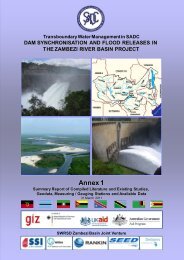
Dam Synchronisation and Flood Releases - agriwaterpedia.info
Dam Synchronisation and Flood Releases - agriwaterpedia.info
Dam Synchronisation and Flood Releases - agriwaterpedia.info

Create successful ePaper yourself
Turn your PDF publications into a flip-book with our unique Google optimized e-Paper software.
DAM SYNCHRONISATION AND FLOOD RELEASES IN THE ZAMBEZI RIVER BASIN: ANNEX 4 OF FINAL REPORT<br />
SUPPORT THE COORDINATION<br />
OF FLOOD RISK ZONING INITIATIVES<br />
Intervention 4.6 Timeframe: Short term Budget range: < 0.5 M USD for<br />
Sheet #<br />
coordination of<br />
initiatives<br />
Linkages: Annex 4, Chapter 6<br />
Concept:<br />
Improved flood protection through flood risk zoning can replace flood protection through dam<br />
management or extra dams.<br />
Purpose:<br />
Justification:<br />
Actions/<br />
Responsibilities:<br />
Benefits/<br />
beneficiaries:<br />
Means of<br />
implementation:<br />
Specific<br />
assumptions/<br />
risks:<br />
Comments<br />
<strong>Flood</strong> risk zoning can serve for regulations for new settlements, current l<strong>and</strong> use practices <strong>and</strong><br />
rescue <strong>and</strong> warning.<br />
<strong>Flood</strong> risk zoning coordination at a river basin scale can make efforts of flood risk zoning on a<br />
national or local scale more cost efficient <strong>and</strong> effective. For the areas downstream of the dams,<br />
flood risk zoning can improve continuous awareness that dams can spill <strong>and</strong> therefore cause out<br />
of season flooding <strong>and</strong>/or sudden rise of flood levels. Their are current initiatives in parts of the<br />
catchment that each apply different metionds: for example UNOSAT for flood mapping in parts<br />
of Mozambique <strong>and</strong> Caprivi strip for rescue <strong>and</strong> warning, UN Habitat in Mozambique for new<br />
settlements, International Federation of Red Cross for vulnerability assessment for rescue <strong>and</strong><br />
warning, FEWS Net for early warning, ZRA around Kariba dam to influence current l<strong>and</strong> use<br />
practices <strong>and</strong> new settlements.<br />
Coordination of different flood risk zoning initiatives currently being<br />
developed independently in different riparian countries; further<br />
identification of the benefits <strong>and</strong> limitations of coordination <strong>and</strong> the<br />
possibilities of innovative techniques.<br />
<strong>Flood</strong> risk zoning efforts can contribute to a combination of:<br />
Prevention: zoning to set rules for new developments;<br />
Preparedness: zoning to give advice or set rules for l<strong>and</strong> use practices<br />
<strong>and</strong> for awareness raising among current inhabitants<br />
Warning <strong>and</strong> rescue: risk zoning to use during emerging flood events<br />
to set priorities<br />
Coordination between current mapping activities in the Zambezi River<br />
Basin is a first <strong>and</strong> useful step in Risk Zoning that will also benefit flood<br />
forecasting <strong>and</strong> involvement of international relief organisations during<br />
floods as well as the underst<strong>and</strong>ing between neighbouring countries.<br />
ZAMCOM /<br />
SADC Secretariat<br />
to coordinate,<br />
Member States to<br />
commit.<br />
Residents in<br />
floodprone areas.<br />
Disaster<br />
Management<br />
organisations,<br />
Surveyor<br />
generals,<br />
Ministries of<br />
Water<br />
ZAMCOM / SADC Secretariat to organise workshop between different initiatives, possibly in<br />
combination with FEWS Net.<br />
<strong>Flood</strong> risk zoning rules for new settlements or for current l<strong>and</strong> use <strong>and</strong> awareness raising only<br />
makes sense as an investment if such a system will be respected by local inhabitants. If flood risk<br />
zoning is introduced as a ‗rule‘, legal experts <strong>and</strong> local governments have to be able to ensure<br />
compliance, which has proven to be difficult. <strong>Flood</strong> risk zoning for flood insurance is not a<br />
viable option in the Zambezi Region because the economies of the region have not developed<br />
well enough to create a market for such insurance <strong>and</strong> because the data availability prevents<br />
good risk calculations.<br />
Data availability in the region for flood risk zoning is limiting the possibilities for flood risk<br />
zoning. A map of maximum flood extents, however, is easy to compile <strong>and</strong> is useful.<br />
Fortunately, only a small level of investment would be needed for the production of such a map.<br />
Mapping of flood frequencies, on the other h<strong>and</strong>, is more difficult. For example, the flood risk<br />
zoning around Kariba, where a distinction is made of zones for multi-year crops <strong>and</strong> seasonal<br />
crops, can be copied to other locations. However, it must be noted that in many floodprone<br />
areas in the basin local people have already adapted such approaches without any official flood<br />
risk zoning, but have decided that there are little viable options for them to move elsewhere.<br />
The current developments in remote sensing will contribute significantly to improved <strong>and</strong> less<br />
costly flood risk zoning in the near future.<br />
114