Dam Synchronisation and Flood Releases - agriwaterpedia.info
Dam Synchronisation and Flood Releases - agriwaterpedia.info
Dam Synchronisation and Flood Releases - agriwaterpedia.info

You also want an ePaper? Increase the reach of your titles
YUMPU automatically turns print PDFs into web optimized ePapers that Google loves.
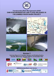
DAM SYNCHRONISATION AND FLOOD RELEASES IN THE ZAMBEZI RIVER BASIN: ANNEX 4 OF FINAL REPORT<br />
6.6 Conclusions <strong>and</strong> recommendations<br />
<strong>Flood</strong> risk zoning for flood insurance is not a viable option in the Zambezi Region at present.<br />
<strong>Flood</strong> risk zoning for regulation of new settlements <strong>and</strong> for regulation of current l<strong>and</strong> use <strong>and</strong><br />
raising of awareness only makes sense as an investment if further local research can show that<br />
such a system will be respected <strong>and</strong> that local inhabitants are not sufficiently aware of risks at<br />
present.<br />
<strong>Flood</strong> risk zoning for warning <strong>and</strong> rescue is already taking place; flood mapping during floods<br />
had been done by UNOSAT for example. <strong>Flood</strong> Risk Vulnerability has been assessed for some<br />
villages by the International Federation for Red Cross. UN Habitat has also commissioned<br />
different flood mapping studies. Coordination between current mapping activities in the<br />
Zambezi River Basin is a first <strong>and</strong> useful step in Risk Zoning that benefit flood forecasting <strong>and</strong><br />
involvement of international relief organisations during floods as well as the underst<strong>and</strong>ing<br />
between neighbouring countries. This coordination is therefore recommended.<br />
Data availability in the region for flood risk zoning, limits the possibilities. A map of maximum<br />
flood extents can be useful <strong>and</strong> is a limited investment, but mapping flood frequencies is more<br />
difficult. The example of the flood risk zoning around Kariba, where a distinction is made of<br />
zones for multi-year crops <strong>and</strong> seasonal crops, can be established in different areas in the<br />
Zambezi river basin, but it needs to be noted that in many areas people may have already<br />
adapted such approaches without any official flood risk zoning.<br />
The current developments in remote sensing will contribute significantly to improved <strong>and</strong> less<br />
costly flood risk zoning in the near future.<br />
65