Dam Synchronisation and Flood Releases - agriwaterpedia.info
Dam Synchronisation and Flood Releases - agriwaterpedia.info
Dam Synchronisation and Flood Releases - agriwaterpedia.info

Create successful ePaper yourself
Turn your PDF publications into a flip-book with our unique Google optimized e-Paper software.
DAM SYNCHRONISATION AND FLOOD RELEASES IN THE ZAMBEZI RIVER BASIN: ANNEX 4 OF FINAL REPORT<br />
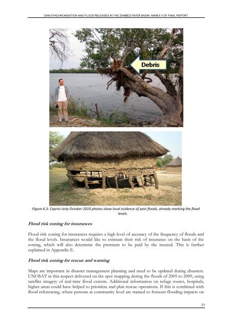
Figure 6.3: Caprivi strip October 2010 photos show local evidence of past floods, already marking the flood<br />
levels.<br />
<strong>Flood</strong> risk zoning for insurances<br />
<strong>Flood</strong> risk zoning for insurances requires a high level of accuracy of the frequency of floods <strong>and</strong><br />
the flood levels. Insurances would like to estimate their risk of insurance on the basis of the<br />
zoning, which will also determine the premium to be paid by the insured. This is further<br />
explained in Appendix E.<br />
<strong>Flood</strong> risk zoning for rescue <strong>and</strong> warning<br />
Maps are important in disaster management planning <strong>and</strong> need to be updated during disasters.<br />
UNOSAT in this respect delivered on the spot mapping during the floods of 2005 to 2009, using<br />
satellite imagery of real-time flood extents. Additional <strong>info</strong>rmation on refuge routes, hospitals,<br />
higher areas could have helped to prioritize <strong>and</strong> plan rescue operations. If this is combined with<br />
flood referencing, where persons at community level are trained to forecast flooding impacts on<br />
59