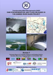
Dam Synchronisation and Flood Releases - agriwaterpedia.info
Dam Synchronisation and Flood Releases - agriwaterpedia.info
Dam Synchronisation and Flood Releases - agriwaterpedia.info

You also want an ePaper? Increase the reach of your titles
YUMPU automatically turns print PDFs into web optimized ePapers that Google loves.
DAM SYNCHRONISATION AND FLOOD RELEASES IN THE ZAMBEZI RIVER BASIN: ANNEX 4 OF FINAL REPORT<br />
severe, inhabitants are encouraged to build elevated houses which will allow water to flow<br />
beneath them without being swept away.<br />
Obstacles to effective flood risk zoning that are recognized by those interviewed include:<br />
<br />
<br />
<br />
cultural reasons <strong>and</strong> beliefs leading to people staying in flood prone areas;<br />
most settlers view their livestock as a symbol of economic wealth, <strong>and</strong> they do not move to<br />
higher ground during floods because their animals are not be able climb the steep slopes; <strong>and</strong><br />
inhabitants who have lived in flood plains <strong>and</strong> have survived previous floods consider<br />
themselves invincible <strong>and</strong> therefore not inclined to react to warning systems.<br />
These are practical considerations from persons in the Water <strong>and</strong>/or Disaster Management<br />
Sectors in Mozambique. In addition, Mozambique is continuing efforts to resettle previous flood<br />
victims to less flood prone areas with funding from donors such as GTZ (INGC website 2010).<br />
Since 2001 temporary refuge areas for floods have been converted to more permanent<br />
resettlement areas (Mozambican government et al., 2007).<br />
Malawi<br />
In Malawi there are bylaws that prevent farming within 50 m of a river, but these are difficult to<br />
implement (interview MIWD, August 2010).<br />
The Ministry of Irrigation <strong>and</strong> Water Development (Interview August 2010) explained that<br />
attempts to move people out of flood prone areas would have little or no chance of success as<br />
these are highly preferred areas for settlement for obvious reasons related to the high agricultural<br />
potential of floodplain areas. It could be preferable to improve safety <strong>and</strong> assist people living<br />
within or close to floodplains. There is conflict between the objectives of hunger <strong>and</strong> poverty<br />
eradication versus environment <strong>and</strong> flood management. The flood plains are fertile <strong>and</strong> are less<br />
drought prone; which contrasts with upl<strong>and</strong> settlement areas which lack these basic livelihood<br />
necessities. It was mentioned that the strategies of the government in this regard were to<br />
promote sustainable livelihoods close to the river but away from the high risk flood prone areas.<br />
However, this may not provide a total solution from a flood protection point of view. Current<br />
practice shows that after June of every year, when there is no risk of flooding, people build huts<br />
in the floodplains <strong>and</strong> start tilling. This cultivation of the floodplains also leads to serious soil<br />
erosion in the flood season.<br />
6.3 Description of investments<br />
Figure 6.2 explains the concept of flood risk zoning, with further explanation in the text in this<br />
section. The concept is illustrated by the Case Studies in Chobe plains <strong>and</strong> downstream of Caia<br />
(Annex F <strong>and</strong> G). There are many different ways of <strong>Flood</strong> Risk Zoning. Box 6-1 illustrates how<br />
the necessary mapping is done in other countries.<br />
54