CORRIGENDUM NO. 3 to RFP Notice No. 10 of 2013 - Gujarat State ...
CORRIGENDUM NO. 3 to RFP Notice No. 10 of 2013 - Gujarat State ...
CORRIGENDUM NO. 3 to RFP Notice No. 10 of 2013 - Gujarat State ...

Create successful ePaper yourself
Turn your PDF publications into a flip-book with our unique Google optimized e-Paper software.
141<br />
142<br />
143<br />
121<br />
120<br />
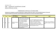
1.2/ Sr.<br />
<strong>No</strong>./ 1.13<br />
1.2/ Sr.<br />
<strong>No</strong>./ 1.8<br />
The system should allow users<br />
<strong>to</strong>:<br />
• Open and enter data in a form<br />
directly from the map & display<br />
these records as icons on the<br />
map.<br />
• Display documents & files on<br />
the map<br />
• Define map symbols as well as<br />
use existing map symbol<br />
libraries<br />
• Draw lines and polygons on<br />
map <strong>to</strong> s<strong>to</strong>re and share with<br />
other authorities responsible for<br />
disaster response.<br />
The geospatial display must<br />
show the area affected<br />
(indicating the specific and<br />
surrounding affected areas and<br />
links <strong>to</strong> all the spatial and other<br />
relevant data associated with<br />
the area). The system should<br />
have capability <strong>to</strong> superimpose<br />
dynamic status information<br />
received from sources at<br />
disaster sites or other agencies<br />
<strong>to</strong> have clear picture <strong>of</strong> available<br />
resources including state <strong>of</strong><br />
roads for travel etc. The type <strong>of</strong><br />
event (classification by type,<br />
magnitude and severity), Status<br />
<strong>of</strong> critical infrastructure<br />
catalogued in the system<br />
General<br />
Does the user require data editing feature<br />
on Web? If yes, then, What is the no. <strong>of</strong><br />
concurrent GIS users need facility for<br />
editing the spatial and attribute data over<br />
web browser?<br />
As per our understanding, live updates are<br />
required <strong>to</strong> be displayed in the GIS system<br />
<strong>to</strong> superimpose dynamic status<br />
information.<br />
Kindly provide details as <strong>to</strong> who will be<br />
responsible for providing the live updates<br />
and in what format the information needs<br />
<strong>to</strong> be integrated in the GIS.<br />
Please clarify.<br />
Is there any preference for selection <strong>of</strong><br />
Open Source GIS program/ S<strong>of</strong>tware<br />
programs? If yes, then which ones?<br />
Yes. <strong>RFP</strong> mentions on that.<br />
Live updates will be received<br />
from government staff<br />
responsible for DM activities at<br />
disaster sites as well as other<br />
EOCs. Information will be in e-<br />
mail formats, textual reports<br />
and video files<br />
<strong>No</strong>.