Tuolumne River Report - U.S. Fish and Wildlife Service
Tuolumne River Report - U.S. Fish and Wildlife Service
Tuolumne River Report - U.S. Fish and Wildlife Service
You also want an ePaper? Increase the reach of your titles
YUMPU automatically turns print PDFs into web optimized ePapers that Google loves.
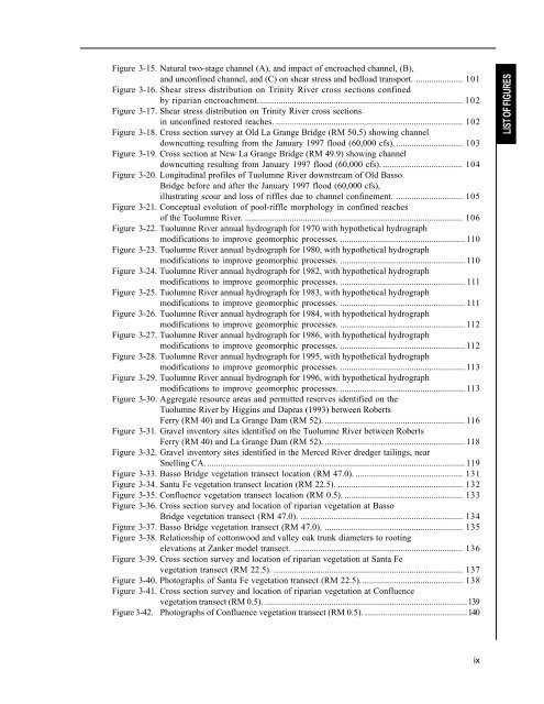
Figure 3-15. Natural two-stage channel (A), <strong>and</strong> impact of encroached channel, (B),<strong>and</strong> unconfined channel, <strong>and</strong> (C) on shear stress <strong>and</strong> bedload transport. ..................... 101Figure 3-16. Shear stress distribution on Trinity <strong>River</strong> cross sections confinedby riparian encroachment............................................................................................ 102Figure 3-17. Shear stress distribution on Trinity <strong>River</strong> cross sectionsin unconfined restored reaches. .................................................................................... 102Figure 3-18. Cross section survey at Old La Grange Bridge (RM 50.5) showing channeldowncutting resulting from the January 1997 flood (60,000 cfs). .............................. 103Figure 3-19. Cross section at New La Grange Bridge (RM 49.9) showing channeldowncutting resulting from January 1997 flood (60,000 cfs). .................................... 104Figure 3-20. Longitudinal profiles of <strong>Tuolumne</strong> <strong>River</strong> downstream of Old BassoBridge before <strong>and</strong> after the January 1997 flood (60,000 cfs),illustrating scour <strong>and</strong> loss of riffles due to channel confinement. .............................. 105Figure 3-21. Conceptual evolution of pool-riffle morphology in confined reachesof the <strong>Tuolumne</strong> <strong>River</strong>. .................................................................................................. 106Figure 3-22. <strong>Tuolumne</strong> <strong>River</strong> annual hydrograph for 1970 with hypothetical hydrographmodifications to improve geomorphic processes. ........................................................ 110Figure 3-23. <strong>Tuolumne</strong> <strong>River</strong> annual hydrograph for 1980, with hypothetical hydrographmodifications to improve geomorphic processes. ........................................................ 110Figure 3-24. <strong>Tuolumne</strong> <strong>River</strong> annual hydrograph for 1982, with hypothetical hydrographmodifications to improve geomorphic processes. ........................................................ 111Figure 3-25. <strong>Tuolumne</strong> <strong>River</strong> annual hydrograph for 1983, with hypothetical hydrographmodifications to improve geomorphic processes. ........................................................ 111Figure 3-26. <strong>Tuolumne</strong> <strong>River</strong> annual hydrograph for 1984, with hypothetical hydrographmodifications to improve geomorphic processes. ........................................................ 112Figure 3-27. <strong>Tuolumne</strong> <strong>River</strong> annual hydrograph for 1986, with hypothetical hydrographmodifications to improve geomorphic processes. ........................................................ 112Figure 3-28. <strong>Tuolumne</strong> <strong>River</strong> annual hydrograph for 1995, with hypothetical hydrographmodifications to improve geomorphic processes. ........................................................ 113Figure 3-29. <strong>Tuolumne</strong> <strong>River</strong> annual hydrograph for 1996, with hypothetical hydrographmodifications to improve geomorphic processes. ........................................................ 113Figure 3-30. Aggregate resource areas <strong>and</strong> permitted reserves identified on the<strong>Tuolumne</strong> <strong>River</strong> by Higgins <strong>and</strong> Dapras (1993) between RobertsFerry (RM 40) <strong>and</strong> La Grange Dam (RM 52). ............................................................... 116Figure 3-31. Gravel inventory sites identified on the <strong>Tuolumne</strong> <strong>River</strong> between RobertsFerry (RM 40) <strong>and</strong> La Grange Dam (RM 52). ............................................................... 118Figure 3-32. Gravel inventory sites identified in the Merced <strong>River</strong> dredger tailings, nearSnelling CA. ....................................................................................................................119Figure 3-33. Basso Bridge vegetation transect location (RM 47.0). ................................................ 131Figure 3-34. Santa Fe vegetation transect location (RM 22.5). ........................................................ 132Figure 3-35. Confluence vegetation transect location (RM 0.5). ..................................................... 133Figure 3-36. Cross section survey <strong>and</strong> location of riparian vegetation at BassoBridge vegetation transect (RM 47.0). ......................................................................... 134Figure 3-37. Basso Bridge vegetation transect (RM 47.0). .............................................................. 135Figure 3-38. Relationship of cottonwood <strong>and</strong> valley oak trunk diameters to rootingelevations at Zanker model transect. ............................................................................ 136Figure 3-39. Cross section survey <strong>and</strong> location of riparian vegetation at Santa Fevegetation transect (RM 22.5). ..................................................................................... 137Figure 3-40. Photographs of Santa Fe vegetation transect (RM 22.5).............................................. 138Figure 3-41. Cross section survey <strong>and</strong> location of riparian vegetation at Confluencevegetation transect (RM 0.5). ...........................................................................................139Figure 3-42. Photographs of Confluence vegetation transect (RM 0.5). ..............................................140LIST OF FIGURESix


