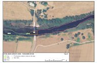
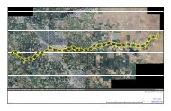
TUOLUMNE RIVER TECHNICAL ADVISORY COMMITTEEHABITAT RESTORATION PLAN FOR THE LOWER TUOLUMNE RIVER CORRIDORCHAPTER 4The total cost for this project, including projectmanagement, planning, <strong>and</strong> implementation, is$414,500. Costs for future coarse sediment managementwill depend on the magnitude, frequency, <strong>and</strong>duration of gravel transporting high flow events.Replacing the quantity of gravel transported out ofthe gravel-bedded reaches would cost more duringwet years than during dry years years when flowsdo not transport appreciable quantities of coarsesediment, <strong>and</strong> gravel augmentation is not required.This proposal contains revised designs for aGasburg Creek Sedimentation Basin.For additional details, the complete projectconceptual design is available upon request.4.5.7. Dredger Tailing Reach ChannelRestoration Project (Threephases)BackgroundThe Dredger Tailing Reach restoration project islocated in the heart of the gravel-bedded zonebetween river miles (RM) 42.5 <strong>and</strong> 46.8 (Reach 6of the Restoration Plan). This reach was severelydegraded by gold dredgers in the early- to mid-1900s, <strong>and</strong> combined with flow <strong>and</strong> sedimentregulation, has not significantly recovered in thefollowing decades. The Dredger Tailing Reachcontains chinook salmon spawning riffles whichare degraded, of poor quality, <strong>and</strong> receive significantlyless spawning use than spawning areasfurther upstream. Within its current physicalconstraints, this reach cannot recover to adesirable state on its own, but offers real opportunityfor restoring natural channel <strong>and</strong> floodplainfeatures, chinook spawning <strong>and</strong> rearing habitats,<strong>and</strong> reducing predator populations.Project ObjectivesThe overall goal of this project is to convert afossilized, highly degraded, remnant channel backinto a dynamic me<strong>and</strong>ering channel. Primaryobjectives include:• Rebuild a natural channel geometry scaled tocurrent channel-forming flows.• Allow the channel to migrate within therestored floodway to improve <strong>and</strong> maintainriparian <strong>and</strong> salmonid habitats.• Restore <strong>and</strong> increase salmon spawning <strong>and</strong>rearing habitats by restoring an alternate bar(pool-riffle) morphology, restoring spawninghabitat within the me<strong>and</strong>ering channel.• Eliminate salmon str<strong>and</strong>ing problems associatedwith backwaters <strong>and</strong> sloughs, <strong>and</strong> floodplain“traps” accessed during moderate flows.• Acquire adjacent floodplain properties fromvoluntary l<strong>and</strong> owners, either through purchaseor conservation easements. The Bobcat FlatL<strong>and</strong> Acquisition currently being negotiated isan excellent example of the type of opportunityavailable within the Dredger Tailing Reach.• Restore native riparian communities onappropriate geomorphic surfaces (i.e., activechannel, floodplains, terraces) within therestored floodway.• Restore riparian canopy habitats for otherendemic wildlife species (e.g., egrets, ospreys,herons).Project DescriptionThe large size of this reach requires that implementationoccur in three phases, similar to projectphasing in the Gravel Mining Reach. The reacheswere delineated by unique restoration objectives<strong>and</strong> sections of channel that will require little orno restoration (natural delineation breaks).Phase I: Zanker Reach (RM 45.4 to 46.5)The upstream portion of this reach is long <strong>and</strong>straight, confined by encroached riparian vegetation(RM 46.0 to 46.5). Immediately downstream,the riparian vegetation is less confining <strong>and</strong> thevalley confinement decreases (RM 45.4 to RM46.0). During high flow events, the bed surface inthe confined section incises, with scouredmaterial depositing <strong>and</strong> aggrading where confinementceases. The result is a long deep chute-likereach upstream with functionally no alluvialdeposits, <strong>and</strong> an aggraded bar downstream thatbacks water upstream into a “lake.” The riffle isover-steepened to the point where preferablespawning depths <strong>and</strong> velocities are in the tail-outarea <strong>and</strong> the margins of the steep riffles. Proposedactivities in the unconfined section includingexcavating a large portion of the bar to restorenatural riffle gradient, using excavated materialsto build bankfull confinement locally <strong>and</strong> fillportions of the channel in the upstream section.166
RESTORING THE TUOLUMNE RIVER CORRIDORActivities in the upstream section may includefilling portions of the confined low flow channelto pre-flood elevations, removing selected portionsof the riparian berms to increase bankfull channelsinuosity, <strong>and</strong> constructing point bars oppositethose locations to further encourage sinuosity.Although some on-site construction materials areavailable, significant fill material may be need fromoff-site sources. Riparian revegetation will occurduring <strong>and</strong> after channel construction.Phase II: Peaslee Creek Reach (RM 43.8 to 45.4)The Peaslee Creek Reach is solely a remnant ofgold dredger activities <strong>and</strong> aggregate removal forconstructing the NDPP. The channel is often deep<strong>and</strong> multi-channeled, following a tortuous coursein the general downstream direction. Excavated“floodplain” surfaces are at reasonable post-NDPP floodplain elevations, but the “bankfull”channel is extremely wide due to the remnantdredger-created channel. Additionally, thedredger mining left extremely steep riffles thatprovide poor salmon spawning habitat. Proposedactivities include recreating a single thread lowflow <strong>and</strong> bankfull channel through the reach,redistributing channel gradient through the reachto restore low gradient riffles, increasing bankfullchannel sinuosity, restoring functional floodplains,<strong>and</strong> revegetating with native riparianvegetation. Salmon spawning habitat should begreatly increased by implementing this project.There is essentially no construction materials onsite,so material would have to be imported fromother sources.Phase III: Hall Reach (RM 42.2 to 43.8)The Hall Reach is very similar to the PeasleeCreek reach, with the exception of havingadequate construction materials in the form ofdredger tailings at RM 43. Proposed activitieswill again include recreating a single thread lowflow <strong>and</strong> bankfull channel through the reach,redistributing channel gradient through the reachto restore low gradient riffles, increasing bankfullchannel sinuosity, restoring functional floodplains,<strong>and</strong> revegetating with native riparianvegetation. Salmon spawning habitat will again begreatly increased by implementing this project.A cost for implementing this project has not beenestimated due to continuing TRTAC discussion onspecific restoration approaches, <strong>and</strong> evolvingl<strong>and</strong>owner interest in conservation easements<strong>and</strong>/or fee-title purchases.For additional details, the complete projectconceptual design is available upon request.4.5.8. Basso Spawning Reach floodplainrestoration (RM 47.6 to 50.5)BackgroundA 60-year legacy of gold mining, grazing, <strong>and</strong>dam construction has resulted in fragmentedriparian st<strong>and</strong>s, poor or non-existent valley oak<strong>and</strong> cottonwood regeneration, fossilized alluvialdeposits, remnant pits that periodically str<strong>and</strong>juvenile chinook salmon during receding highflows, <strong>and</strong> reduced spawning gravel storagewithin the bankfull channel. Extensive golddredging (from valley wall to valley wall)occurred through the 1940’s, leaving no definedchannel, <strong>and</strong> voluminous dredger tailings piledon floodplain surfaces. Flood events after 1937began reinitiating a defined channel through thetailings, but by 1963 the channel still lackeddefined floodplains <strong>and</strong> me<strong>and</strong>er sequences.These dredger tailings were removed for theconstruction of New Don Pedro Dam from 1965to 1970. Their removal left shallow pits <strong>and</strong> nondrainingsurfaces. After New Don Pedro Dam wascompleted in 1971, the channel between rivermile 50.5 <strong>and</strong> 46.6 was reconstructed to improvechinook salmon spawning habitat. However,riparian vegetation <strong>and</strong> floodplains were notrestored, <strong>and</strong> cattle grazing <strong>and</strong> flow regulationhas discouraged riparian regeneration at the site.White alder <strong>and</strong> narrow-leaf willow have encroachedonto point bars, partially fossilizingthese alluvial deposits. Lastly, the 1997 flooddeposited tens of thous<strong>and</strong>s of cubic yards of s<strong>and</strong>in the reach. The interaction between floodplainelevation, riparian vegetation <strong>and</strong> a contemporarybankfull discharge must be restored.The cumulative impacts of these changes tochinook salmon habitat has been amplifiedbecause this reach has the highest concentrationof spawning in the river, <strong>and</strong> possibly the highestconcentration of juvenile rearing. Significantstr<strong>and</strong>ing periodically occurs in this reach duringhigh flows because many of the floodplainundulations <strong>and</strong> pits do not drain back to theriver, so as high flows recede, fry <strong>and</strong> juvenilechinook salmon are str<strong>and</strong>ed <strong>and</strong> die in theseareas. The remnant dredger tailing surface iscomprised of large cobbles, gravels, <strong>and</strong> s<strong>and</strong>,which prohibits natural riparian regeneration.Additionally, substantial loss of the high flowCHAPTER 4167
- Page 1 and 2:
Habitat Restoration Plan for theLow
- Page 4 and 5:
TUOLUMNE RIVER TECHNICAL ADVISORY C
- Page 6 and 7:
TUOLUMNE RIVER TECHNICAL ADVISORY C
- Page 8 and 9:
TUOLUMNE RIVER TECHNICAL ADVISORY C
- Page 10 and 11:
TUOLUMNE RIVER TECHNICAL ADVISORY C
- Page 12 and 13:
TUOLUMNE RIVER TECHNICAL ADVISORY C
- Page 14 and 15:
TUOLUMNE RIVER TECHNICAL ADVISORY C
- Page 16 and 17:
TUOLUMNE RIVER TECHNICAL ADVISORY C
- Page 18 and 19:
TUOLUMNE RIVER TECHNICAL ADVISORY C
- Page 20 and 21:
TUOLUMNE RIVER TECHNICAL ADVISORY C
- Page 22 and 23:
TUOLUMNE RIVER TECHNICAL ADVISORY C
- Page 24 and 25:
TUOLUMNE RIVER TECHNICAL ADVISORY C
- Page 26 and 27:
TUOLUMNE RIVER TECHNICAL ADVISORY C
- Page 28 and 29:
TUOLUMNE RIVER TECHNICAL ADVISORY C
- Page 30 and 31:
TUOLUMNE RIVER TECHNICAL ADVISORY C
- Page 32 and 33:
TUOLUMNE RIVER TECHNICAL ADVISORY C
- Page 34 and 35:
TUOLUMNE RIVER TECHNICAL ADVISORY C
- Page 36 and 37:
TUOLUMNE RIVER TECHNICAL ADVISORY C
- Page 38 and 39:
TUOLUMNE RIVER TECHNICAL ADVISORY C
- Page 40 and 41:
TUOLUMNE RIVER TECHNICAL ADVISORY C
- Page 42 and 43:
TUOLUMNE RIVER TECHNICAL ADVISORY C
- Page 44 and 45:
TUOLUMNE RIVER TECHNICAL ADVISORY C
- Page 46 and 47:
TUOLUMNE RIVER TECHNICAL ADVISORY C
- Page 48 and 49:
TUOLUMNE RIVER TECHNICAL ADVISORY C
- Page 50 and 51:
CHAPTER 226Table 2-5. Revised minim
- Page 52 and 53:
TUOLUMNE RIVER TECHNICAL ADVISORY C
- Page 54 and 55:
TUOLUMNE RIVER TECHNICAL ADVISORY C
- Page 56 and 57:
TUOLUMNE RIVER TECHNICAL ADVISORY C
- Page 58 and 59:
TUOLUMNE RIVER TECHNICAL ADVISORY C
- Page 60 and 61:
CHAPTER 2TUOLUMNE RIVER TECHNICAL A
- Page 62 and 63:
TUOLUMNE RIVER TECHNICAL ADVISORY C
- Page 64 and 65:
TUOLUMNE RIVER TECHNICAL ADVISORY C
- Page 66 and 67:
TUOLUMNE RIVER TECHNICAL ADVISORY C
- Page 68 and 69:
CHAPTER 2TUOLUMNE RIVER TECHNICAL A
- Page 70 and 71:
TUOLUMNE RIVER TECHNICAL ADVISORY C
- Page 72 and 73:
TUOLUMNE RIVER TECHNICAL ADVISORY C
- Page 74 and 75:
TUOLUMNE RIVER TECHNICAL ADVISORY C
- Page 76 and 77:
TUOLUMNE RIVER TECHNICAL ADVISORY C
- Page 78 and 79:
TUOLUMNE RIVER TECHNICAL ADVISORY C
- Page 80 and 81:
TUOLUMNE RIVER TECHNICAL ADVISORY C
- Page 82 and 83:
TUOLUMNE RIVER TECHNICAL ADVISORY C
- Page 84 and 85:
TUOLUMNE RIVER TECHNICAL ADVISORY C
- Page 86 and 87:
TUOLUMNE RIVER TECHNICAL ADVISORY C
- Page 88 and 89:
TUOLUMNE RIVER TECHNICAL ADVISORY C
- Page 90 and 91:
TUOLUMNE RIVER TECHNICAL ADVISORY C
- Page 92 and 93:
TUOLUMNE RIVER TECHNICAL ADVISORY C
- Page 94 and 95:
TUOLUMNE RIVER TECHNICAL ADVISORY C
- Page 96 and 97:
TUOLUMNE RIVER TECHNICAL ADVISORY C
- Page 98 and 99:
TUOLUMNE RIVER TECHNICAL ADVISORY C
- Page 100 and 101:
TUOLUMNE RIVER TECHNICAL ADVISORY C
- Page 102 and 103:
TUOLUMNE RIVER TECHNICAL ADVISORY C
- Page 104 and 105:
TUOLUMNE RIVER TECHNICAL ADVISORY C
- Page 106 and 107:
TUOLUMNE RIVER TECHNICAL ADVISORY C
- Page 108 and 109:
TUOLUMNE RIVER TECHNICAL ADVISORY C
- Page 110 and 111:
TUOLUMNE RIVER TECHNICAL ADVISORY C
- Page 112 and 113:
TUOLUMNE RIVER TECHNICAL ADVISORY C
- Page 114 and 115:
TUOLUMNE RIVER TECHNICAL ADVISORY C
- Page 116 and 117:
TUOLUMNE RIVER TECHNICAL ADVISORY C
- Page 118 and 119:
TUOLUMNE RIVER TECHNICAL ADVISORY C
- Page 120 and 121:
TUOLUMNE RIVER TECHNICAL ADVISORY C
- Page 122 and 123:
TUOLUMNE RIVER TECHNICAL ADVISORY C
- Page 124 and 125:
CHAPTER 3100Elevation (ft)110105100
- Page 126 and 127:
TUOLUMNE RIVER TECHNICAL ADVISORY C
- Page 128 and 129:
CHAPTER 3104Elevation (ft)195190185
- Page 130 and 131:
TUOLUMNE RIVER TECHNICAL ADVISORY C
- Page 132 and 133:
CHAPTER 3108Table 3-8. Wy 1970-1997
- Page 134 and 135:
TUOLUMNE RIVER TECHNICAL ADVISORY C
- Page 136 and 137:
TUOLUMNE RIVER TECHNICAL ADVISORY C
- Page 138 and 139:
TUOLUMNE RIVER TECHNICAL ADVISORY C
- Page 140 and 141: TUOLUMNE RIVER TECHNICAL ADVISORY C
- Page 142 and 143: TUOLUMNE RIVER TECHNICAL ADVISORY C
- Page 144 and 145: TUOLUMNE RIVER TECHNICAL ADVISORY C
- Page 146 and 147: TUOLUMNE RIVER TECHNICAL ADVISORY C
- Page 148 and 149: TUOLUMNE RIVER TECHNICAL ADVISORY C
- Page 150 and 151: TUOLUMNE RIVER TECHNICAL ADVISORY C
- Page 152 and 153: TUOLUMNE RIVER TECHNICAL ADVISORY C
- Page 154 and 155: TUOLUMNE RIVER TECHNICAL ADVISORY C
- Page 156 and 157: TUOLUMNE RIVER TECHNICAL ADVISORY C
- Page 158 and 159: 134Relative elevation (ft)140130120
- Page 160 and 161: CHAPTER 3136Relative elevation (ft)
- Page 162 and 163: TUOLUMNE RIVER TECHNICAL ADVISORY C
- Page 164 and 165: TUOLUMNE RIVER TECHNICAL ADVISORY C
- Page 166 and 167: TUOLUMNE RIVER TECHNICAL ADVISORY C
- Page 168 and 169: TUOLUMNE RIVER TECHNICAL ADVISORY C
- Page 170 and 171: TUOLUMNE RIVER TECHNICAL ADVISORY C
- Page 172 and 173: TUOLUMNE RIVER TECHNICAL ADVISORY C
- Page 174 and 175: TUOLUMNE RIVER TECHNICAL ADVISORY C
- Page 176 and 177: TUOLUMNE RIVER TECHNICAL ADVISORY C
- Page 178 and 179: TUOLUMNE RIVER TECHNICAL ADVISORY C
- Page 180 and 181: TUOLUMNE RIVER TECHNICAL ADVISORY C
- Page 182 and 183: TUOLUMNE RIVER TECHNICAL ADVISORY C
- Page 184 and 185: TUOLUMNE RIVER TECHNICAL ADVISORY C
- Page 186 and 187: TUOLUMNE RIVER TECHNICAL ADVISORY C
- Page 188 and 189: TUOLUMNE RIVER TECHNICAL ADVISORY C
- Page 192 and 193: TUOLUMNE RIVER TECHNICAL ADVISORY C
- Page 194 and 195: ADAPTIVE MANAGEMENT5. ADAPTIVE MANA
- Page 196 and 197: ADAPTIVE MANAGEMENTmonitoring progr
- Page 198 and 199: ADAPTIVE MANAGEMENTWILDLIFE POPULAT
- Page 200 and 201: ADAPTIVE MANAGEMENT• Distribution
- Page 202 and 203: REFERENCESREFERENCESAlderdice, D. F
- Page 204 and 205: REFERENCESKjelson, M. A., P. F. Raq
- Page 206 and 207: REFERENCESTID (Turlock Irrigation D
- Page 208 and 209: APPENDIX AAPPENDIX AANNUAL HYDROGRA
- Page 210 and 211: APPENDIX A30,00028,00026,00024,0002
- Page 212 and 213: APPENDIX A30,00028,00026,00024,0002
- Page 214 and 215: APPENDIX A30,00028,00026,00024,0002
- Page 216 and 217: APPENDIX A30,00028,00026,00024,0002
- Page 218 and 219: APPENDIX A30,00028,00026,00024,0002
- Page 220 and 221: APPENDIX A30,00028,00026,00024,0002
- Page 222 and 223: APPENDIX A30,00028,00026,00024,0002
- Page 224 and 225: APPENDIX A30,00028,00026,00024,0002
- Page 226 and 227: APPENDIX A30,00028,00026,00024,0002
- Page 228 and 229: APPENDIX A30,00028,00026,00024,0002
- Page 230 and 231: APPENDIX BAPPENDIX BTUOLUMNE RIVER
- Page 232 and 233: VEGETATION SERIESNATURAL DIVERSITY
- Page 234 and 235: VEGETATION SERIESNATURAL DIVERSITY
- Page 236 and 237: Nature Conservancy Heritage Program
- Page 238 and 239: 215Scientific Name Common Name Loca
- Page 240:
APPENDIX BAPPENDIX B217