Minnegang Creek Flood Study Report - Wollongong City Council
Minnegang Creek Flood Study Report - Wollongong City Council
Minnegang Creek Flood Study Report - Wollongong City Council
- No tags were found...
You also want an ePaper? Increase the reach of your titles
YUMPU automatically turns print PDFs into web optimized ePapers that Google loves.
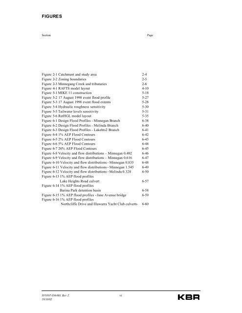
FIGURESSectionPageFigure 2-1 Catchment and study area 2-4Figure 2-2 Zoning boundaries 2-5Figure 2-3 <strong>Minnegang</strong> <strong>Creek</strong> and tributaries 2-6Figure 4-1 RAFTS model layout 4-10Figure 5-1 MIKE 11 construction 5-18Figure 5-2 17 August 1998 event flood profile 5-27Figure 5-3 17 August 1998 event flood extents 5-28Figure 5-4 Hydraulic roughness sensitivity 5-30Figure 5-5 Tailwater levels sensitivity 5-31Figure 5-6 RatHGL model layout 5-35Figure 6-1 Design <strong>Flood</strong> Profiles - Minnegan Branch 6-38Figure 6-2 Design <strong>Flood</strong> Profiles - Melinda Branch 6-40Figure 6-3 Design <strong>Flood</strong> Profiles - Lakehts2 Branch 6-41Figure 6-4 1% AEP <strong>Flood</strong> Contours 6-42Figure 6-5 2% AEP <strong>Flood</strong> Contours 6-43Figure 6-6 5% AEP <strong>Flood</strong> Contours 6-44Figure 6-7 20% AEP <strong>Flood</strong> Contours 6-45Figure 6-8 Velocity and flow distributions - Minnegan 0.402 6-46Figure 6-9 Velocity and flow distributions - Minnegan 0.616 6-47Figure 6-10 Velocity and flow distributions - Minnegan 0.835 6-48Figure 6-11 Velocity and flow distributions - Minnegan 1.545 6-49Figure 6-12 Velocity and flow distributions - Melinda 0.328 6-50Figure 6-13 1% AEP flood profilesLake Heights Road culvert 6-57Figure 6-14 1% AEP flood profilesBarina Park detention basin 6-58Figure 6-15 1% AEP flood profiles - Jane Avenue bridge 6-59Figure 6-16 1% AEP flood profilesNorthcliffe Drive and Illawarra Yacht Club culverts 6-60SV8507-D0-001 Rev 218/10/02vi


