Minnegang Creek Flood Study Report - Wollongong City Council
Minnegang Creek Flood Study Report - Wollongong City Council
Minnegang Creek Flood Study Report - Wollongong City Council
- No tags were found...
You also want an ePaper? Increase the reach of your titles
YUMPU automatically turns print PDFs into web optimized ePapers that Google loves.
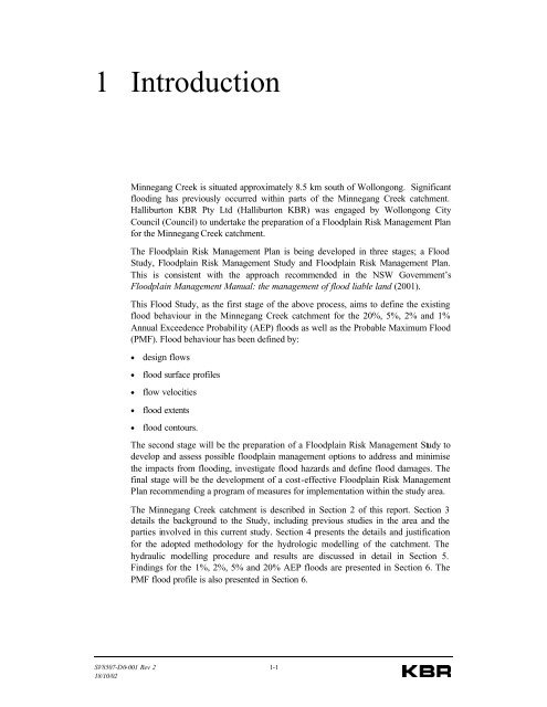
1 Introduction<strong>Minnegang</strong> <strong>Creek</strong> is situated approximately 8.5 km south of <strong>Wollongong</strong>. Significantflooding has previously occurred within parts of the <strong>Minnegang</strong> <strong>Creek</strong> catchment.Halliburton KBR Pty Ltd (Halliburton KBR) was engaged by <strong>Wollongong</strong> <strong>City</strong><strong>Council</strong> (<strong>Council</strong>) to undertake the preparation of a <strong>Flood</strong>plain Risk Management Planfor the <strong>Minnegang</strong> <strong>Creek</strong> catchment.The <strong>Flood</strong>plain Risk Management Plan is being developed in three stages; a <strong>Flood</strong><strong>Study</strong>, <strong>Flood</strong>plain Risk Management <strong>Study</strong> and <strong>Flood</strong>plain Risk Management Plan.This is consistent with the approach recommended in the NSW Government’s<strong>Flood</strong>plain Management Manual: the management of flood liable land (2001).This <strong>Flood</strong> <strong>Study</strong>, as the first stage of the above process, aims to define the existingflood behaviour in the <strong>Minnegang</strong> <strong>Creek</strong> catchment for the 20%, 5%, 2% and 1%Annual Exceedence Probability (AEP) floods as well as the Probable Maximum <strong>Flood</strong>(PMF). <strong>Flood</strong> behaviour has been defined by:• design flows• flood surface profiles• flow velocities• flood extents• flood contours.The second stage will be the preparation of a <strong>Flood</strong>plain Risk Management <strong>Study</strong> todevelop and assess possible floodplain management options to address and minimisethe impacts from flooding, investigate flood hazards and define flood damages. Thefinal stage will be the development of a cost-effective <strong>Flood</strong>plain Risk ManagementPlan recommending a program of measures for implementation within the study area.The <strong>Minnegang</strong> <strong>Creek</strong> catchment is described in Section 2 of this report. Section 3details the background to the <strong>Study</strong>, including previous studies in the area and theparties involved in this current study. Section 4 presents the details and justificationfor the adopted methodology for the hydrologic modelling of the catchment. Thehydraulic modelling procedure and results are discussed in detail in Section 5.Findings for the 1%, 2%, 5% and 20% AEP floods are presented in Section 6. ThePMF flood profile is also presented in Section 6.SV8507-D0-001 Rev 2 1-118/10/02


