

Minnegang Creek Flood Study Report - Wollongong City Council
Minnegang Creek Flood Study Report - Wollongong City Council
Minnegang Creek Flood Study Report - Wollongong City Council
- No tags were found...

You also want an ePaper? Increase the reach of your titles
YUMPU automatically turns print PDFs into web optimized ePapers that Google loves.
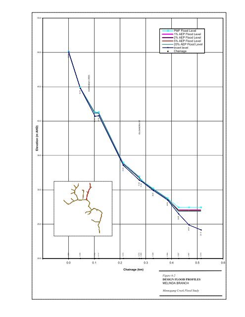
55.050.0PMF <strong>Flood</strong> Level1% AEP <strong>Flood</strong> Level2% AEP <strong>Flood</strong> Level5% AEP <strong>Flood</strong> Level20% AEP <strong>Flood</strong> LevelInvert levelChainage24.1544.7824.8740.7026.4940.7828.5029.9131.4031.2433.5550.0645.0KARRABAH CRESElevation (m AHD)40.00.0000.0450.1020.1170.2120.2740.2820.3280.3840.4270.4670.514GILGANDRA ST35.030.025.020.0-0.1 0.0 0.1 0.2 0.3 0.4 0.5 0.6Chainage (km)Figure 6-2DESIGN FLOOD PROFILESMELINDA BRANCH<strong>Minnegang</strong> <strong>Creek</strong> <strong>Flood</strong> <strong>Study</strong>


