Introductory Exercises for GIS Using ArcMap & ArcCatalog
Introductory Exercises for GIS Using ArcMap & ArcCatalog
Introductory Exercises for GIS Using ArcMap & ArcCatalog

You also want an ePaper? Increase the reach of your titles
YUMPU automatically turns print PDFs into web optimized ePapers that Google loves.
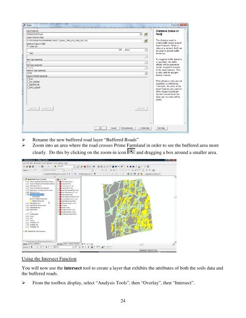
Rename the new buffered road layer “Buffered Roads”Zoom into an area where the road crosses Prime Farmland in order to see the buffered area moreclearly. Do this by clicking on the zoom-in icon and dragging a box around a smaller area.<strong>Using</strong> the Intersect FunctionYou will now use the intersect tool to create a layer that exhibits the attributes of both the soils data andthe buffered roads.From the toolbox display, select “Analysis Tools”, then “Overlay”, then “Intersect”.24