Introductory Exercises for GIS Using ArcMap & ArcCatalog
Introductory Exercises for GIS Using ArcMap & ArcCatalog
Introductory Exercises for GIS Using ArcMap & ArcCatalog

You also want an ePaper? Increase the reach of your titles
YUMPU automatically turns print PDFs into web optimized ePapers that Google loves.
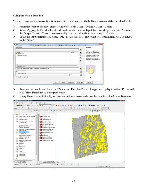
<strong>Using</strong> the Union FunctionYou will now use the union function to create a new layer of the buffered areas and the farmland soils.From the toolbox display, chose “Analysis Tools”, then “Overlay”, then “Union”.Select Aggregate Farmland and Buffered Roads from the Input Features dropdown list. As usual,the Output Feature Class is automatically determined and can be changed of desired.Leave all other defaults and click “OK” to run the tool. The result will be automatically be addedto the project.Rename the new layer “Union of Roads and Farmland” and change the display to reflect Prime andNot Prime Farmland as done previously.<strong>Using</strong> the zoom tool, display an area so that you can clearly see the results of the Union function.26