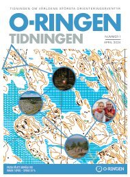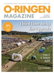
O-Ringen Magazine, nr 1 2024
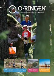
The worlds biggest orienteering adventure. Oskarshamn, Smålandskusten, July 21st to 27 th 2024.
The worlds biggest orienteering adventure. Oskarshamn, Smålandskusten, July 21st to 27 th 2024.

Create successful ePaper yourself
Turn your PDF publications into a flip-book with our unique Google optimized e-Paper software.
» Arena DÖDERHULTSDALEN<br />
STAGE 4 MIDDLE DISTANCE<br />
Friday July 26 th <strong>2024</strong><br />
STAGE 5 LONG DISTANCE<br />
Saturday July 27 th <strong>2024</strong><br />
» Arena DÖDERHULTSDALEN<br />
The arena for the final two stages is located right<br />
next to the O-<strong>Ringen</strong> campsite in Döderhultsdalen.<br />
Close by and easy to get to for everyone<br />
staying there.<br />
STAGE 4<br />
MIDDLE DISTANCE<br />
STAGE 5<br />
LONG DISTANCE<br />
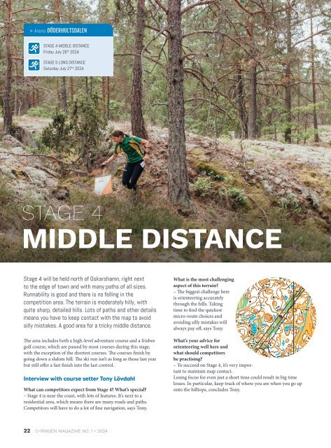
Photo: Cornelia Höglind.<br />
Stage 4 will be held north of Oskarshamn, right next<br />
to the edge of town and with many paths of all sizes.<br />
Runnability is good and there is no felling in the<br />
competition area. The terrain is moderately hilly, with<br />
quite sharp, detailed hills. Lots of paths and other details<br />
means you have to keep contact with the map to avoid<br />
silly mistakes. A good area for a tricky middle distance.<br />
The area includes both a high-level adventure course and a frisbee<br />
golf course, which are passed by most courses during this stage,<br />
with the exception of the shortest courses. The courses finish by<br />
going down a slalom hill. The ski run isn’t as long as those last year<br />
but still offer a fast finish into the last control.<br />
Interview with course setter Tony Lövdahl<br />
What can competitors expect from Stage 4? What’s special?<br />
– Stage 4 is near the coast, with lots of features. It’s next to a<br />
residential area, which means there are many roads and paths.<br />
Competitors will have to do a lot of fine navigation, says Tony.<br />
What is the most challenging<br />
aspect of this terrain?<br />
– The biggest challenge here<br />
is orienteering accurately<br />
through the hills. Taking<br />
time to find the quickest<br />
micro-route choices and<br />
avoiding silly mistakes will<br />
always pay off, says Tony.<br />
What’s your advice for<br />
orienteering well here and<br />
what should competitors<br />
be practising?<br />
– To succeed on Stage 4, it’s very important<br />
to maintain map contact.<br />
Losing focus for even just a short time could result in big time<br />
losses. In particular, keep track of where you are when you go up<br />
onto the hilltops, concludes Tony.<br />
The final stage will take place north-west of Oskarshamn<br />
and the terrain has a different character to that of stages<br />
3 and 4. Small, complex hill formations are mixed with<br />
flatter and vaguer areas. This stage mostly features open<br />
pine forest crossed by some forest roads and a diffuse<br />
path network. You’ll find runnable hilltops mixed with<br />
denser, younger coniferous plantation, as well as open,<br />
managed forest of varying runnability.<br />
Despite being less hilly, this area will offer plenty of challenges. In the<br />
vaguer areas with limited visibility it’s important to take careful bearings<br />
and use the features that are there, otherwise it can be easy to lose<br />
time. Most courses finish by crossing a hilltop with more deciduous<br />
trees that limit visibility, before heading down the steep hillside, which<br />
is stony in places. They then cross a meadow normally used to exercise<br />
horses. The last kilometre uses the same bit of forest used at the end of<br />
Stage 4, with lots of paths and other features. There will be many small<br />
hills and short, steep slopes, where spending a few extra seconds on<br />
route choices and map reading could well pay off. From the pre-warning<br />
to the finish there will be fast running across open fields and past<br />
the ski hill, with open views over the finish arena.<br />
Interview with course setter Lennart Kalén<br />
What can competitors expect from Stage 5? What’s special?<br />
– The Stage 5 terrain has a different character to stages 3 and 4.<br />
Here, the small, complex hill shapes are interspersed with vaguer,<br />
flat areas. The forest is more managed here, meaning runnability is<br />
more varied, answers Lennart.<br />
What is the most challenging aspect of this terrain?<br />
– Make sure you check your bearings carefully in the vaguer areas<br />
with poorer visibility, otherwise it’s easy to lose a lot of time. In<br />
the final part you’ll find yourself in an area with many features,<br />
especially lots of small, steep-sided hills. Take extra care with<br />
map-reading and route choices here, says Lennart.<br />
What’s your advice for orienteering well<br />
here and what should competitors be practising?<br />
– To give yourself the best chance on Stage 5, like always, take<br />
care when following your compass and slow down to read the<br />
clear features on the way into each control. Again, as always, train<br />
to be able to run strongly through the forest. Even though the area<br />
isn’t all that hilly, the undulating terrain will sap your<br />
energy, finishes Lennart.<br />
22 O-RINGEN MAGAZINE NO. 1 • <strong>2024</strong> O-RINGEN MAGAZINE NO. 1 • <strong>2024</strong> 23