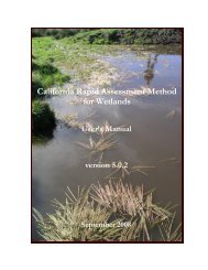
(CRAM) For Wetlands User's Manual Version 5.0.2
(CRAM) For Wetlands User's Manual Version 5.0.2
(CRAM) For Wetlands User's Manual Version 5.0.2
You also want an ePaper? Increase the reach of your titles
YUMPU automatically turns print PDFs into web optimized ePapers that Google loves.
4.0 Summary<br />
California Rapid Assessment Method for <strong>Wetlands</strong> v. <strong>5.0.2</strong> – Chapter 4<br />
CHAPTER 4:<br />
GUIDELINES FOR SCORING <strong>CRAM</strong> METRICS<br />
This chapter contains detailed guidelines for using <strong>CRAM</strong>. Each metric is supported by a<br />
definition, rationale, and an indication of the metric’s sensitivity to seasonal variability in wetland<br />
condition. Also provided are visual cues or indicators of condition that can be used in the field<br />
or when studying the imagery of a site to guide the scoring of the metrics.<br />
The attributes and stressor checklists are the same for all wetland types and regions of the State.<br />
The wetland types are very different from each other, however, in terms of their form and<br />
structure. Some metrics have been adjusted to reflect these differences. There is not enough<br />
evidence at this time to warrant adjusting any metric for regional differences in any wetland type.<br />
A full set of data sheets and worksheets for each wetland type is provided on the <strong>CRAM</strong> website<br />
(www.cramwetlands.org) as a basic hardcopy field book for conducting <strong>CRAM</strong> assessments.<br />
<strong>CRAM</strong> training materials are also available at the <strong>CRAM</strong> web site (www.cramwetlands.org).<br />
4.1 Attribute 1: Buffer and Landscape Context<br />
<strong>For</strong> the purposes of <strong>CRAM</strong>, a buffer is a zone of transition between the immediate margins of a<br />
wetland and its surrounding environment that is likely to help protect the wetland from<br />
anthropogenic stress (see Figure 2.2). Areas adjoining wetlands that probably do not provide<br />
protection are not considered buffers.<br />
Buffers can protect wetlands by filtering pollutants, providing refuge for wetland wildlife during<br />
times of high water levels, acting as barriers to disruptive incursions by people and pets into<br />
wetlands, and moderating predation by ground-dwelling terrestrial predators. Buffers can also<br />
reduce the risk of invasion by non-native plants and animals, by either obstructing terrestrial<br />
corridors of invasion or by helping to maintain the integrity and therefore the resistance of<br />
wetland communities to invasions.<br />
Because regulation and protection of wetlands historically did not extend to adjacent uplands,<br />
these areas in some cases have been converted to recreational, agricultural, or other human land<br />
uses and might no longer provide their critical buffer functions for wetlands.<br />
<strong>CRAM</strong> includes two metrics to assess the Buffer and Landscape Context attribute of wetlands:<br />
the Landscape Connectivity metric and the Buffer metric. The buffer metric is composed of<br />
three submetrics: (1) percentage of the AA perimeter that has a buffer; (2) the average buffer<br />
width; and (3) the condition or quality of the buffer.<br />
4.1.1 Landscape Connectivity<br />
A. Definition: The landscape connectivity of an Assessment Area is assessed in terms of its<br />
spatial association with other areas of aquatic resources, such as other wetlands, lakes, streams,<br />
etc. It is assumed that wetlands close to each other have a greater potential to interact<br />
ecologically and hydrologically, and that such interactions are generally beneficial.<br />
43


