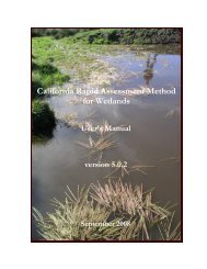
(CRAM) For Wetlands User's Manual Version 5.0.2
(CRAM) For Wetlands User's Manual Version 5.0.2
(CRAM) For Wetlands User's Manual Version 5.0.2
Create successful ePaper yourself
Turn your PDF publications into a flip-book with our unique Google optimized e-Paper software.
California Rapid Assessment Method for <strong>Wetlands</strong> v. <strong>5.0.2</strong> – Chapter 4<br />
Non-native species owe their occurrence in California to the actions of people ever since shortly<br />
before Euro American contact. “Invasive” species are non-native species that tend to dominate<br />
one or more plant layers within an AA. <strong>CRAM</strong> uses the California Invasive Plant Council (Cal-<br />
IPC) list to determine the invasive status of plants, with augmentation by regional experts.<br />
B. Rationale: The functions of whole-wetland systems are optimized when a rich native flora<br />
dominates the plant community, and when the botanical structure of the wetland is complex in<br />
3-dimensional space, due to species diversity and recruitment, and resulting in suitable habitat<br />
for multiple animal species. Much of the natural microbial, invertebrate, and vertebrate<br />
communities of wetlands are adjusted to the architectural forms, phenologies, detrital materials,<br />
and chemistry of the native vegetation. Furthermore, the physical form of wetlands is partly the<br />
result of interactions between plants and physical processes, especially hydrology. A sudden<br />
change in the dominant species, such as results from plant invasions, can have cascading effects<br />
on whole-system form, structure, and function.<br />
C. Seasonality: This suite of metrics is ideally assessed during the latter third of the growing<br />
season, when all plant layers have developed to their full extent.<br />
D. Field Indicators: The Plant Community Metric is assessed in terms of the similarity between<br />
the dominant species composition of the plant community and what is expected based on<br />
<strong>CRAM</strong> verification and validation studies, regional botanical surveys, and historical resources.<br />
This metric requires the ability to recognize the most common and abundant plants species of<br />
wetlands. When a <strong>CRAM</strong> field team lacks the necessary botanical expertise, voucher specimens<br />
will need to be collected using standard plant presses and site documentation. This can greatly<br />
increase the time required to complete a <strong>CRAM</strong> assessment.<br />
4.4.1.1 Number of Plant Layers Present<br />
The first submetric of the Plant Community Metric is the Number of Plant Layers Present in the<br />
AA. This submetric does not pertain to Vernal Pools or Playas. Plant layers play a large role in<br />
the assessment of the biotic structure attribute. They are distinguished from one another by the<br />
differences in average maximum heights of their co-dominant plant species. <strong>For</strong> the Other<br />
Depressional <strong>Wetlands</strong>, plus Estuarine, Lacustrine, and Non-confined Riverine <strong>Wetlands</strong> a<br />
maximum of five plant layers are recognized by <strong>CRAM</strong>. <strong>For</strong> Slope <strong>Wetlands</strong> and Confined<br />
Riverine <strong>Wetlands</strong>, a maximum of four layers are recognized. To be counted in <strong>CRAM</strong>, a layer<br />
must cover at least 5% of the portion of the AA that is suitable for the layer (see Appendix II). This<br />
would be the littoral zone of lakes and depressional wetlands for the one aquatic layer, called<br />
“floating.” The “short,” “medium,” and “tall” layers might be found throughout the non-aquatic<br />
areas of each wetland class, except in areas of exposed bedrock, mudflat, beaches, active point<br />
bars, etc. The “very tall” layer is usually expected to occur along the backshore, except in<br />
forested wetlands.<br />
It is essential that the layers be identified by the actual plant heights (i.e., the approximate<br />
maximum heights) of plant species in the AA, regardless of the growth potential of the species.<br />
<strong>For</strong> example, in a riverine system a young sapling redwood between 0.5 m and 0.75 m tall would<br />
belong to the “medium” layer, even though in the future the same individual redwood might<br />
belong to the “very tall” layer. Some species might belong to multiple plant layers. <strong>For</strong> example,<br />
groves of red alders of all different ages and heights might collectively represent all four non-<br />
75


