Planning for Sport and Active Recreation Facilities ... - Brent Council
Planning for Sport and Active Recreation Facilities ... - Brent Council
Planning for Sport and Active Recreation Facilities ... - Brent Council

You also want an ePaper? Increase the reach of your titles
YUMPU automatically turns print PDFs into web optimized ePapers that Google loves.
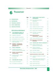
Graph Map Table Description Page<br />
Map 1 Wards within the Borough of <strong>Brent</strong> 11<br />
Map 2 Population densities by ward 12<br />
Map 3 Key regeneration areas within <strong>Brent</strong> 12<br />
Table 1 <strong>Brent</strong>’s population by ethnicity 13<br />
Graph 1 Ethnic distribution by age group 2006 <strong>and</strong> 2016 13<br />
Graph 2 Population pyramid 14<br />
Map 4 Deprivation levels within individual wards 14<br />
Map 5 The most <strong>and</strong> least income deprived wards in the borough 15<br />
Map 6 Male life-expectancy gaps between deprived <strong>and</strong> affluent wards in<br />
<strong>Brent</strong> (Harlesden to South Kenton along the Bakerloo line)<br />
Map 7 Main bus <strong>and</strong> rail routes within <strong>Brent</strong> 16<br />
Map 8 Public transport accessibility levels in <strong>Brent</strong> 17<br />
Map 9 Cycle routes in <strong>Brent</strong> 17<br />
Table 2 <strong>Brent</strong>’s <strong>Active</strong> People survey results 18<br />
Map 10 <strong>Brent</strong>’s 2006 <strong>Active</strong> People survey results by middle super output<br />
area<br />
Table 3 <strong>Active</strong> People survey results ‘zero participation‘ 19<br />
Table 4 <strong>Active</strong> People survey - key results 20<br />
Table 5 <strong>Active</strong> People survey - sports provision satisfaction levels results 21<br />
Table 6 <strong>Active</strong> People survey results, <strong>Brent</strong>’s surrounding boroughs 21<br />
Table 7 <strong>Active</strong> People survey results, <strong>Brent</strong>’s regional statistical neighbours 22<br />
Table 8 <strong>Active</strong> People survey results. green space <strong>and</strong> participation rates<br />
within <strong>Brent</strong>’s regional statistical neighbours<br />
Table 9 <strong>Active</strong> People survey results, cycling 23<br />
Table 10 <strong>Active</strong> People survey results, individual sports participation rates 23<br />
Table 11 <strong>Active</strong> People survey results, outdoor sports <strong>and</strong> activities<br />
participation rates<br />
Graph 3 Parks survey respondents’ preferences <strong>for</strong> facilities that would<br />
encourage residents to take part in more physical exercise<br />
Graph 4 Parks survey respondents’ preferences <strong>for</strong> improvements 32<br />
111<br />
Table of Maps, Graphs<br />
Map 11 Location of mosaic type D27 in <strong>Brent</strong> 34<br />
Map 12 Location of mosaic type C20 in <strong>Brent</strong> 34<br />
Map 13 Location of mosaic type E28 in <strong>Brent</strong> 34<br />
Map 14 Location of mosaic type F36 in <strong>Brent</strong> 35<br />
Map 15 Dominant market segmentation map <strong>for</strong> <strong>Brent</strong> within the lower<br />
super output areas<br />
Map 16 <strong>Sport</strong> Engl<strong>and</strong> market segmentation - Jamie 36<br />
Map 17 <strong>Sport</strong> Engl<strong>and</strong> market segmentation - Kev 37<br />
Map 18 <strong>Sport</strong> Engl<strong>and</strong> market segmentation - Tim 38<br />
Map 19 <strong>Sport</strong> Engl<strong>and</strong> market segmentation - Chloe 39<br />
Map 20 <strong>Sport</strong> Engl<strong>and</strong> market segmentation - Leanne 40<br />
Map 21 Example of <strong>Brent</strong> facility catchment area map 42<br />
15<br />
19<br />
22<br />
24<br />
32<br />
35


![0702012-khat[1] - Brent Council](https://img.yumpu.com/11457346/1/184x260/0702012-khat1-brent-council.jpg?quality=85)